Trading & travelling across the world!

2022 09 30 07 06 11

Greetings, fellow traders!

Recently, I embarked on a trip across these 5 new countries, to learn more about Central Asia:

  • Dubai (1 day transit)
  • Kyrgyzstan
  • Kazakhstan
  • Tajikistan
  • Uzbekistan
  • Turkey

central asia exploration map


I started off with a day trip in Dubai, since I had quite a few hours in transit, then moved on to cover 4 Stan countries and Turkey.

I wanted to do Turkmenistan as well, but it was still closed due to Covid.

The Stans were a lot less touristy, which meant they were slightly less developed, but the good thing is that there were less crowds.

Turkey was very touristy, and a lot more crowded.

Overall, I really liked the food and culture in Central Asia.

To see the full photo albums for all my trips, please visit: https://synapsetrading.com/travel-log/


Here are some photos from the trip, with brief intro snippets from Wikipedia:


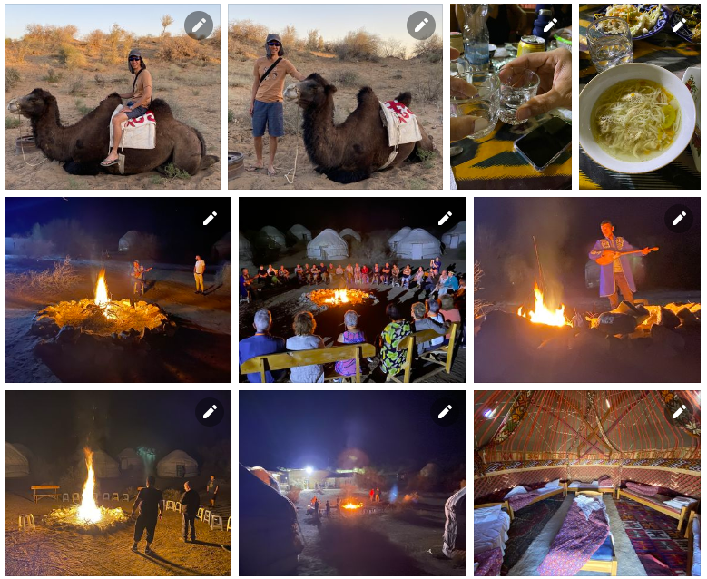
1. Desert Safari, Dubai, UAE

Dubai has a major tourist attraction called the Desert Safari where tourists get to enjoy the amazing sand dunes, cultural performances and BBQ Dinner. While there are a few different variations in this excursion, the most common one involves getting picked up in a 4×4 Toyota Land Cruiser late in the afternoon and then driving 50kms away from the city to enjoy the serene and untouched sand dunes of Dubai.

The driver is a trained professional who maneuvers the 4×4 up and down the dunes, performing daring stunts for the passengers sitting inside. Afterwards the driver takes a quick break at a sunset viewing point and later the passengers are taken to a camp site where they get to enjoy a few performances and eat delicious BBQ dinner among other things.

Click here to see full Facebook photo album!

desert safari collage

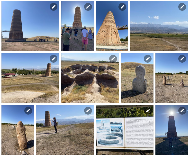
2. Bishkek & Burana Tower, Kyrgyzstan

Bishkek is the capital and largest city of Kyrgyzstan. Bishkek is also the administrative centre of the Chüy Region. The region surrounds the city, although the city itself is not part of the region but rather a region-level unit of Kyrgyzstan. Bishkek is situated near the Kazakhstan–Kyrgyzstan border. Its population was 1,074,075 in 2021.

The Burana Tower is a large minaret in the Chüy Valley in northern Kyrgyzstan. It is located about 80 km east of the country’s capital Bishkek, near the town of Tokmok. The tower, along with grave markers, some earthworks and the remnants of a castle and three mausoleums, is all that remains of the ancient city of Balasagun, which was established by the Karakhanids at the end of the 9th century. The tower was built in the 11th century and was used as a template for other minarets. It is one of the oldest architectural constructions in Central Asia.

Click here to see full Facebook photo album!

burana tower collage

3. Chong-Kemin Valley, Kyrgyzstan

Chong-Kemin Nature Park is a park in Kemin District of Chüy Region of Kyrgyzstan established in August 1997. The purpose of the park is conservation of the unique nature complexes in Chong-Kemin Valley of the Kemin District and organization of recreation for local and foreign tourists. The area of the park is 123,564 hectares. The park is located in 30 km from the regional center Kemin and in 135 km from Bishkek.

This national park is one of the most picturesque parts of Kyrgyzstan. The 116 km long river Chong-Kemin flows through the park, and there are seven lakes in its basin.

The ecosystem is diverse and is home to rare species, such as the snow leopard, golden eagle and maral (the smallest cervid in Central Asia).

Click here to see full Facebook photo album!

chong kemin collage

4. Kochkor & Issy-Kul Lake & Karakol, Kyrgyzstan

Kochkor is a large village in northern Naryn Region of Kyrgyzstan, at an altitude of 1,800 m. Its population was 11,373 in 2021. It is on the main A365 highway from Torugart Pass (China) north to Bishkek, and about 45 km northeast along the highway is Balykchy on Lake Issyk-Kul.

Issyk-Kul is an endorheic lake (without outflow) in the Northern Tian Shan mountains in Eastern Kyrgyzstan. It is the seventh-deepest lake in the world, the tenth-largest lake in the world by volume and the second-largest saline lake after the Caspian Sea. Issyk-Kul means “warm lake” in the Kyrgyz language; although it is located at a lofty elevation of 1,607 metres and subject to severe cold during winter, it never freezes.

Karakol is the fourth-largest city in Kyrgyzstan, near the eastern tip of Lake Issyk-Kul, about 150km from the Kyrgyzstan–China border and 380km from the capital Bishkek. It is the administrative capital of Issyk-Kul Region.

Click here to see full Facebook photo album!

kochkor collage

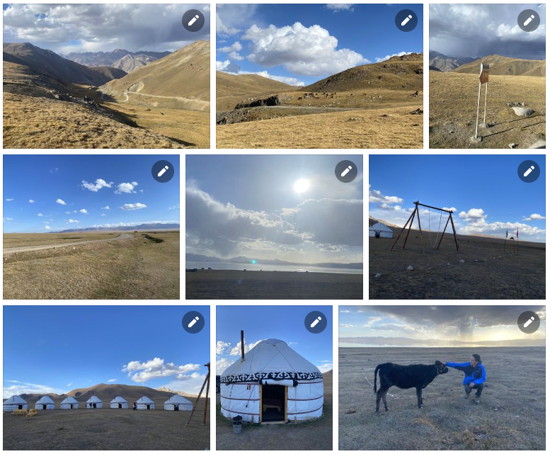
5. Song-Kol Lake, Kyrgyzstan

Song-Köl (literally “following lake”) is an alpine lake in northern Naryn Region, Kyrgyzstan. It lies at an altitude of 3016 m, and has an area of about 270 km2 and volume of 2.64 km3. The lake’s maximum length is 29 km, breadth about 18 km, and the deepest point is 13.2 m. It is the second largest lake in Kyrgyzstan after Issyk-Kul, and the largest fresh water lake in Kyrgyzstan.

Click here to see full Facebook photo album!

song kul collage

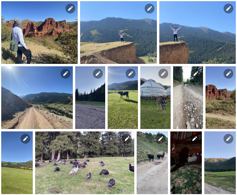
6. Jeti-Oguz, Kyrgyzstan

Jeti-Ögüz (seven bulls) is a district of Issyk-Kul Region in north-eastern Kyrgyzstan. Its seat lies at Kyzyl-Suu. Its area is 14,499 square kilometres, and its resident population was 93,392 in 2021. It comprises much of the eastern end of the Terskey Ala-Too Range.

Click here to see full Facebook photo album!

jeti oguz collage

7. Kolsay Lakes National Park, Kazakhstan

Kolsay Lakes National Park is located on the north slope of the Tian Shan Mountains, southeast Kazakhstan (10km from the border with Kyrgyzstan). Often referred to as “Pearls of Tien Shan”, the park’s main feature are the Kolsay Lakes located between the Raiymbek District and Talgar District of Almaty Region. The scenic Lake Kaindy is also within the park. The park boundary is 120km southeast of Almaty. Lakes of landslide-tectonic origin, approximately formed in 1887 and 1911 on the Kaindy and Kolsay rivers.

Click here to see full Facebook photo album!

kolsay lakes collage

8. Charyn Canyon, Kazakhstan

Charyn Canyon (also known as Sharyn Canyon) is a canyon on the Sharyn River in Kazakhstan (200km east of Almaty, close to the Chinese border). The canyon is roughly 154km in length, and is part of the Charyn National Park (established on 23 February 2004). Over time, the canyon has gained colorful formations of varying shapes and sizes. Though it is much smaller than the Grand Canyon, it has been described as being equally impressive.

Charyn Canyon is a unique natural object with peculiar relief forms in the form of chapels, towers, animals, etc., which were formed by the weathering of sedimentary rock.

Click here to see full Facebook photo album!

charyn canyon collage

9. Almaty, Kazakhstan

Almaty, formerly known as Alma-Ata, is the largest city in Kazakhstan, with a population of about 2 million. It was the capital of Kazakhstan from 1929 to 1936 as an autonomous republic as part of the Soviet Union, then from 1936 to 1991 as a union republic and finally from 1991 as an independent state to 1997 when the government relocated the capital to Akmola.

Almaty is still the major commercial, financial, and cultural centre of Kazakhstan, as well as its most populous and most cosmopolitan city.

Click here to see full Facebook photo album!

almaty collage

10. Dushanbe, Tajikistan

Dushanbe (literally ’Monday’) is the capital and largest city of Tajikistan. As of January 2020, Dushanbe had a population of 863,400 and that population was largely Tajik. Until 1929, the city was known in Russian as Dyushambe, and from 1929 to 1961 as Stalinabad, after Joseph Stalin.

In ancient times, what is now or is close to modern Dushanbe was settled by various empires and peoples, including Mousterian tool-users, various neolithic cultures, the Achaemenid Empire, Greco-Bactria, the Kushan Empire, and the Hephthalites. In the Middle Ages, more settlements began near modern-day Dushanbe such as Hulbuk and its famous palace.

Click here to see full Facebook photo album!

dushanbe collage

11. Iskanderkul Lake & Waterfall, Tajikistan

Iskanderkul is a mountain lake of glacial origin in Tajikistan’s Sughd Province. It lies at an altitude of 2,195m on the northern slopes of the Gissar Range in the Fann Mountains.

The lake takes its name from Alexander the Great’s passage in Tajikistan: Iskander is the Persian pronunciation of Alexander, and kul means lake in many Turkic languages. There are two legends connecting the lake to Alexander. The first one states it used to be a location the inhabitants of which resisted Alexander’s rule, and in fury, the king ordered to divert a river and annihilate them. The second legend states that Bucephalus had drowned in the lake.

Click here to see full Facebook photo album!

iskanderkul lake collage

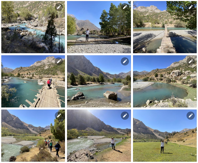
12. Fann Mountains, Tajikistan

The Fann Mountains are part of the western Pamir-Alay mountain system in Tajikistan’s Sughd Province, between the Zarafshan Range to the north and the Gissar Range to the south. In an east-west direction, they extend from the Fan Darya to the Archimaydan River.

The Fanns boast about a hundred peaks, with several rising to altitudes of more than 5,000 meters and relative elevations of up to 1,500m. The highest point in Fann Mountains is Chimtarga peak (5,489 m).

Click here to see full Facebook photo album!

fann mountains collage

13. Khujand, Tajikistan

Khujand is the second-largest city of Tajikistan and the capital of Tajikistan’s northernmost Sughd province.

Khujand is one of the oldest cities in Central Asia, dating back about 2,500 years to the Persian Empire. Situated on the Syr Darya river at the mouth of the Fergana Valley, Khujand was a major city along the ancient Silk Road. After being captured by Alexander the Great in 329 BC, it was renamed Alexandria Eschate and has since been part of various empires in history, including the Umayyad Caliphate (8th century), the Mongol Empire (13th century) and the Russian empire (19th century).

Click here to see full Facebook photo album!

khujand collage

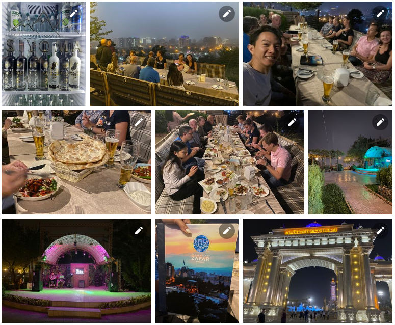
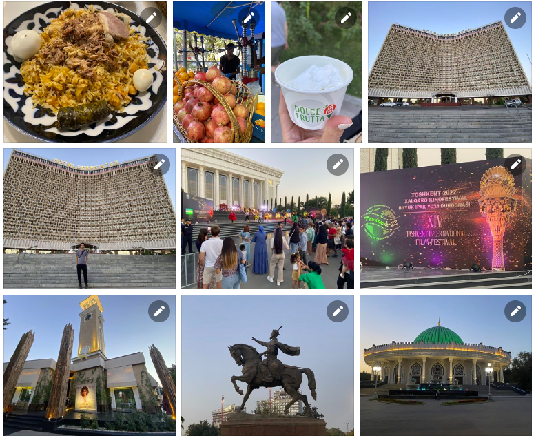
14. Tashkent, Uzbekistan

Tashkent, also historically known as Chach is the capital and largest city of Uzbekistan, as well as the most populous city in Central Asia, with a population of 2,909,000 (2022). It is in northeastern Uzbekistan, near the border with Kazakhstan. Tashkent comes from the Turkic tash and kent, literally translated as “Stone City” or “City of Stones”.

Before Islamic influence started in the mid-8th century AD, Tashkent was influenced by the Sogdian and Turkic cultures. After Genghis Khan destroyed it in 1219, it was rebuilt and profited from the Silk Road. From the 18th to the 19th century, the city became an independent city-state, before being re-conquered by the Khanate of Kokand. In 1865, Tashkent fell to the Russian Empire; it became the capital of Russian Turkestan.

Click here to see full Facebook photo album!

tashkent collage

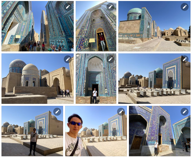
15. Samarkand, Uzbekistan

Samarkand is a city in southeastern Uzbekistan and among the oldest continuously inhabited cities in Central Asia. There is evidence of human activity in the area of the city from the late Paleolithic Era. Though there is no direct evidence of when Samarkand was founded, several theories propose that it was founded between the 8th and 7th centuries BCE.

Prospering from its location on the Silk Road between China and Europe, at times Samarkand was one of the largest cities of Central Asia.[3] Most of the inhabitants of this city are native Persian-speakers and speak the Tajik Persian dialect. This city is one of the historical centers of the Tajik people in Central Asia, which in the past was one of the important cities of the great empires of Iran.

Click here to see full Facebook photo album!

samarkand collage

16. Lake Aydarkul, Uzbekistan

The Aydar Lake (Lake Aydarkul) is part of the man-made Aydar-Arnasay system of lakes, which covers 4,000 square kilometres. This has 3 brackish water lakes (the two others being Arnasay and Tuzkan), deep basins of the south-eastern Kyzyl Kum (now in Uzbekistan and Kazakhstan). The lakes are expansive reservoirs of Soviet planning.

Being brackish rather than saline they have high rates of evaporation, prompting a moist summer microclimate, often attracting rain clouds, which has led to the replenishment of the North Aral Sea.

Click here to see full Facebook photo album!

aydarkul collage

17. Bukhara, Uzbekistan

Bukhara is the seventh-largest city in Uzbekistan, with a population of 280,187 as of 1 January 2020, and the capital of Bukhara Region. People have inhabited the region around Bukhara for at least five millennia, and the city has existed for half that time. Located on the Silk Road, the city has long served as a center of trade, scholarship, culture, and religion. The mother tongue of the majority of people of Bukhara is Tajik, a dialect of the Persian language, although Uzbek is spoken as a second language by most residents.

Bukhara served as the capital of the Samanid Empire, Khanate of Bukhara, and Emirate of Bukhara and was the birthplace of scholar Imam Bukhari.[4] The city has been known as “Noble Bukhara”. Bukhara has about 140 architectural monuments. UNESCO has listed the historic center of Bukhara (which contains numerous mosques and madrasas) as a World Heritage Site.

Click here to see full Facebook photo album!

bukhara collage

18. Khiva, Uzbekistan

Khiva is a district-level city of approximately 93,000 people in Xorazm Region, Uzbekistan. According to archaeological data, the city was established around 1500 years ago. It is the former capital of Khwarezmia, the Khanate of Khiva, and the Khorezm People’s Soviet Republic.

Itchan Kala in Khiva was the first site in Uzbekistan to be inscribed in the World Heritage List (1991). The astronomer, historian and polymath, Al-Biruni[4] (973-1048 CE) was born in either Khiva or the nearby city of Kath.

Click here to see full Facebook photo album!

khiva collage

19. Istanbul, Turkey

Istanbul, formerly known as Constantinople, is the largest city in Turkey, serving as the country’s economic, cultural and historic hub. The city straddles the Bosporus strait, lying in both Europe and Asia, and has a population of over 15 million residents, comprising 19% of the population of Turkey. Istanbul is the most populous European city, and the world’s 15th-largest city.

Over 13.4 million foreign visitors came to Istanbul in 2018, eight years after it was named a European Capital of Culture, making it the world’s eighth most visited city. Istanbul is home to several UNESCO World Heritage Sites, and hosts the headquarters of numerous Turkish companies, accounting for more than thirty percent of the country’s economy.

Click here to see full Facebook photo album!

istanbul collage

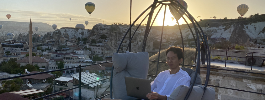
20. Cappadocia, Turkey

Cappadocia or Capadocia, is a historical region in Central Anatolia, Turkey. It largely is in the provinces Nevşehir, Kayseri, Aksaray, Kırşehir, Sivas and Niğde.

According to Herodotus, in the time of the Ionian Revolt (499 BC), the Cappadocians were reported as occupying a region from Mount Taurus to the vicinity of the Euxine (Black Sea). Cappadocia, in this sense, was bounded in the south by the chain of the Taurus Mountains that separate it from Cilicia, to the east by the upper Euphrates, to the north by Pontus, and to the west by Lycaonia and eastern Galatia.

The name, traditionally used in Christian sources throughout history, continues in use as an international tourism concept to define a region of exceptional natural wonders, in particular characterized by fairy chimneys and a unique historical and cultural heritage.

Click here to see full Facebook photo album!

cappadocia collage

21. Antalya, Turkey

Antalya is the fifth-most populous city in Turkey as well as the capital of Antalya Province. Located on Anatolia’s southwest coast bordered by the Taurus Mountains, Antalya is the largest Turkish city on the Mediterranean coast outside the Aegean region with over one million people in its metropolitan area.

Antalya is Turkey’s biggest international sea resort, located on the Turkish Riviera. Large-scale development and governmental funding has promoted tourism. A record 13.6 million tourists passed through the city in 2019.

Click here to see full Facebook photo album!

antalya collage

22. Pamukkale, Turkey

Pamukkale, meaning “cotton castle” in Turkish, is a natural site in Denizli Province in southwestern Turkey. The area is famous for a carbonate mineral left by the flowing of thermal spring water. It is located in Turkey’s Inner Aegean region, in the River Menderes valley, which has a temperate climate for most of the year.

The ancient Greek city of Hierapolis was built on top of the travertine formation which is in total about 2,700 metres long, 600m wide and 160m high. It can be seen from the hills on the opposite side of the valley in the town of Denizli, 20 km away. This area has been drawing visitors to its thermal springs since the time of classical antiquity. The Turkish name refers to the surface of the shimmering, snow-white limestone, shaped over millennia by calcite-rich springs. Dripping slowly down the mountainside, mineral-rich waters collect in and cascade down the mineral terraces, into pools below.

It was added as a UNESCO World Heritage Site in 1988 along with Hierapolis.

Click here to see full Facebook photo album!

pamukkale collage

23. Kusadasi, Turkey

Kuşadası is a large resort town on Turkey’s Aegean coast, and the center of the seaside district of the same name within Aydın Province. Kuşadası is 95 km south of İzmir, and about 60 km from Aydın. The municipality’s primary industry is tourism.

The district of Kuşadası had a total residential population of 121,493 in 2020, though the actual population is thought to rise to well over half a million in the summer months due to a significant influx of both domestic and international tourists as well as those visiting family or returning to their summer residence.
Click here to see full Facebook photo album!

kusadasi collage

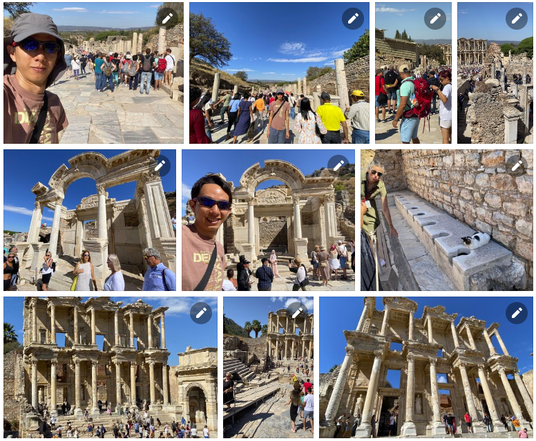
24. Ephesus, Turkey

Ephesus was a city in ancient Greece on the coast of Ionia, 3 kilometres southwest of present-day Selçuk in İzmir Province, Turkey. It was built in the 10th century BC on the site of Apasa, the former Arzawan capital, by Attic and Ionian Greek colonists. During the Classical Greek era, it was one of twelve cities that were members of the Ionian League. The city came under the control of the Roman Republic in 129 BC.

The city was famous in its day for the nearby Temple of Artemis (completed around 550 BC), which has been designated one of the Seven Wonders of the Ancient World. Its many monumental buildings included the Library of Celsus and a theatre capable of holding 24,000 spectators.

Today, the ruins of Ephesus are a favourite international and local tourist attraction, being accessible from Adnan Menderes Airport and from the resort town Kuşadası. In 2015, the ruins were designated a UNESCO World Heritage Site.

Click here to see full Facebook photo album!

ephesus collage


Once again, to see the full photo albums for all my trips, please visit: https://synapsetrading.com/travel-log/

Enjoy! ?

central asia travelling trader

After 3 years of not being able to travel due to Covid, I am now ready to embark on my next adventure!

In fact, I have also sold my house, so I’m not sure how long I will be on the road. (Until property prices come back down lol)

This trip will bring my total country tally to 70+ countries, let’s see how many I can hit by the end of the year.

As per usual, I will continue to provide market updates, as long as I have an internet connection.

Let’s all build up our warchest and get ready for the big sale!


thumbnail an unofficial guide to living our best life beyond financial freedom

If you are excited to get more life hacks, also check out: “Beyond Financial Freedom: An Unofficial Guide to Living Your Best Life”

2021 09 13 01.45.16

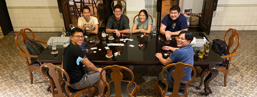
Last night, over pizza, drinks, and poker, we had some interesting discussions about crypto, NFTs, and the Metaverse which really piqued my curiosity and got me thinking.

Food for thought:

  • How close are we to achieving the Metaverse?
  • What will the Metaverse look like?
  • What currency or financial system will we be using?
  • Which company/companies will be running the systems?
  • What are the latest trends in blockchain and crypto?
  • What are the potential future developments in this space?
  • What are the best areas to invest my time and money?


View this post on Instagram


A post shared by Spencer Li (@iamrecneps)

If you have the answers, please let me know in the comments below! 😀

chernobyl tour

Greetings, fellow traders! 😀

At the end of last year, I embarked on a trip across these 14 countries, to learn more about communism in Eastern Europe:

  • Belarus
  • Ukraine
  • Transnistria
  • Moldova
  • Romania
  • Bulgaria
  • North Macedonia
  • Kosovo
  • Bosnia
  • Albania
  • Montenegro
  • Serbia
  • Croatia
  • Slovakia

It was really an eye-opener, with a big disparity in the standards of living between different countries in Europe, especially those within the EU who seem much better off.

I was amazed at the diversity of experiences, including abandoned irradiated towns, nuclear missile bunkers, war-torn buildings and weapon museums, quaint castles, and many unique Soviet/communist quirks.


I think one of the biggest advantage of swing trading is that it doesn’t require you to spend much time monitoring the markets, so all you need is to spend a few minutes a day updating your positions using a mobile phone, which allowed me to continue raking in profits with minimal effort even while on holiday.

To see the full photo albums for this trip, please visit: https://synapsetrading.com/travel-log/


Here are some photos from the trip, with brief intro snippets from Wikitravel or Wikipedia:

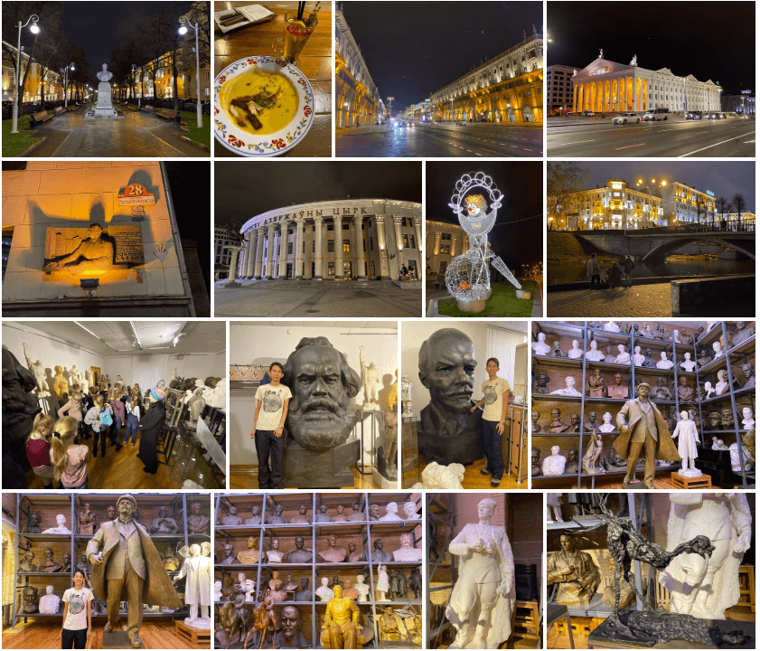
1. Minsk, Belarus

Minsk , with a population of 1,959,800 (according to the 2016 survey), is the capital and largest city of Belarus.

After the Pale of Settlement of 1835, the population of Minsk became 1/3 Jews, almost all of whom fled or were killed during World War II. During the war, the population of Minsk was reduced from 300,000 people to 50,000 people. The city was 80% destroyed and was rebuilt in the 1950s to the liking of Stalin. The population of the city grew due to industrialization and movement of young people from the Belarusian countryside.

English is rarely spoken but Russian is spoken by all, in addition to Belarusian. It helps to learn some key phrases in Russian.

Minsk, Belarus


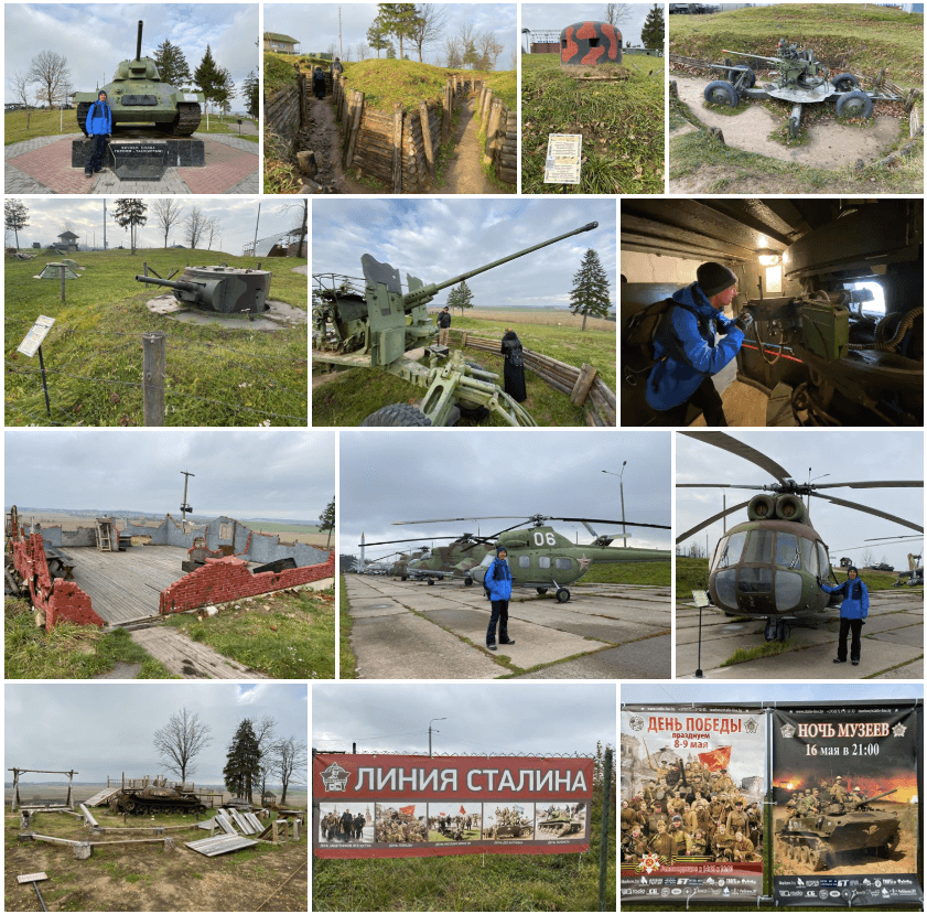
2. Stalin Line, Belarus

The Stalin Line was a line of fortifications along the western border of the Soviet Union. Work began on the system in the 1920s to protect the USSR against attacks from the West. The line was made up of concrete bunkers and gun emplacements, somewhat similar to, but less elaborate than the Maginot Line. It was not a continuous line of defense along the entire border, but rather a network of fortified districts, meant to channel potential invaders along certain corridors.

Stalin Line, Belarus


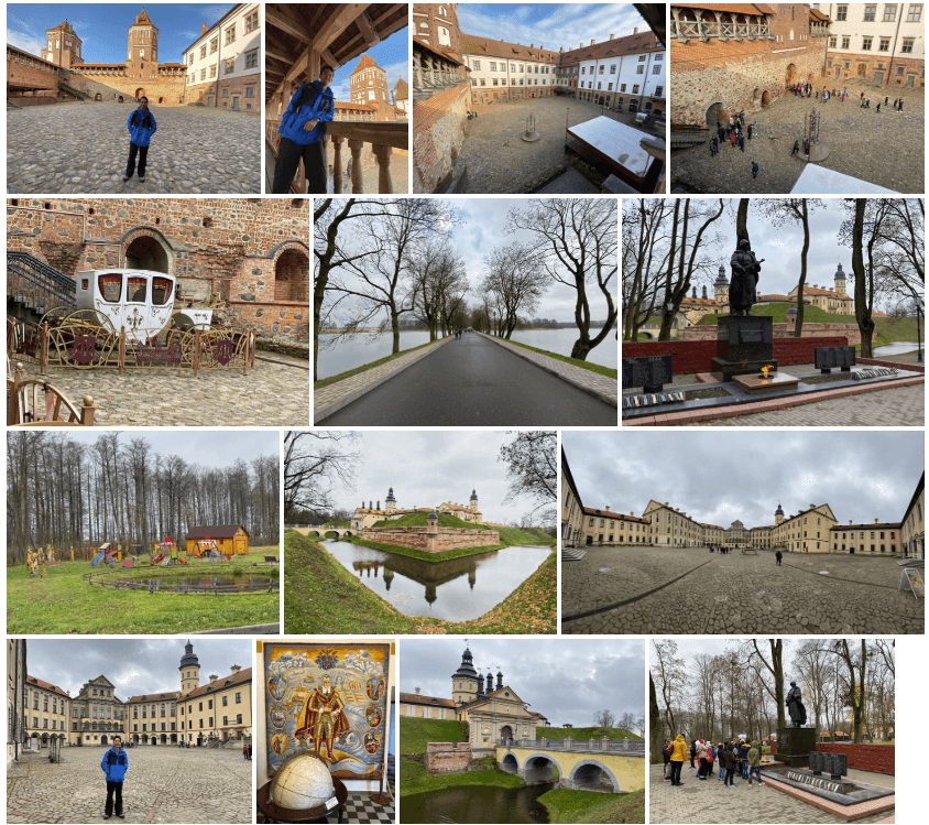
3. Nesvizh & Mir Castle, Belarus

The Mir Castle Complex is a UNESCO World Heritage site in Belarus. It is in the town of Mir, in the Kareličy District of the Hrodna voblast, 29km NW of another World Heritage site, Nesvizh Castle. Mir Castle Complex is 164m above sea level. From 1921 to 1939, the castle belonged to the territory of Poland.

Nesvizh Castle is a residential castle of the Radziwiłł family in Niasviž, Belarus. It is 183m above sea level. From 1919 to 1945, the complex was part of Poland and was considered one of the most beautiful castles in the Kresy region.

Nesvizh & Mir Castle, Belarus


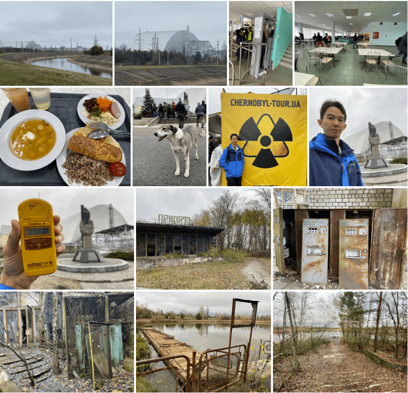
4. Chernobyl, Ukraine

The Chernobyl disaster was a nuclear accident that occurred on Saturday 26 April 1986, at the No. 4 nuclear reactor in the Chernobyl Nuclear Power Plant, near the city of Pripyat in the north of the Ukrainian SSR. It is considered the worst nuclear disaster in history and is one of only two nuclear energy disasters rated at seven—the maximum severity—on the International Nuclear Event Scale, the other being the 2011 Fukushima Daiichi nuclear disaster in Japan.

Chernobyl, Ukraine


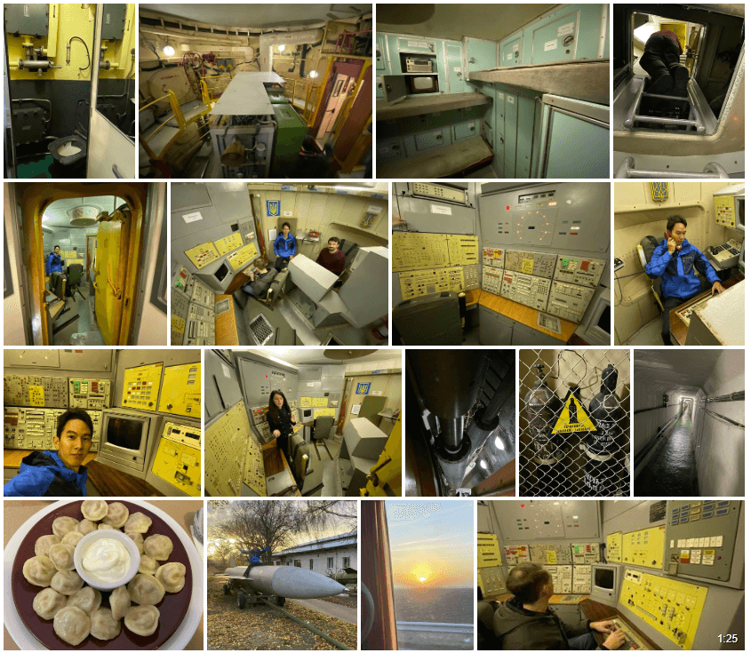
5. Nuclear Missile Base, Ukraine

The unique site of a former Cold-War-era ICBM silo and Launch Control Centre (LCC) of the Soviet Union, located in now independent Ukraine, in the countryside between Kiev and Odessa, near the small town of Pervomaisk (not the one in Donbas!). In addition to the original silo and LCC there’s a plethora of related objects on open-air display as well as a dedicated small museum. But the highlight remains going down to the original underground LCC for the spectacle of a simulated launch.

Nuclear Missile Base, Ukraine


6. Kiev & Odessa, Ukraine

Kiev or Kyiv is the capital and most populous city of Ukraine. It is in north-central Ukraine along the Dnieper River. Its population in July 2015 was 2,887,974, making Kiev the 6th-most populous city in Europe. Kiev is an important industrial, scientific, educational and cultural center of Eastern Europe.

Odessa is a port city on the Black Sea in southern Ukraine. It’s known for its beaches and 19th-century architecture, including the Odessa Opera and Ballet Theater. The monumental Potemkin Stairs, immortalized in “The Battleship Potemkin,” lead down to the waterfront with its Vorontsov Lighthouse. Running parallel to the water, the grand Primorsky Boulevard is a popular promenade lined with mansions and monuments.

Kiev & Odessa, Ukraine


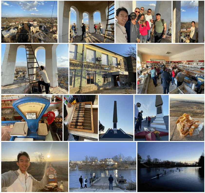
7. Tiraspol, Transnistria

Tiraspol is internationally recognised as the second largest city in Moldova, but is effectively the capital and administrative centre of the unrecognised Pridnestrovian Moldavian Republic (Transnistria). The city is located on the eastern bank of the Dniester River. Tiraspol is a regional hub of light industry, such as furniture and electrical goods production.

The modern city of Tiraspol was founded by the Russian generalissimo Alexander Suvorov in 1792, although the area had been inhabited for thousands of years by varying ethnic groups. The city celebrates its anniversary every year on October 14.

Tiraspol, Transnistria


8. Chitcani, Transnistria

Chițcani is a commune in Căușeni District, Moldova, situated to the south-east of the city of Tighina (Bender). The locality, although situated on the right (western) bank of the river Dniester, is under the control of the breakaway Transnistrian authorities. On the opposite side of the river lies the city of Tiraspol.

Chițcani is one of the oldest recorded villages in Moldova, its history dating back to 1367. The name of the village means “shrews” in Romanian language.

The village is also well known as the home of the Noul Neamţ Monastery. The monastery was closed when Moldova was under the Soviet Union. It was then used as a hospital, a storehouse, then as a makeshift museum.

Chitcani, Transnistria


9. Bender, Transnistria

Bender is a city within the internationally recognized borders of Moldova under de facto control of the unrecognized Pridnestrovian Moldavian Republic (Transnistria) (PMR) since 1992. It is located on the western bank of the river Dniester in the historical region of Bessarabia.

Bender is located in the buffer zone established at the end of the 1992 War of Transnistria. While the Joint Control Commission has overriding powers in the city, Transnistria has de facto administrative control.

The fortress of Tighina was one of the important historic fortresses of the Principality of Moldova.

Bender, Transnistria


10. Chisinau, Moldova

Chișinău is the capital and largest city of the Republic of Moldova. The city is Moldova’s main industrial and commercial center, and is located in the middle of the country, on the river Bâc, a tributary of Dniester.

According to the results of the 2014 census, the city proper had a population of 532,513, while the population of the Municipality of Chișinău (which includes the city itself and other nearby communities) was 662,836.

Chișinău is the most economically prosperous locality in Moldova and its largest transportation hub.

Chisinau, Moldova


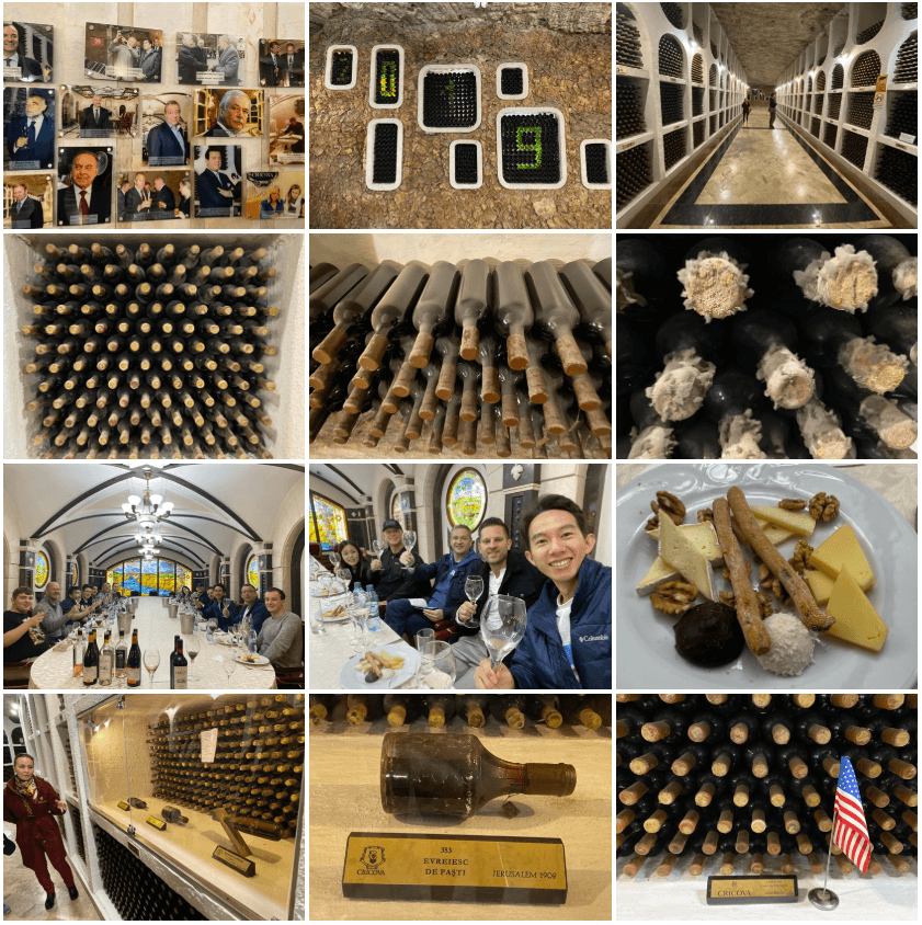
11. Cricova Winery, Moldova

Cricova is a Moldovan winery, located in the town with the same name, 15 km north of Chişinău. Famous wine cellars make it a popular attraction for tourists.

The wine cellars of Cricova is the second largest wine cellar in Moldova, boasting 120 km of labyrinthine roadways, including tunnels that have existed under Cricova since the 15th century, when limestone was dug out to help build Chişinău. They were converted into an underground wine emporium in the 1950s.

Legend has it that in 1966 cosmonaut Yuri Gagarin entered the cellars, re-emerging (with assistance) two days later. Russian president Vladimir Putin celebrated his 50th birthday there.

Cricova Winery, Moldova


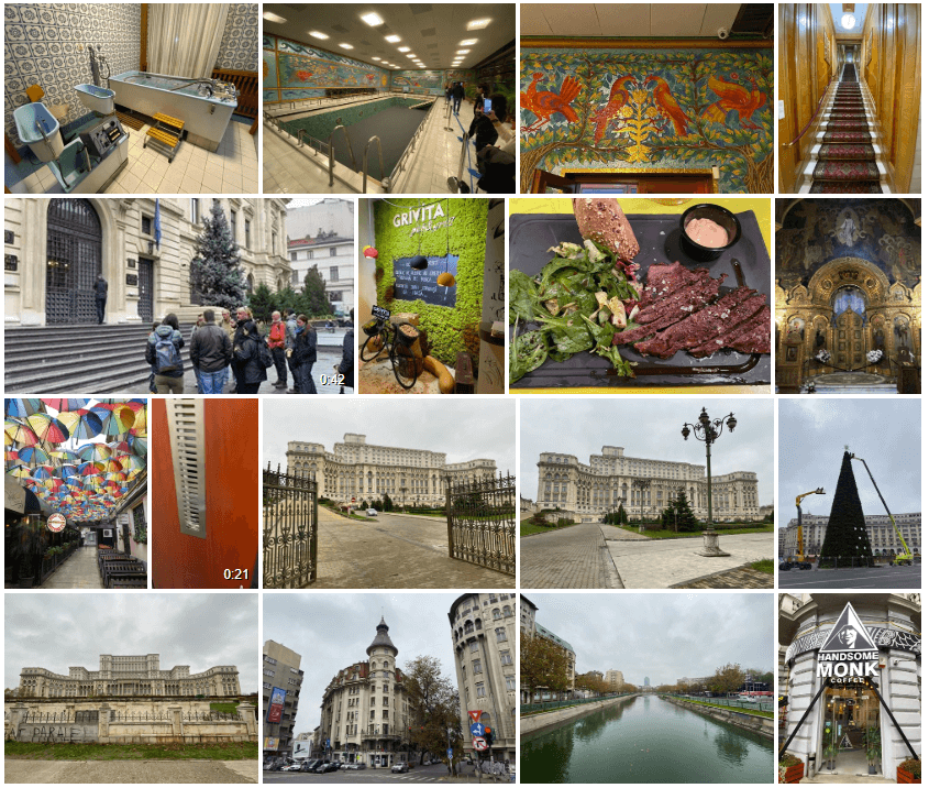
12. Bucharest, Romania

Bucharest is the capital and largest city of Romania, as well as its cultural, industrial, and financial centre. It is located in the southeast of the country, on the banks of the Dâmbovița River, less than 60 km north of the Danube River and the Bulgarian border.

Its iconic landmark is the massive, communist-era Palatul Parlamentului government building, which has 1,100 rooms. Nearby, the historic Lipscani district is home to an energetic nightlife scene as well as tiny Eastern Orthodox Stavropoleos Church and 15th-century Curtea Veche Palace, where Prince Vlad III (“The Impaler”) once ruled.

Bucharest, Romania


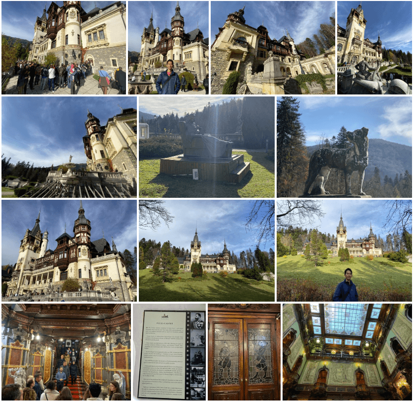
13. Transylvania, Romania

Transylvania is a historical region which is located in central Romania. It’s known for medieval towns, mountainous borders and castles like Bran Castle, a Gothic fortress associated with the legend of Dracula.

The Anglosphere commonly associates Transylvania with vampires, thanks to the dominant influence of Bram Stoker’s novel Dracula and the many films the tale inspired.

The city of Brașov features Saxon walls and bastions, as well as expansive Council Square, ringed by colorful baroque buildings, the towering Gothic Black Church and cafes. Nearby Poiana Brașov is a popular ski resort.

Transylvania, Romania


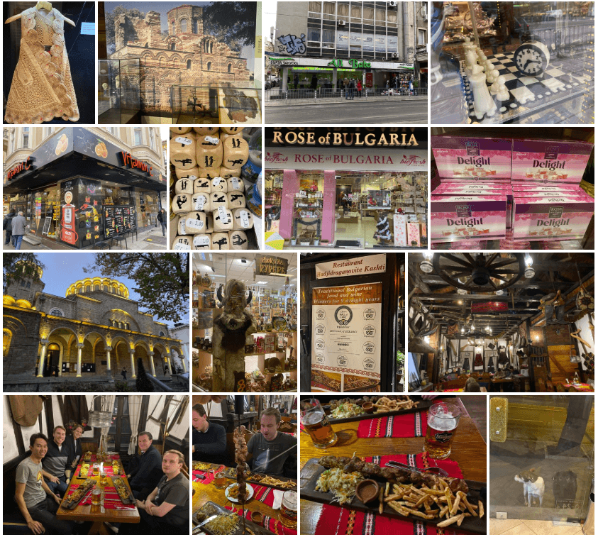
14. Sofia, Bulgaria

Sofia is the capital and largest city of Bulgaria. The city is at the foot of Vitosha mountain in the western part of the country. Being in the centre of the Balkans, it is midway between the Black Sea and the Adriatic Sea, and closest to the Aegean Sea.

The city’s landmarks reflect more than 2,000 years of history, including Greek, Roman, Ottoman and Soviet occupation.

Sofia has been described as the ‘triangle of religious tolerance’. This is due to the fact that three colossal temples of the three world major religions – Christianity, Islam and Judaism, reside inside the borders of the city, which are the Sveta Nedelya Church, Banya Bashi Mosque and Sofia Synagogue.

Sofia, Bulgaria


15. Skopje, North Macedonia

Skopje is the capital and largest city of North Macedonia. It is the country’s political, cultural, economic, and academic centre.

During the First World War the city was seized by the Kingdom of Bulgaria, and after this war, it became part of the newly formed Kingdom of Yugoslavia becoming the capital of the Vardarska banovina.

In the Second World War the city was again captured by Bulgaria and in 1944 became the capital of SR Macedonia, then a federated state of Yugoslavia. The city developed rapidly, but this trend was interrupted in 1963 when it was hit by a disastrous earthquake.

Skopje, North Macedonia


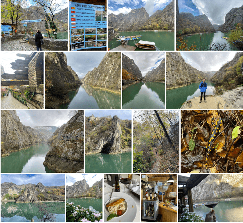
16. Matka Canyon, North Macedonia

Matka is a canyon located west of central Skopje, North Macedonia. Covering roughly 5,000 hectares, Matka is one of the most popular outdoor destinations in Macedonia and is home to several medieval monasteries. The Matka Lake within the Matka Canyon is the oldest artificial lake in the country.

There are ten caves at Matka Canyon, with the shortest in length being 20 metres and the longest being 176 metres. The canyon also features two vertical pits, both roughly extending 35 metres in depth.

Matka Canyon, North Macedonia


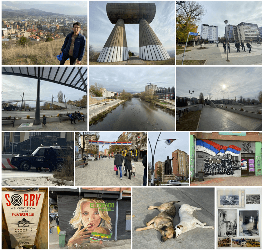
17. Pristina, Kosovo

Pristina is the capital and largest city of Kosovo. The city has a majority Albanian population, alongside other smaller communities. With a municipal population of 204,721 inhabitants (2016), Pristina is the second-largest city in the world with a predominantly Albanian-speaking population, after Albania’s capital, Tirana.

Pristina is also the most essential economic, financial, political and trade center of Kosovo mostly due to its significant location in the center of the country. It is the seat of power of the Government of Kosovo, the residences for work of the President and Prime Minister of Kosovo and the Parliament of Kosovo.

Pristina, Kosovo


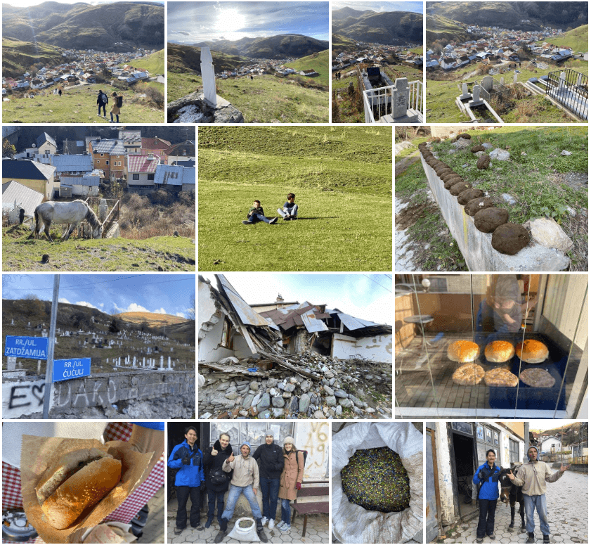
18. Brod, Kosovo

Brod is a village in south of Kosovo, in the region of Gora, in the municipality of Dragaš. It is part of the District of Prizren, and is a big village with 900 houses.

The majority of people are Gorani, who are Muslims, and they are traditionally known for good confectioners and a variety of foods.

Brod, Kosovo


19. Mitrovica, Kosovo

Mitrovica is a city and municipality located in Kosovo, which was badly affected by the 1999 Kosovo War. The area had been the scene of guerrilla activity by the Kosovo Liberation Army (KLA) prior to the war.

It became the focus for ethnic clashes between the two communities, exacerbated by the presence of nationalist extremists on both sides. The bridges linking the two sides of the town were guarded by armed groups determined to prevent incursions by the other side. Violence and harassment was often directed against members of the “wrong” ethnic community on both sides of the river, necessitating the presence of troops and police checkpoints around individual areas of the city and even in front of individual buildings.

On 17 March 2004, the drowning of an Albanian child in the river prompted major ethnic violence in the town and a Serbian teenager was killed. Demonstrations by thousands of angry Albanians and Serbs mobilised to stop them crossing the river degenerated into rioting and gunfire, leaving at least eight Albanians dead and at least 300 injured. The bloodshed sparked off the worst unrest in Kosovo seen since the end of the 1999 war.

Tensions rose considerably in the city of Mitrovica after Kosovo declared independence on 17 February 2008. Some 150 Kosovo Serb police officers refused to take orders from the ethnic Albanian authorities and were suspended. Serb protesters prevented ethnic Albanian court employees from crossing the bridge over the Ibar River. UN police raided and seized the courthouse on 14 March using tear gas against Serbs and leaving some of them wounded. The explosion of a hand-grenade injured several UN and NATO staff on 17 March; UN forces were later withdrawn from the northern part of Mitrovica.

Mitrovica, Kosovo


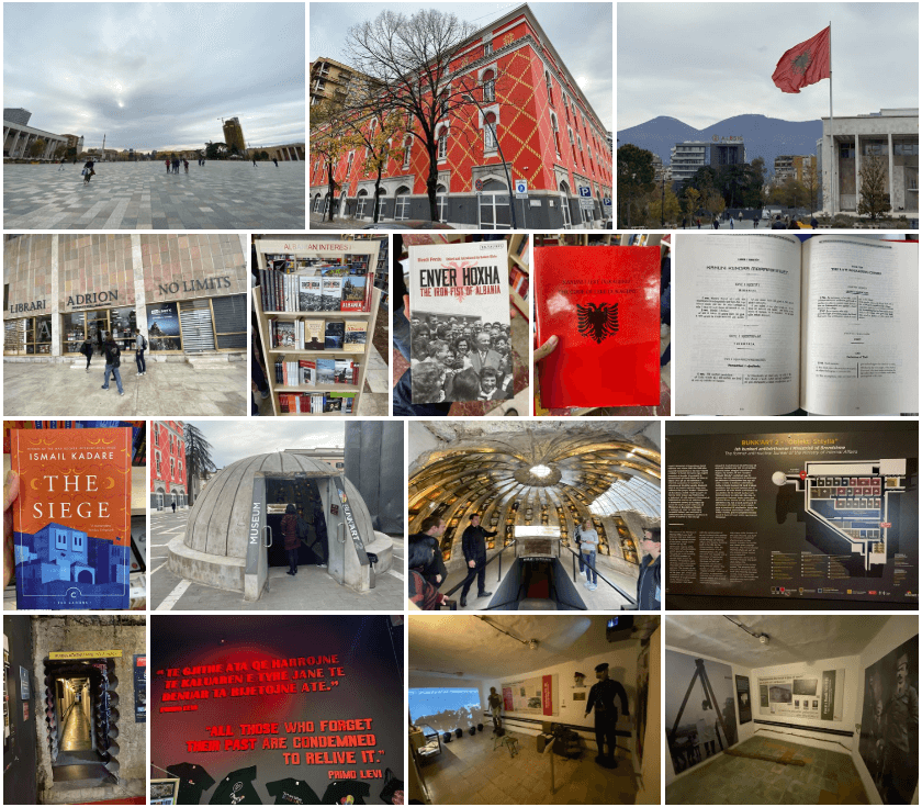
20. Tirana, Albania

Tirana is the capital and largest city by area and population of the Republic of Albania. The city was fairly unimportant until the 20th century, when the Congress of Lushnjë proclaimed it as Albania’s capital, after the Albanian Declaration of Independence in 1912.

Due to its location within the Plain of Tirana and the close proximity to the Mediterranean Sea, the city is particularly influenced by a Mediterranean seasonal climate. It is among the wettest and sunniest cities in Europe, with 2,544 hours of sun per year.

Tirana, Albania


21. Budva & Tivat & Kotor, Montenegro

Montenegro is a country of South and Southeast Europe on the coast of the Balkans.

After World War I, it became part of Yugoslavia. Following the breakup of Yugoslavia, the republics of Serbia and Montenegro together established a federation known as the Federal Republic of Yugoslavia, which was renamed to the State Union of Serbia and Montenegro in 2003.

On the basis of an independence referendum held in May 2006, Montenegro declared independence and the federation peacefully dissolved on 3 June of that year, ending a nearly 88-year union between the two states.

Budva & Tivat & Kotor, Montenegro


22. Belgrade, Serbia

Belgrade is the capital and largest city of Serbia. In a fatally strategic position, the city has been battled over in 115 wars and razed 44 times. It was also the capital of Yugoslavia from its creation in 1918 to its dissolution in 2006.

Following disastrous casualties in World War I, and the subsequent unification of the former Habsburg crownland of Vojvodina (and other lands) with Serbia, the country co-founded Yugoslavia with other South Slavic peoples, which would exist in various political formations until the Yugoslav Wars of the 1990s.

During the breakup of Yugoslavia, Serbia formed a union with Montenegro, which was peacefully dissolved in 2006 and restoring Serbia’s independence as a sovereign state for the first time since the late 1910s. In 2008, the parliament of the province of Kosovo unilaterally declared independence, with mixed responses from the international community.

Belgrade, Serbia


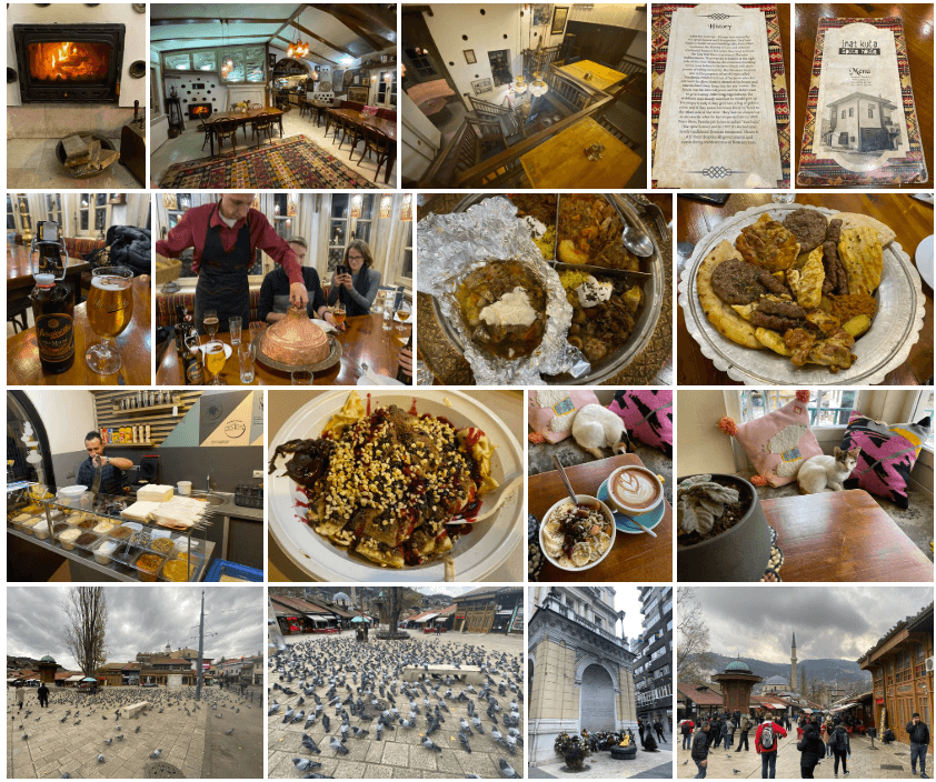
23. Sarajevo, Bosnia & Herzegovina

Sarajevo is the political, financial, social and cultural center of Bosnia and Herzegovina (B&H) and a prominent center of culture in the Balkans, with region-wide influence in entertainment, media, fashion and the arts.

Due to its long history of religious and cultural diversity, Sarajevo is sometimes called the “Jerusalem of Europe”. It is one of only a few major European cities to have a mosque, Catholic church, Orthodox church and synagogue within the same neighborhood.

In 1885, Sarajevo was the first city in Europe and the second city in the world to have a full-time electric tram network running through the city, following San Francisco. In 1914, it was the site of the assassination of Archduke Franz Ferdinand of Austria by local Young Bosnia activist Gavrilo Princip that sparked World War I, which also ended Austro-Hungarian rule in Bosnia and resulted in the creation of the Kingdom of Yugoslavia.

Later, after World War II, the establishment of the Socialist Republic of B&H within the Second Yugoslavia led to a massive expansion of Sarajevo, then the constituent republic’s capital, which culminated with the hosting of the 1984 Winter Olympics marking a prosperous era for the city. However, after the start of the Yugoslav Wars, for 1,425 days, from April 1992 to February 1996, the city suffered the longest siege of a capital city in the history of modern warfare, during the Bosnian War and the breakup of Yugoslavia.

Sarajevo, Bosnia & Herzegovina


24. Tunnel & Winter Olympics, Bosnia & Herzegovina

The Sarajevo Tunnel, also known as Tunel spasa and Tunnel of Hope, was a tunnel constructed between March and June 1993 during the Siege of Sarajevo in the midst of the Bosnian War. It was built by the Bosnian Army in order to link the city of Sarajevo, which was entirely cut off by Serbian forces, with Bosnian-held territory on the other side of the Sarajevo Airport, an area controlled by the United Nations.

The tunnel linked the Sarajevo neighborhoods of Dobrinja and Butmir (that’s why it’s also called “Tunnel D-B”), allowing food, war supplies, and humanitarian aid to come into the city, and allowing people to get out. The tunnel became a major way of bypassing the international arms embargo and providing the city defenders with weaponry.

When Sarajevo was awarded the 1984 Winter Olympics in 1977, a bobsleigh and luge track was proposed. The first international competition of merit held at the track was the 1983 European Bobsleigh Championships in January of that year. The 1984 games had 20,000 luge spectators and 30,000 bobsleigh spectators.

After the Winter Olympics, the track was used for World Cup competitions until the start of the Yugoslav wars in 1991 that would include the Bosnian War the following year. The track was damaged as a result of Siege of Sarajevo. During the siege, the track was used as an artillery position by Bosnian Serb forces.

Tunnel & Winter Olympics


25. Zagreb, Croatia

Zagreb is the capital and the largest city of Croatia. It is located in the northwest of the country, along the Sava river, at the southern slopes of the Medvednica mountain.

Zagreb is also the most important transport hub in Croatia where Central Europe, the Mediterranean and Southeast Europe meet, making the Zagreb area the centre of the road, rail and air networks of Croatia.

It is a city known for its diverse economy, high quality of living, museums, sporting, and entertainment events. Its main branches of economy are high-tech industries and the service sector.

Zagreb, Croatia


26. Bratislava, Slovakia

Bratislava is the capital of Slovakia. With a population of about 430,000, it is one of the smaller capitals of Europe but still the country’s largest city. Bratislava is in southwestern Slovakia, occupying both banks of the River Danube and the left bank of the River Morava.

The city’s history has been influenced by people of many nations and religions, including Austrians, Bulgarians, Croats, Czechs, Germans, Hungarians, Jews, Serbs and Slovaks.

It was the coronation site and legislative center of the Kingdom of Hungary from 1536 to 1783,[8] and has been home to many Slovak, Hungarian and German historical figures.

Bratislava, Slovakia


27. Devin Castle & TV Tower, Slovakia

Devín Castle is a castle in Devín, which is a borough of Bratislava, the capital of Slovakia.

The most photographed part of the castle is the tiny watchtower, known as the Maiden Tower. Separated from the main castle, it balances perilously on a lone rock and has spawned countless legends concerning imprisoned lovelorn daughters leaping to their deaths.

Inside the castle is a sprawling landscape of walls, staircases, open courtyards and gardens in various states of disrepair.

The Kamzík TV Tower is a 196-metre tall television transmission tower in the Koliba area of Bratislava. It sits 437m above sea level on the Kamzík hill, part of the Little Carpathians, overlooking much of the city. It was constructed in 1975, replacing a previous transmission tower.

The tower has a public observation deck. In conditions of good visibility, Austria, Hungary and the Czech Republic are visible from the tower.

Devin Castle & TV Tower


Once again, to see the full photo albums for this trip, please visit: https://synapsetrading.com/travel-log/

Enjoy! 😀

2019 12 26 13.45.00

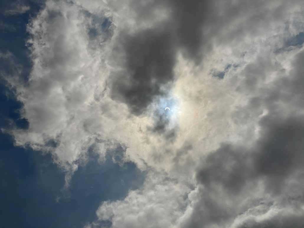
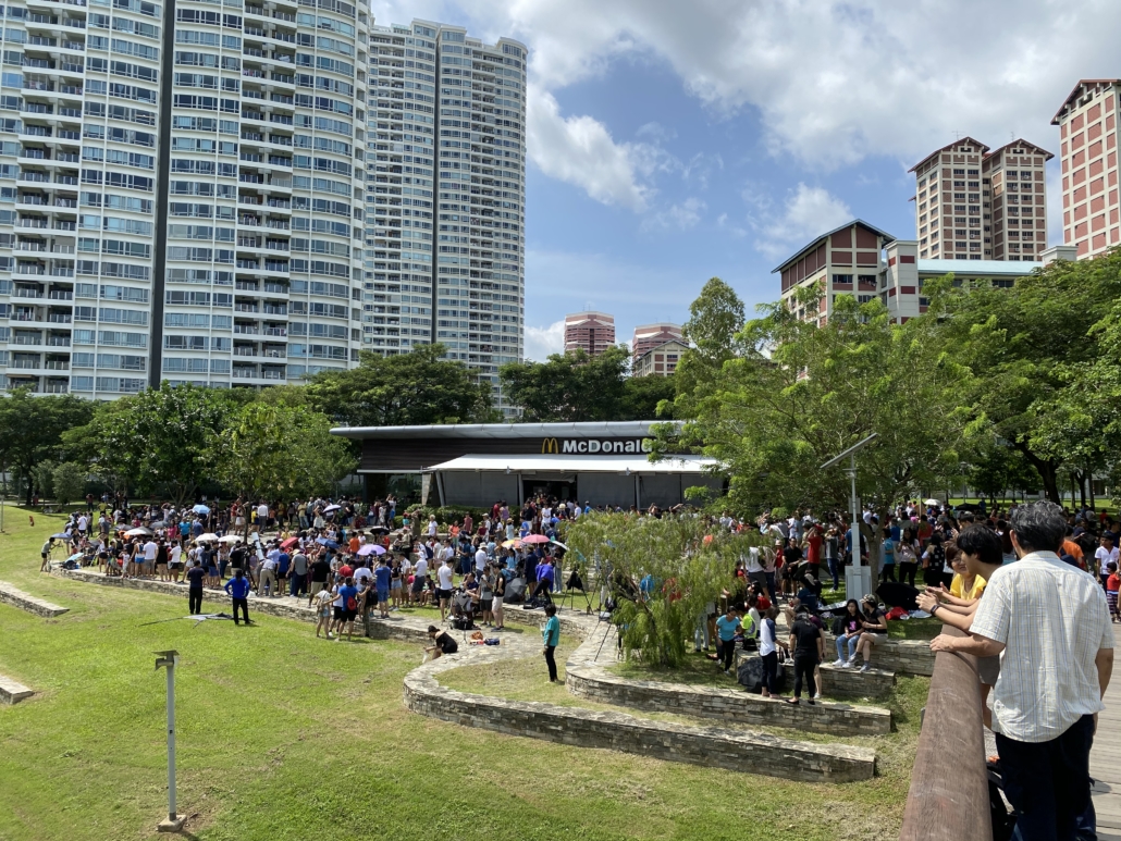
On 26th December, there was a rare “Ring of Fire” annular solar eclipse, which occurs when the Moon covers the centre of the Sun, giving the appearance of a fiery ring around it.

Here in Singapore, this sight was visible for the first time in two decades, and will next appear in 2063.

As a former member of the Astronomy club (back when I was in school), I was delighted to see the general public take such an interest in this event.

Here are some of the photos I got:

Solar Eclipse

Solar Eclipse 3

Solar Eclipse 5

Solar Eclipse 5

Solar Eclipse 6

Solar Eclipse 7

Solar Eclipse 8


Hope you didn’t miss it, or you will need to wait for another 40 years! ?