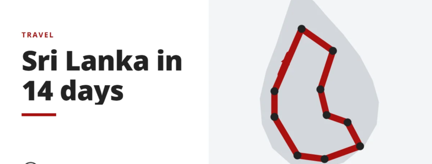
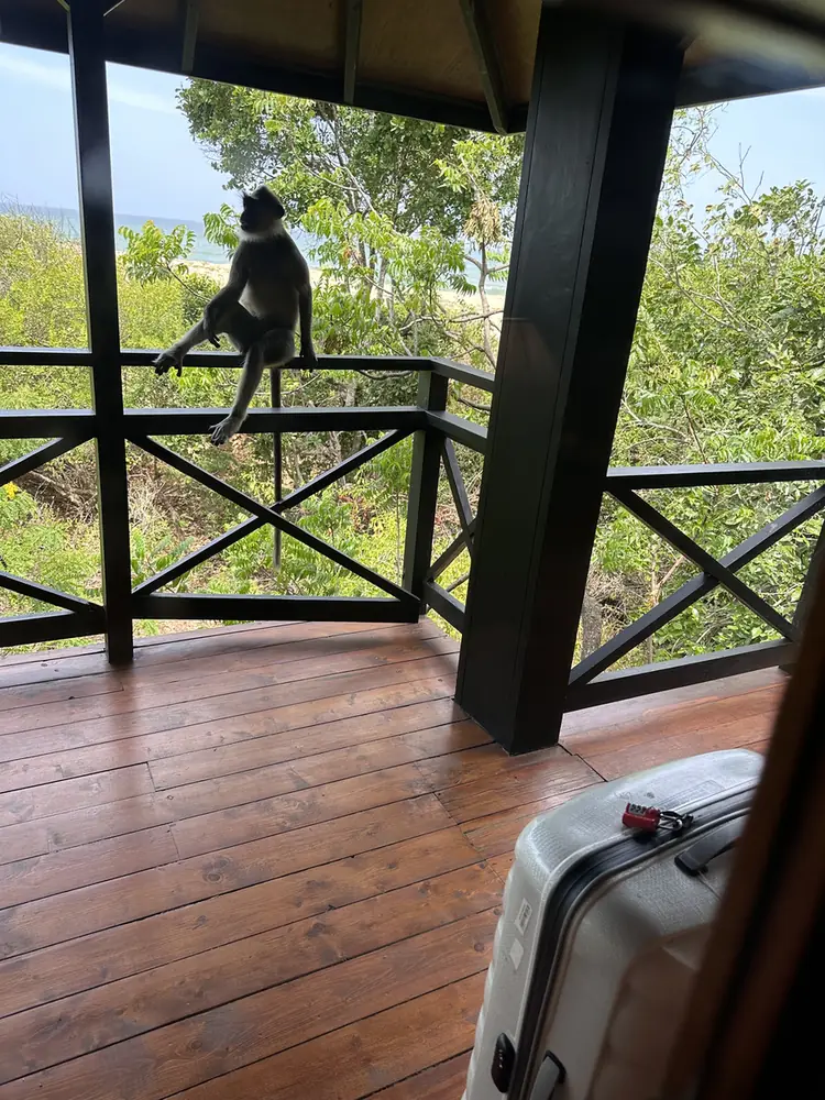
In June 2023, my wife and I spent 14 days going around Sri Lanka, and it was our first big trip together.
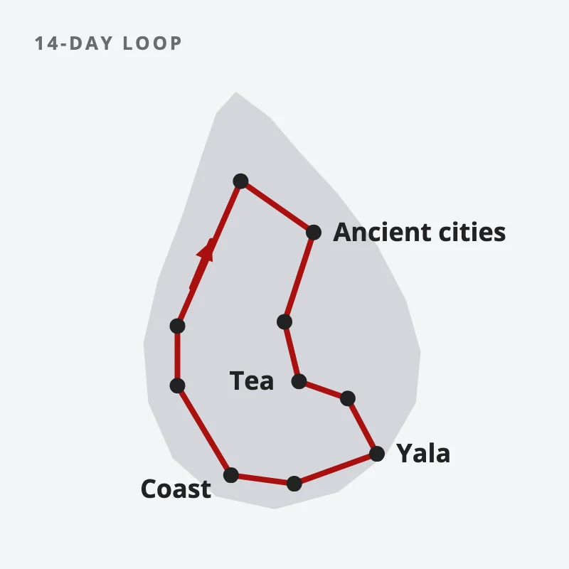
We planned a 2-week loop of the island, then booked a car and an English-speaking driver-guide to take us round it, with the train seats reserved in advance.
So how did the plan hold up on the ground? Mostly, it held. Nearly every stop on the plan is a pin on my visited map.
Why Sri Lanka?
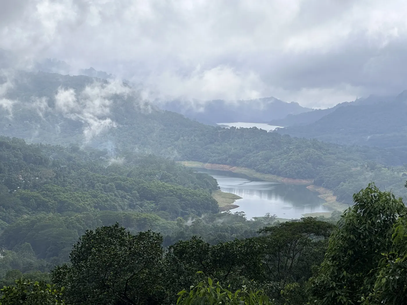
Sri Lanka is about the size of Ireland, a short flight from Singapore, and it packs ancient cities, tea hills, rainforest, beaches and national parks into a loop you can drive in 2 weeks. Do note that June is the southwest monsoon. On the coast that means 26 to 30 degrees in the day, the hill country sits at a cool 14 to 22, and short afternoon showers are common.
A 2-week loop by car takes in ancient cities, tea hills, Yala and the coast.
The ancient cities: what is worth the heat?
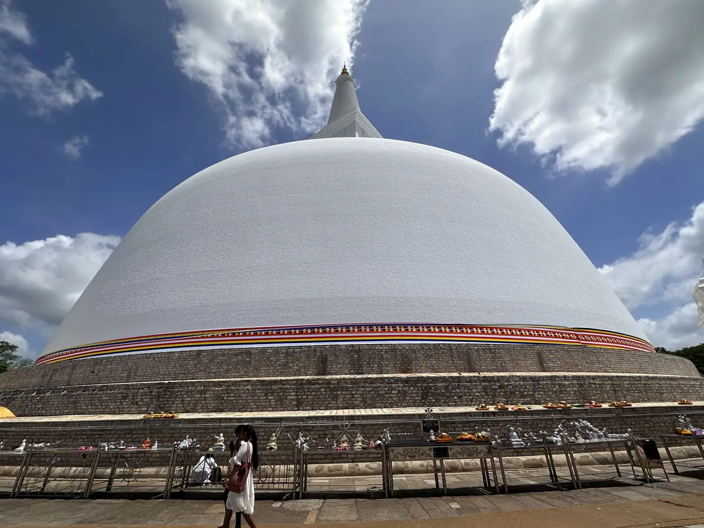
We landed in Negombo, near the airport, and drove north to Anuradhapura, the island’s first great capital. The Sri Maha Bodhi is a fig tree grown from a cutting of the tree the Buddha sat under, and it has been tended there for over 2,000 years. Nearby Mihintale is the hill where Buddhism is said to have arrived in Sri Lanka.
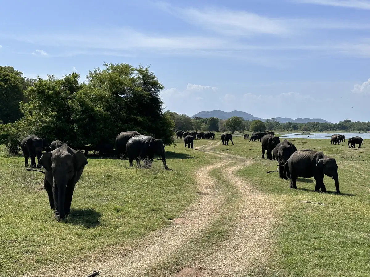
From there we went to Minneriya for an elephant safari. In the dry months, herds gather around the old reservoir there to feed on the grass, and it is one of the largest gatherings of Asian elephants anywhere.
Then Polonnaruwa, the later medieval capital, and the Dambulla cave temples, where the rock is painted and lined with Buddha statues.
Sigiriya or Pidurangala?
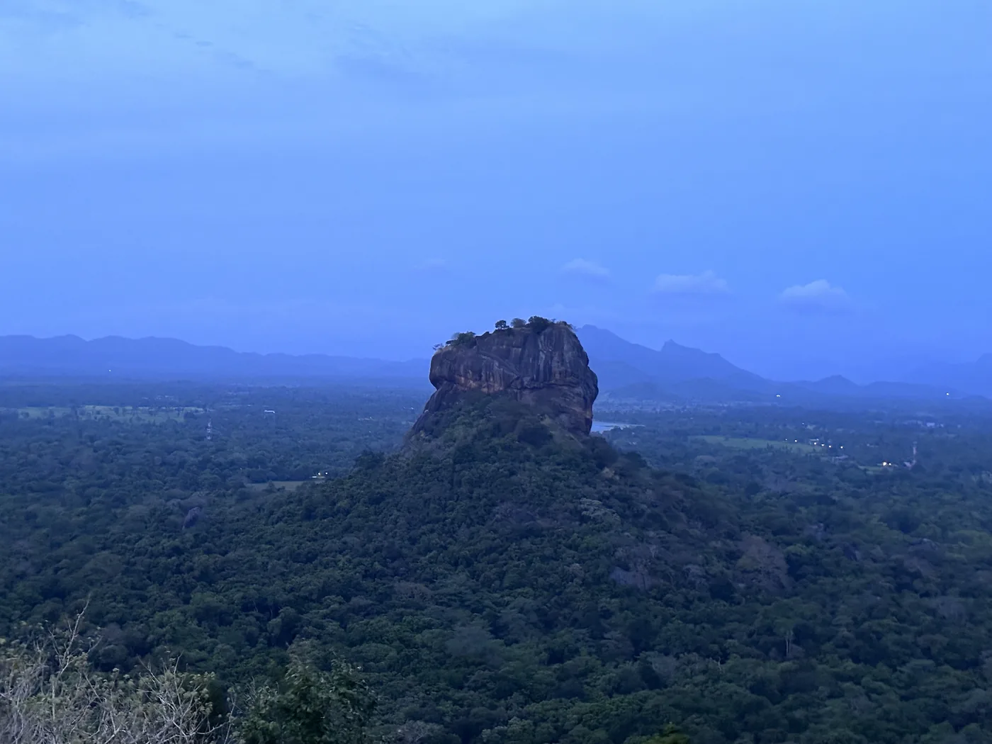
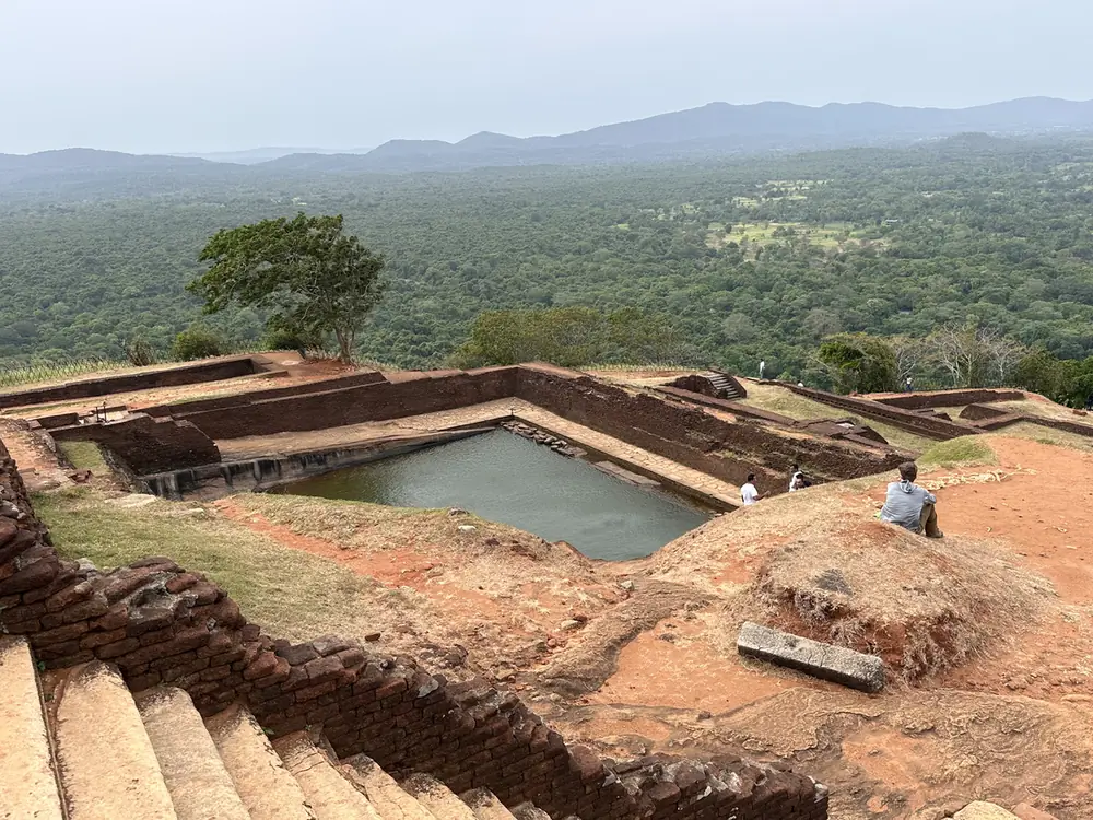
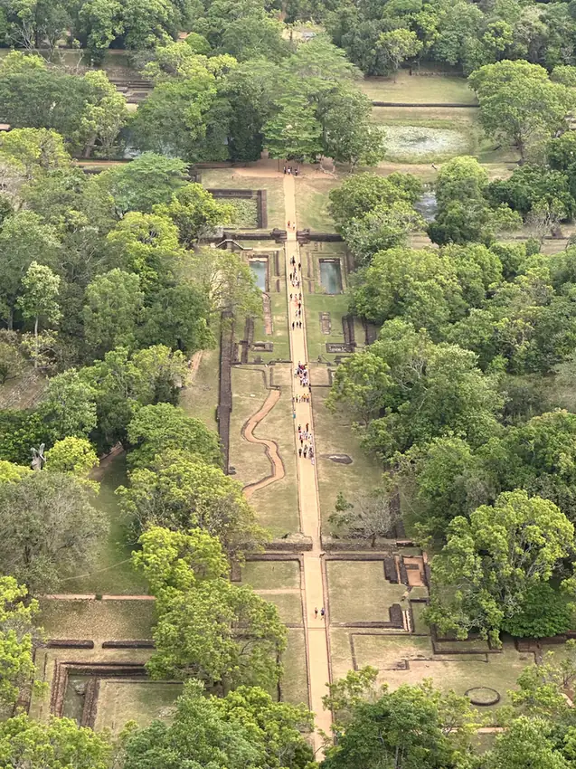
Both, if you can. Sigiriya is the famous one, a 5th-century palace built on top of a rock that rises about 200 metres out of the plain. Pidurangala is the rock next door, and it is the one you climb for the view of Sigiriya itself. We went to both.
Kandy and the tea country
On the way to Kandy we stopped at a spice garden, then spent a night in Kandy, by the lake. Kandy’s big sight is the Temple of the Tooth, which holds what is believed to be a tooth of the Buddha. We also walked the Royal Botanic Gardens at Peradeniya.
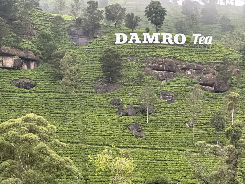
From Kandy, the road climbs into tea country. We had lunch at Chill Ramboda on the way up, with a waterfall view, and then Nuwara Eliya, the old British hill station that people still call “Little England”. We visited the tea plantations, sat in a tea lounge in the middle of the estates, and had English high tea at The Grand Hotel.
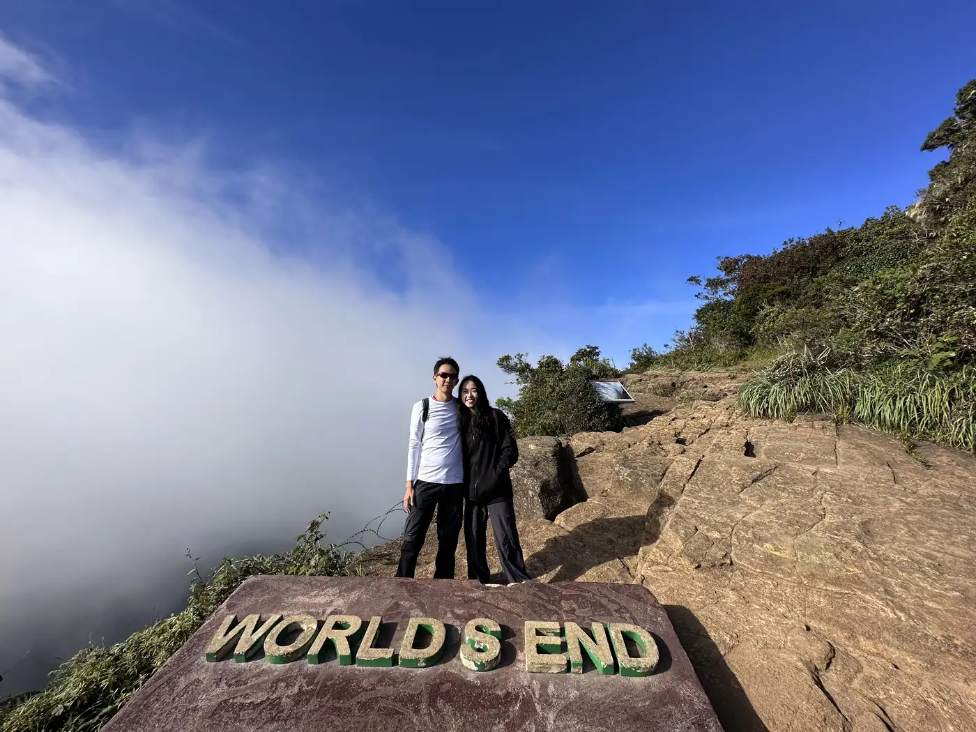
We also walked Horton Plains, a high plateau that ends at a cliff called World’s End, with Baker’s Falls along the trail.
Ella: what is there to do?
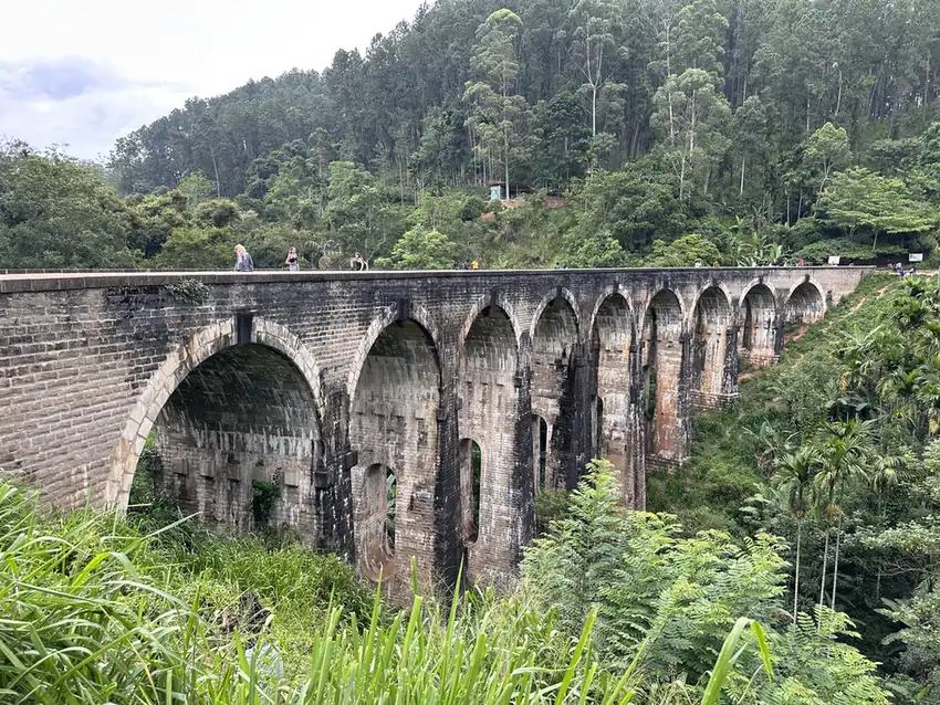
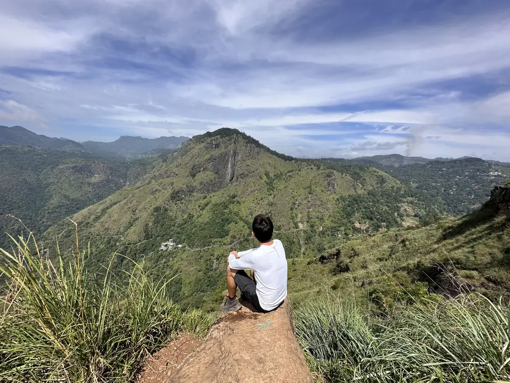
In Ella we walked to the Nine Arches Bridge, a stone railway bridge in the middle of the jungle, climbed Little Adam’s Peak, looked across at Ella Rock, and went down the Flying Ravana zipline. We ate at Higher Ground, a treehouse cafe.
Yala: leopard country
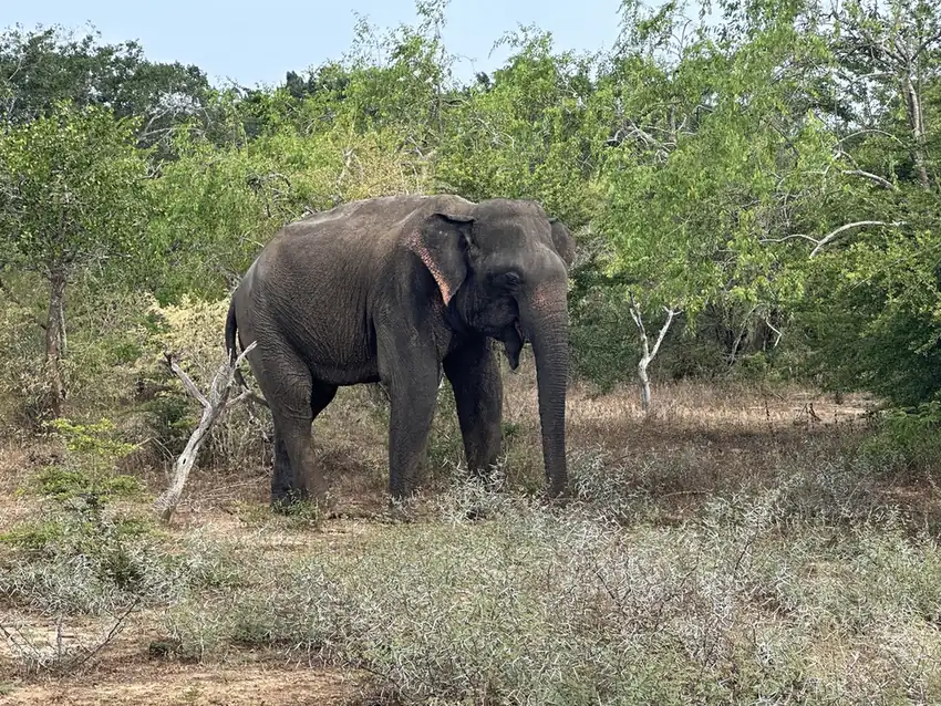
Yala National Park is known for having one of the highest densities of leopards in the world, and we stayed at a lodge right on the park’s edge.
The south coast and Colombo
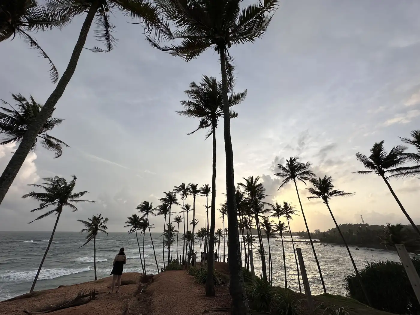
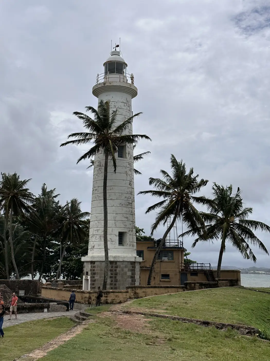
The last few days were on the south coast. We stayed at Mirissa, climbed Coconut Tree Hill, the palm-topped headland that is on every Sri Lanka Instagram feed, and spent time on Unawatuna Beach. We stopped at a sea turtle hatchery and walked the walls of Galle Fort, the old Dutch fort town.
We ended in Colombo, at the Gangaramaya Temple, the Lotus Tower and Galle Face Green, the seafront where the street food comes out in the evening.
How did the trading fit in?
The same way it always does, in about 15 minutes a day. Sri Lanka is 2.5 hours behind Singapore, which barely moves the routine.
That routine is what lets a 2-week trip run without the markets running the trip. I wrote up how it works, the watchlist, the alerts and the time zones, in how I trade while travelling.
What would I tell a friend?
If you are planning Sri Lanka, here are three things. Hire a car and a driver-guide for the loop, because the distances are short on the map and slow on the road. Do Pidurangala for the view and Sigiriya for the history. And give Ella at least 2 nights.
Have you been to Sri Lanka? Which would you pick first, the ancient cities, the tea country or the coast? Let me know in the comments.
All my other trips are on the travel log, country by country, and more photos from this one are on Instagram, @iamrecneps.
https://synapsetrading.com/wp-content/uploads/2026/10/sri-lanka-2023-card.webp6301200Spencer Lihttps://synapsetrading.com/wp-content/uploads/2026/10/synapse-logo-horizontal-light.pngSpencer Li2023-06-26 12:00:002026-10-22 12:51:58Sri Lanka in 14 Days: Ancient Cities, Tea Country and Yala by Private Driver
In September 2022, after almost 3 years without a real trip, I spent about 5 weeks in Central Asia. I crossed 4 of the “Stans”, Kyrgyzstan, Kazakhstan, Tajikistan and Uzbekistan, and finished in Turkey.
All 4 Stans were new countries for me, and the short version is this. The Stans were far less touristy than I expected, a little less developed, and much quieter, which I counted as a good thing. Turkey was the opposite: beautiful, and very crowded. And across the whole of Central Asia, I really liked the food and the culture.
Why the Stans?
These are 4 countries that were part of the Soviet Union until 1991, sitting on the old Silk Road between China and Europe, and they only became easy to visit in the last decade or so.
I wanted to do all 5. Turkmenistan was still closed to visitors because of Covid, so it stays on the list for another trip.
Dubai: how do you spend a long transit?
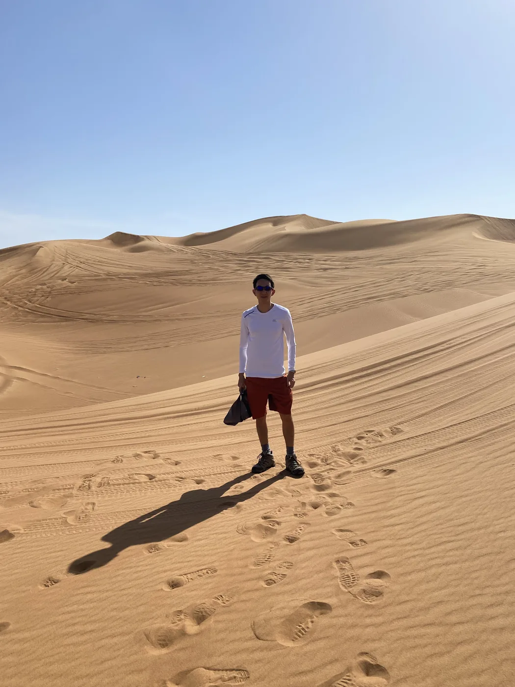
Dubai was a stop on the way, with enough hours in transit to leave the airport. So I did the desert safari.
The usual version goes like this. A 4×4 picks you up in the late afternoon and drives about 50 km out of the city into the dunes. The driver then takes the car up and down the sand at angles that make the passengers grip the seats, stops at a viewpoint for the sunset, and ends at a desert camp with a show and a barbecue dinner. It is touristy, and it is still a far better use of a long transit than a wait at the gate.
Kyrgyzstan
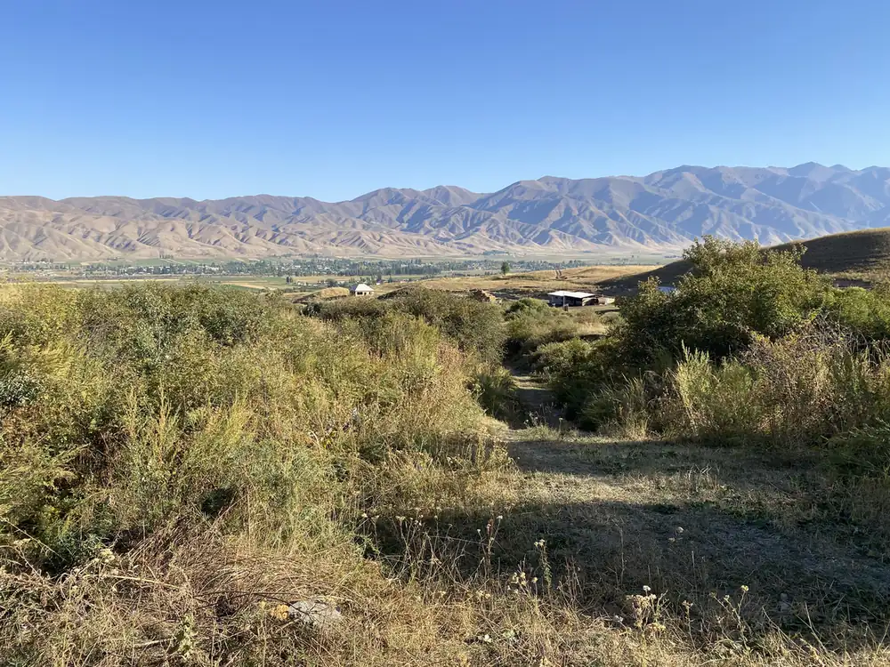
Kyrgyzstan is the mountain country of the trip. About 90% of it is mountains, and the Tian Shan range runs right across it. It also has the most stops on my route.
Bishkek and the Burana Tower
Bishkek, the capital, is a city of about 1 million people near the Kazakh border, laid out in wide Soviet-era streets with the mountains in view to the south.
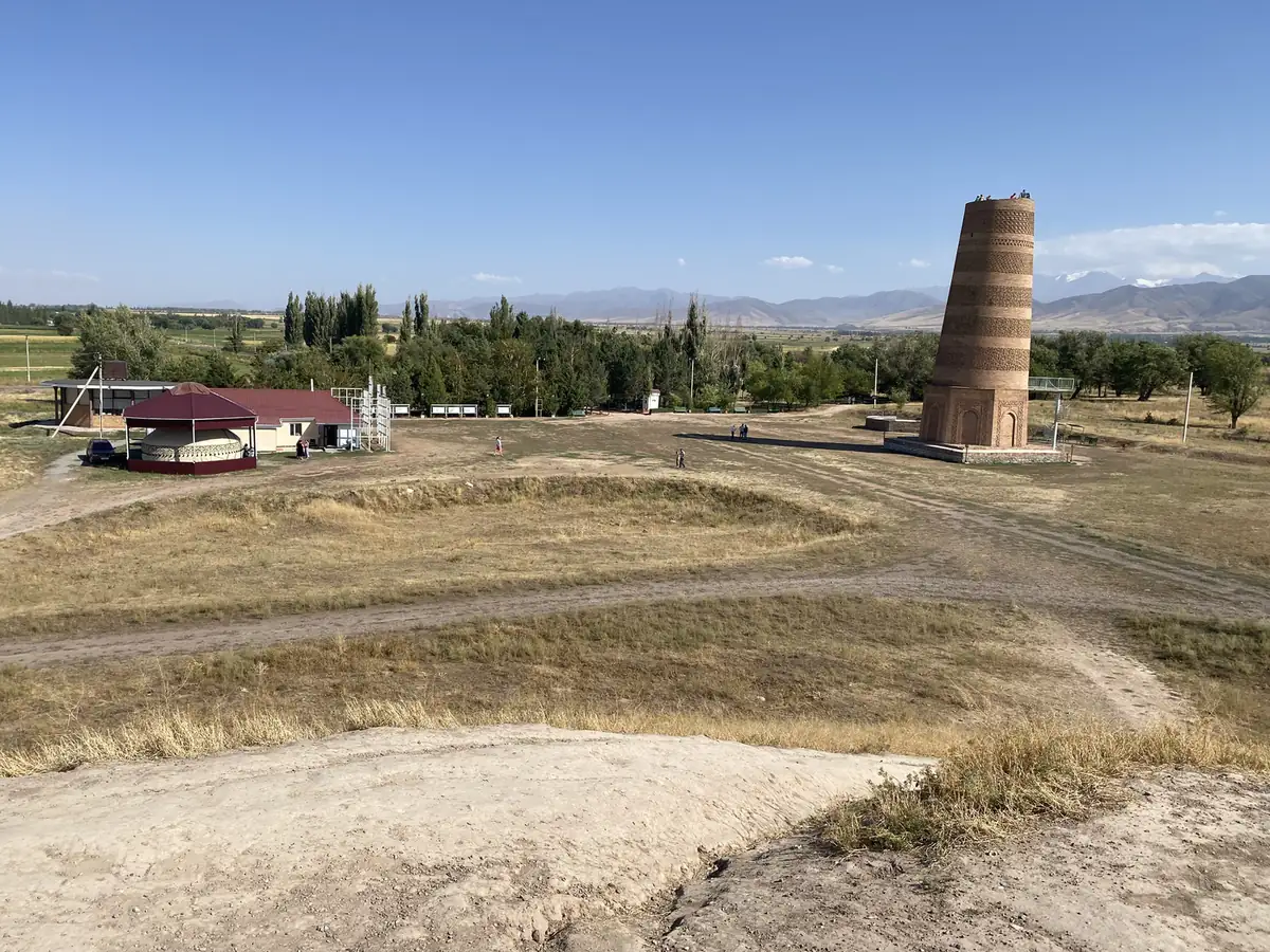
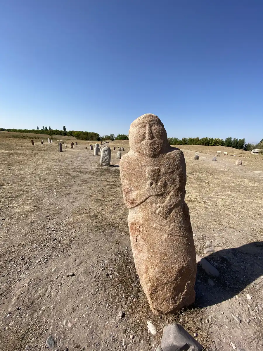
About 80 km east of the city stands the Burana Tower, a minaret built in the 11th century. It is almost all that is left of Balasagun, a city founded at the end of the 9th century on the Silk Road. Around it, in a field, stand rows of old carved stone grave markers.
Chong-Kemin Valley
From Bishkek, the road runs east into Chong-Kemin, a national park of about 1,200 square kilometres with a river running 116 km through it and 7 lakes in its basin. It is one of the prettiest valleys in the country, and it is home to snow leopards and golden eagles.
Kochkor and the yurts
Kochkor is a large village at about 1,800 metres, on the main road that runs from the Chinese border at Torugart up to Bishkek. It is also the jumping-off point for Song-Kol.
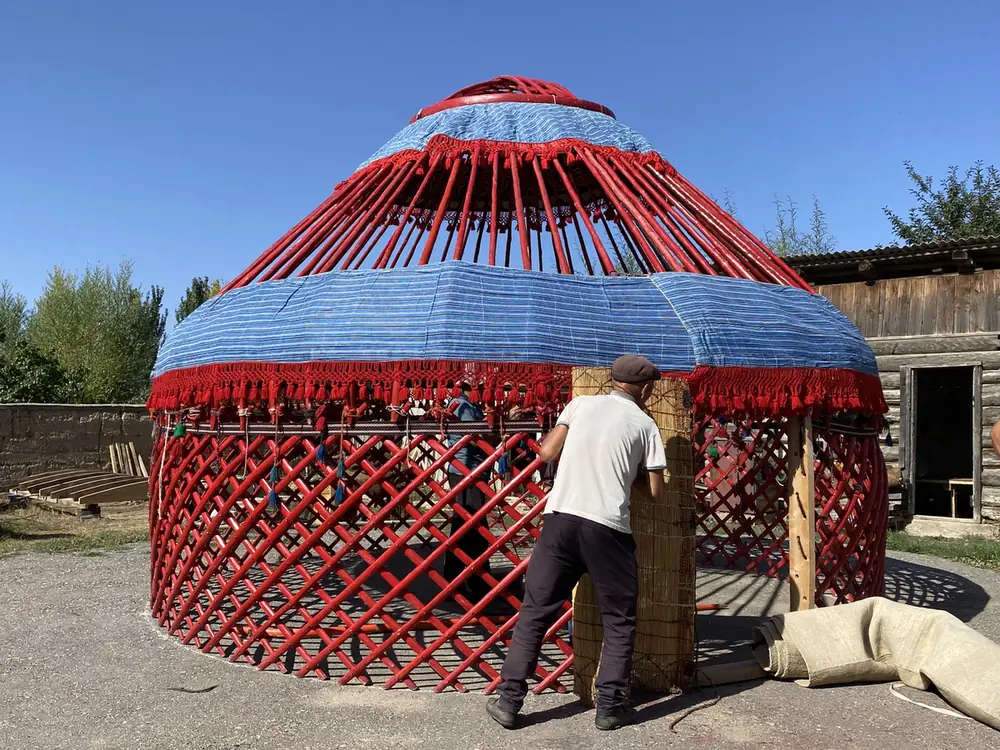
My photo folder for this stretch has a set labelled “yurt making”, and that was one of the things I most wanted to see on the trip. A yurt is the round felt tent the nomads of Central Asia have lived in for centuries, and the Kyrgyz still set them up in the high pastures every summer.
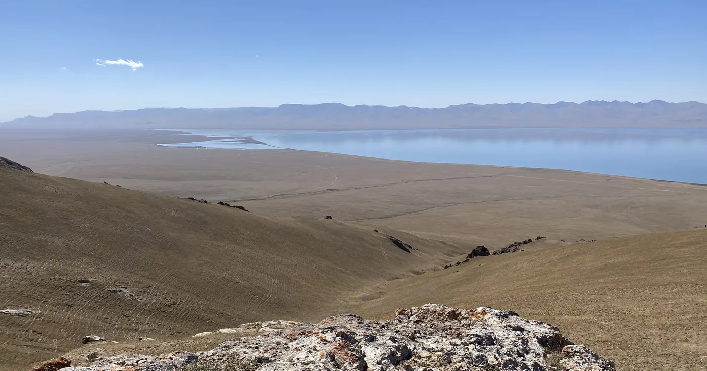
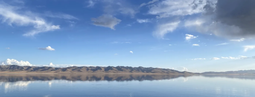
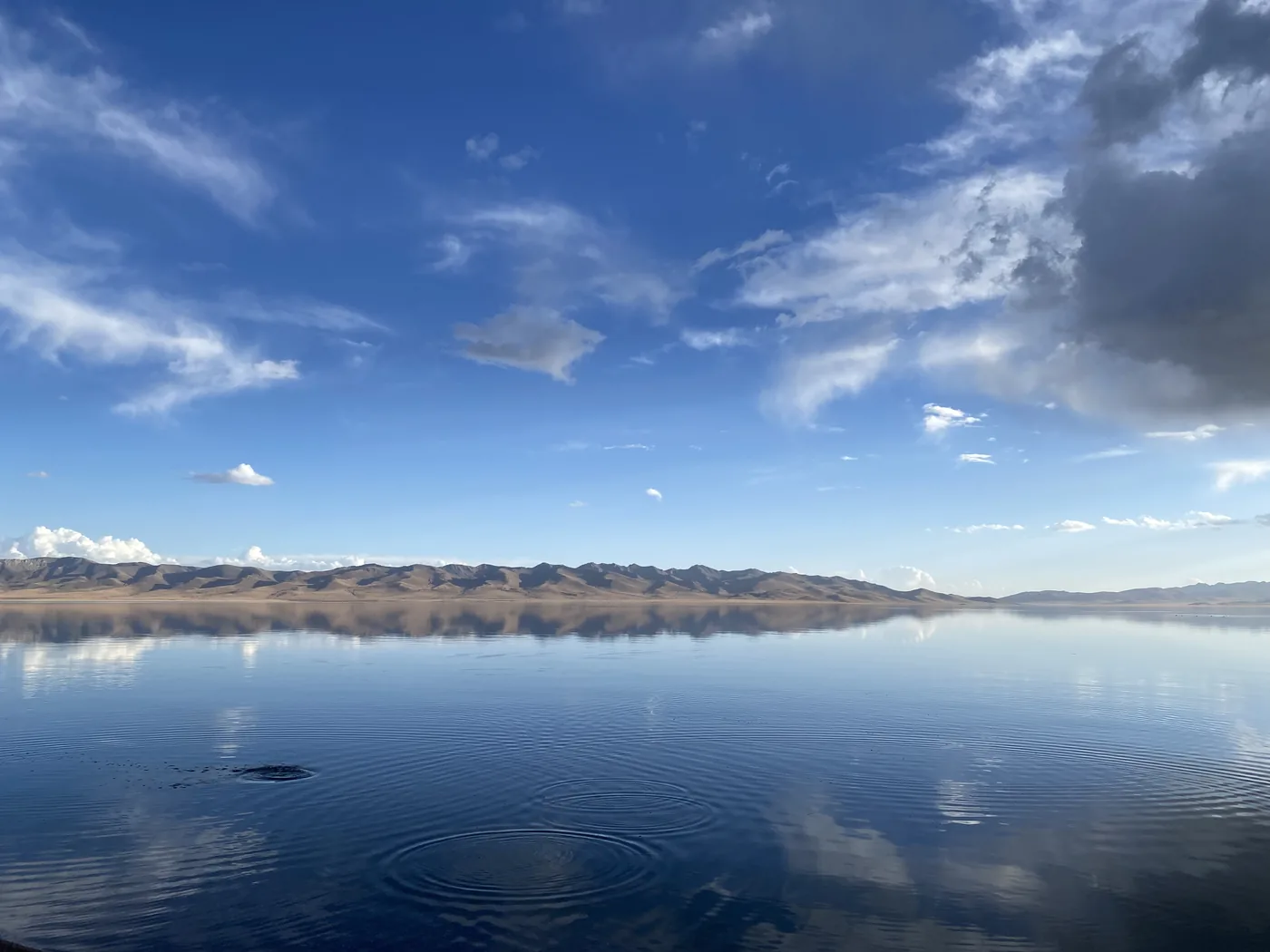
Song-Kol sits at about 3,016 metres. It is the largest freshwater lake in Kyrgyzstan, about 29 km long and 18 km wide, and in summer the herders bring their horses and sheep up to the pastures around it and live there in yurts until the cold comes back.
Issyk-Kul, Jeti-Oguz and Karakol
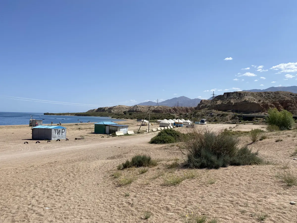
Issyk-Kul is the big one. It is the 2nd-largest salt lake in the world after the Caspian Sea, and one of the deepest. Its name means “warm lake” in Kyrgyz, because although it sits at about 1,600 metres and the winters are hard, it never freezes.
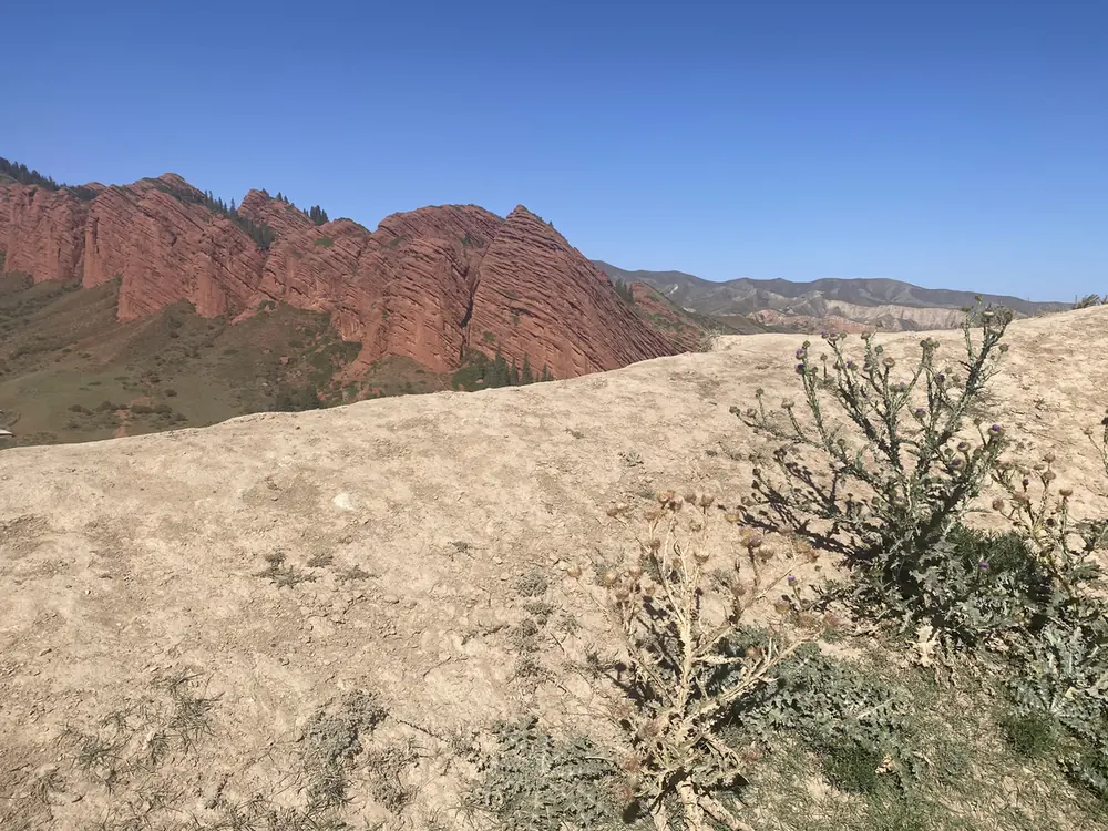
Near its eastern end lies Jeti-Oguz, “seven bulls”, a line of red sandstone cliffs that the name compares to a row of bulls. And Karakol, the 4th-largest city in the country, is the base for all of it, about 380 km from Bishkek and 150 km from the Chinese border.
Kazakhstan
Saty, Kolsay Lakes and Kaindy Lake
From Karakol, I went on into Kazakhstan, to the Kolsay Lakes. The village of Saty is the usual base, and the lakes sit in a national park on the north side of the Tian Shan, about 10 km from the Kyrgyz border.
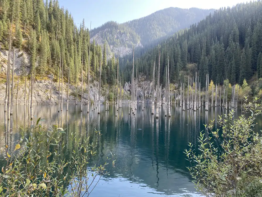
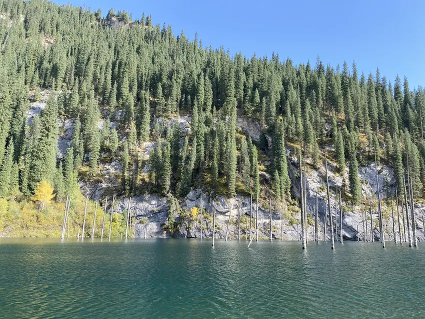
The Kolsay Lakes are often called the “pearls of the Tian Shan”. The one people come for is Lake Kaindy, formed by a landslide in 1911 that dammed a river and drowned a forest of spruce trees. The trunks still stand straight up out of the water, more than 100 years later.
Kolsay is one of the stops I picked for the highlights on my travel log.
Charyn Canyon
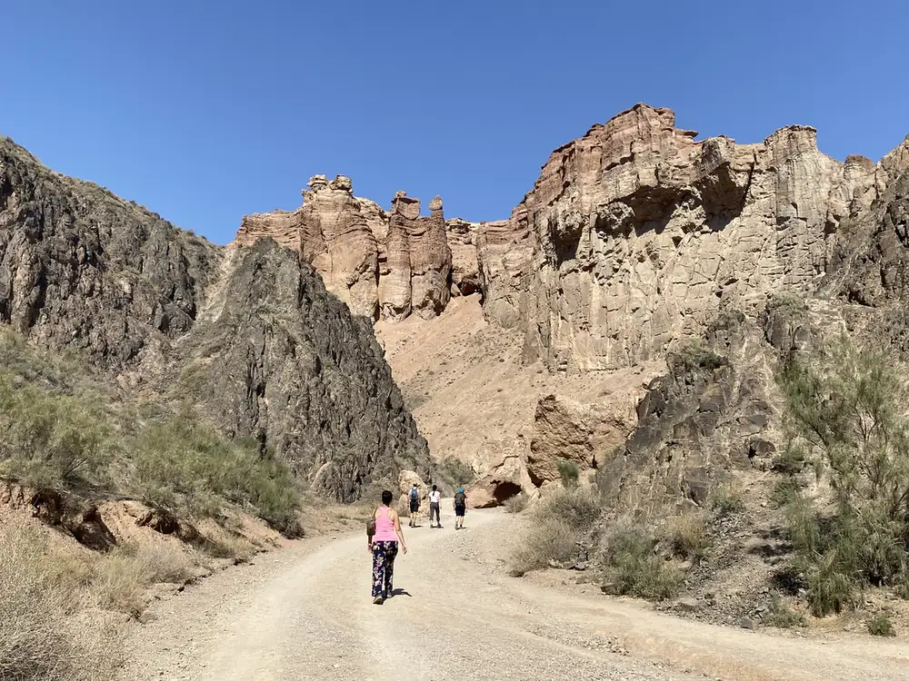
About 200 km east of Almaty, close to the Chinese border, the Sharyn River has cut a canyon about 154 km long. It is often compared with the Grand Canyon, on a smaller scale: the red and orange rock has weathered into towers, walls and shapes that people name after castles and animals.
Almaty
Almaty is the largest city in Kazakhstan, with about 2 million people. It was the capital until 1997, when the government moved north to what is now Astana, and it is still the country’s commercial centre and its most cosmopolitan city.
Tajikistan
Dushanbe
Dushanbe means “Monday” in Tajik, after the Monday market that once stood there. From 1929 to 1961 it was called Stalinabad. Today it is the capital and largest city, with a population of about 860,000, and most of it is Tajik, which means Persian rather than Turkic in language, a real change from the 2 countries before it.
Iskanderkul and the Fann Mountains
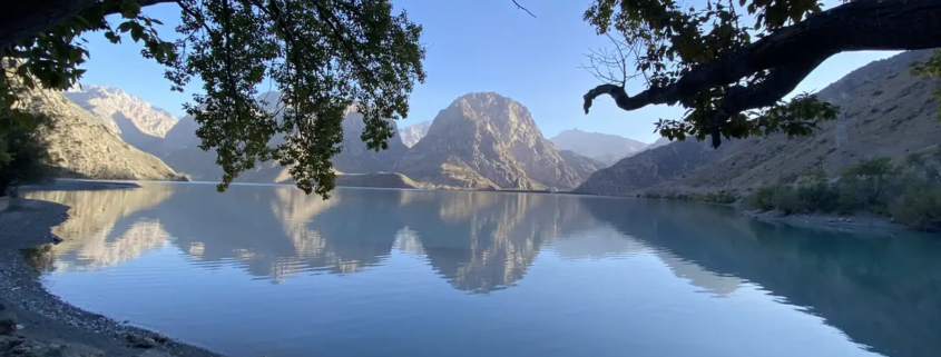
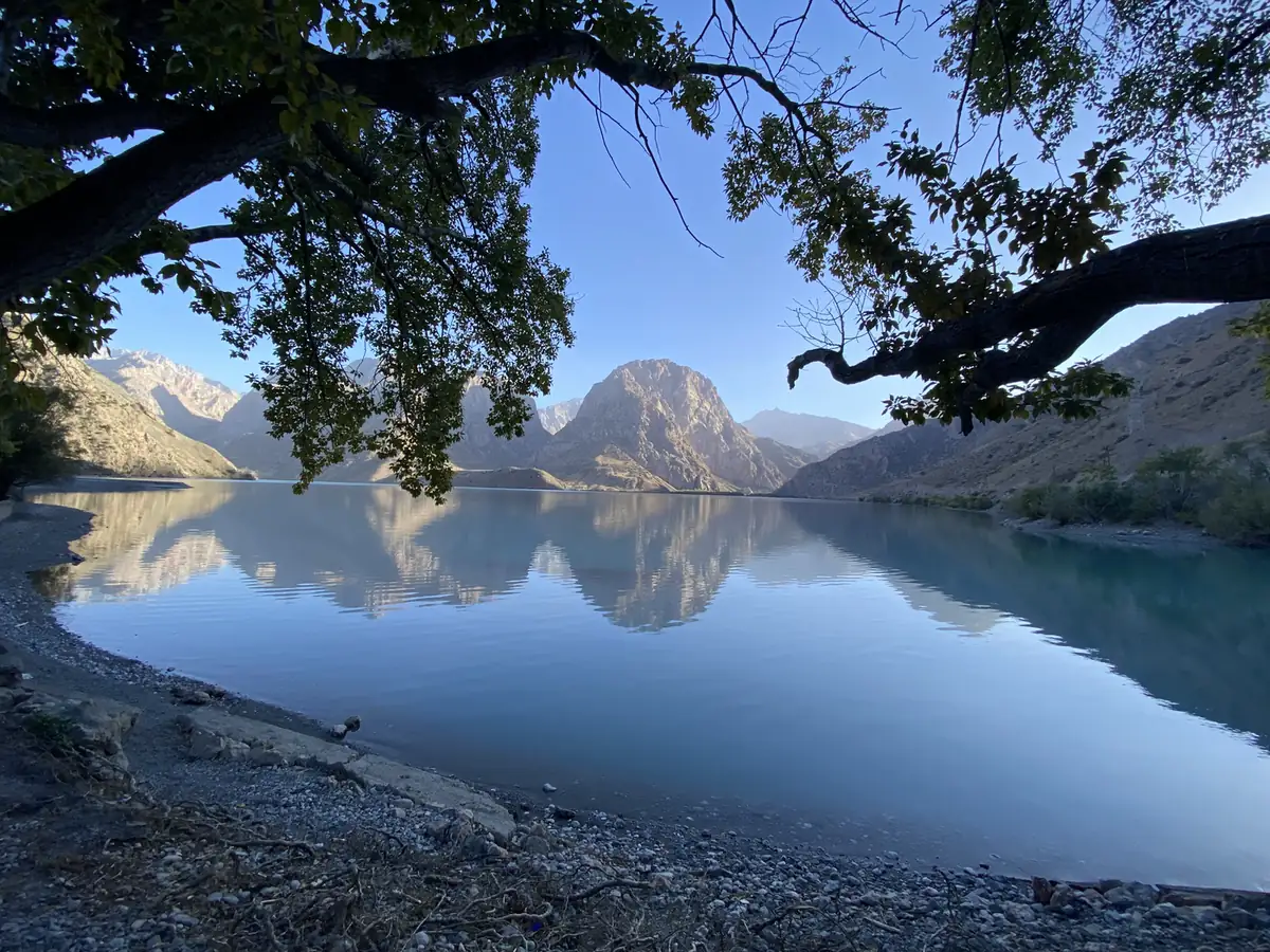
Iskanderkul is a glacial lake at about 2,195 metres in the Fann Mountains, and it takes its name from Alexander the Great: Iskander is the Persian form of Alexander, and “kul” means lake. One legend says his horse, Bucephalus, drowned in it. Near the lake there is a waterfall, which is the stop my photo folder calls “Iskandar Darya”.
The Fann Mountains around it hold about 100 peaks, several over 5,000 metres, with the highest, Chimtarga, at 5,489 metres. Iskanderkul is another of the stops I chose for the highlights on the travel log.
Khujand, in the far north, is one of the oldest cities in Central Asia, about 2,500 years old. Alexander the Great took it in 329 BC and renamed it Alexandria Eschate, “Alexandria the Furthest”. It sits where the Syr Darya river leaves the Fergana Valley, which made it an important stop on the Silk Road.
Uzbekistan
Uzbekistan is where the Silk Road stops being a phrase and becomes buildings. This is the stretch most people have heard of.
Tashkent
Tashkent is the largest city in Central Asia, with almost 3 million people. The name comes from the Turkic “tash” and “kent”, the city of stone. Genghis Khan destroyed it in 1219, it was rebuilt on the trade of the Silk Road, and in 1865 it fell to the Russian Empire, which is a lot of history for a city that now looks mostly modern.
Samarkand
Samarkand is one of the oldest continuously inhabited cities in Central Asia, with theories putting its founding in the 8th or 7th century BC. For long stretches it was one of the largest cities on the route between China and Europe, and today most of the people there speak Tajik, a form of Persian, rather than Uzbek.
Lake Aydarkul
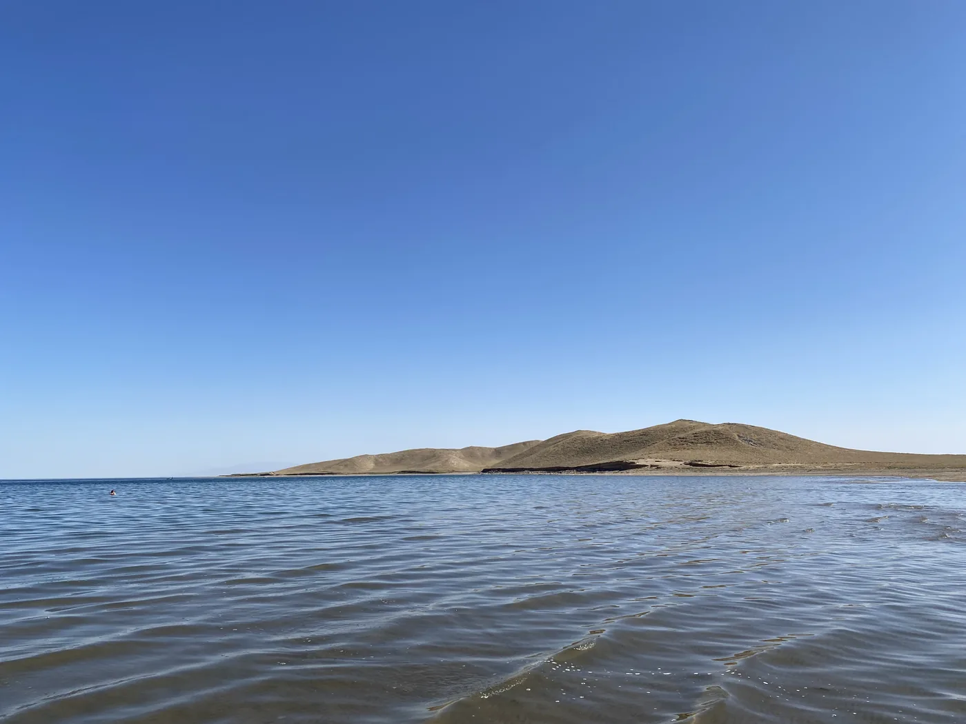
Aydarkul is a lake that should not exist. It formed by accident in the Soviet era, when water from an overflowing reservoir was diverted into a dry basin in the Kyzylkum desert in 1969, and it became part of a lake system covering about 4,000 square kilometres. A blue lake in the middle of a desert is a strange sight, and it is the third of my Central Asia highlights on the travel log.
Bukhara
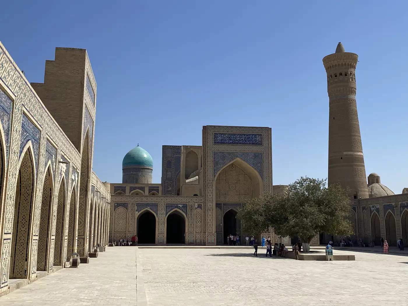
Bukhara has been lived in for at least 5,000 years, and the city itself is about half that age. It was a centre of trade, scholarship and religion on the Silk Road, and its old centre, with about 140 listed monuments, is a UNESCO World Heritage Site.
Khiva
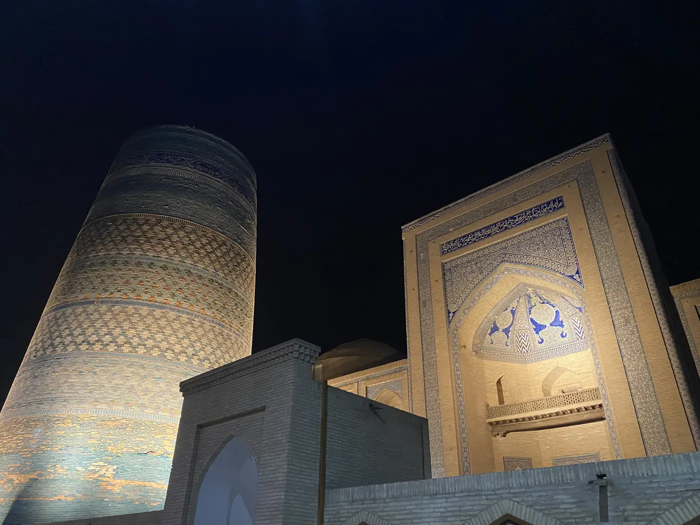
Khiva was the last stop in Uzbekistan. Its walled inner town, Itchan Kala, was the first place in Uzbekistan to be added to the World Heritage List, in 1990. The old town inside the walls is so complete that it is often called an open-air museum, except that people still live there.
Turkey
After 4 quiet weeks in the Stans, Turkey was a shock. It was very touristy and a lot more crowded.
Istanbul
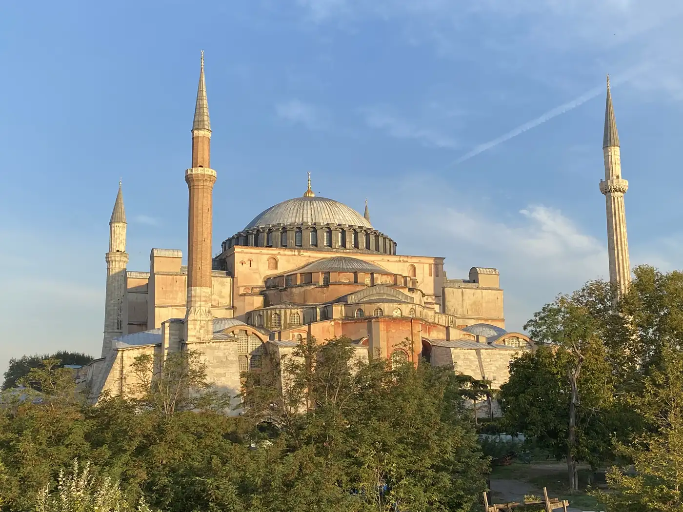
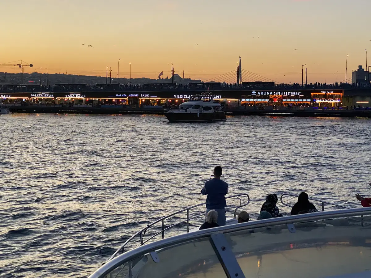
Istanbul, once Constantinople, sits on both sides of the Bosporus, half in Europe and half in Asia, and holds over 15 million people, about 1 in 5 of the country.
Cappadocia
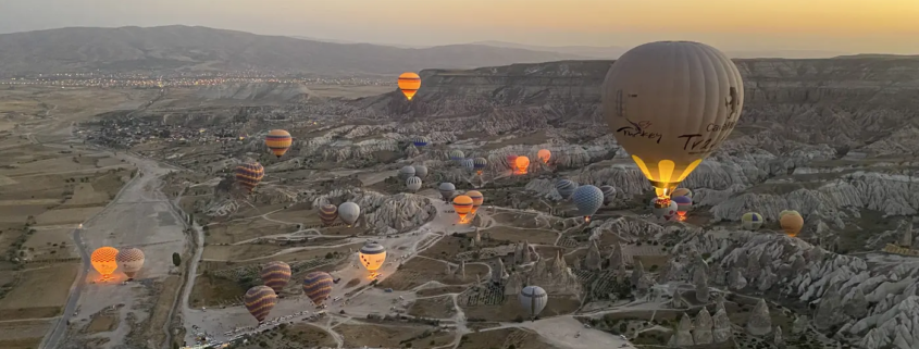
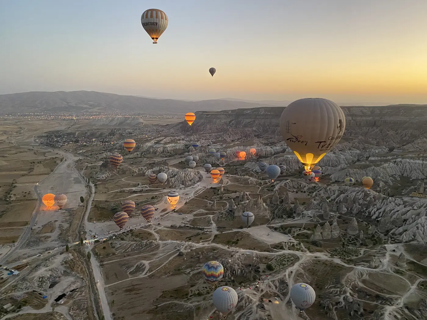
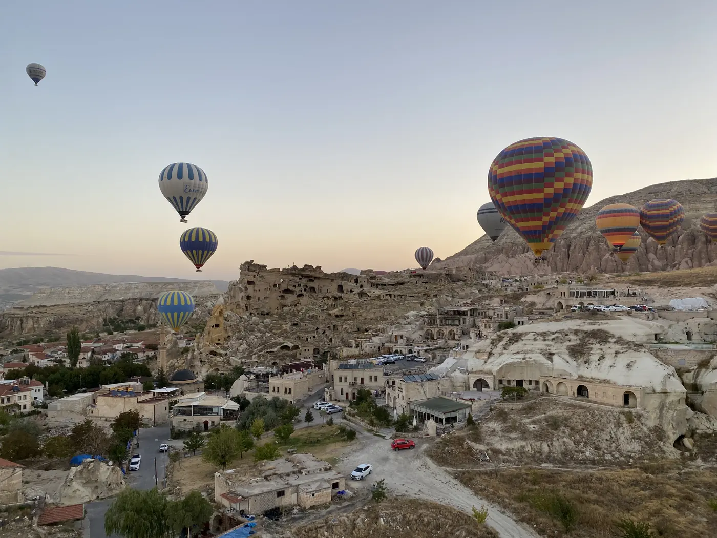
Cappadocia, in central Turkey, is known for its “fairy chimneys”: tall cones of soft volcanic rock, worn into shape by wind and rain, and dug out over centuries into homes, churches and whole underground towns.
Antalya, Pamukkale, Kusadasi and Ephesus
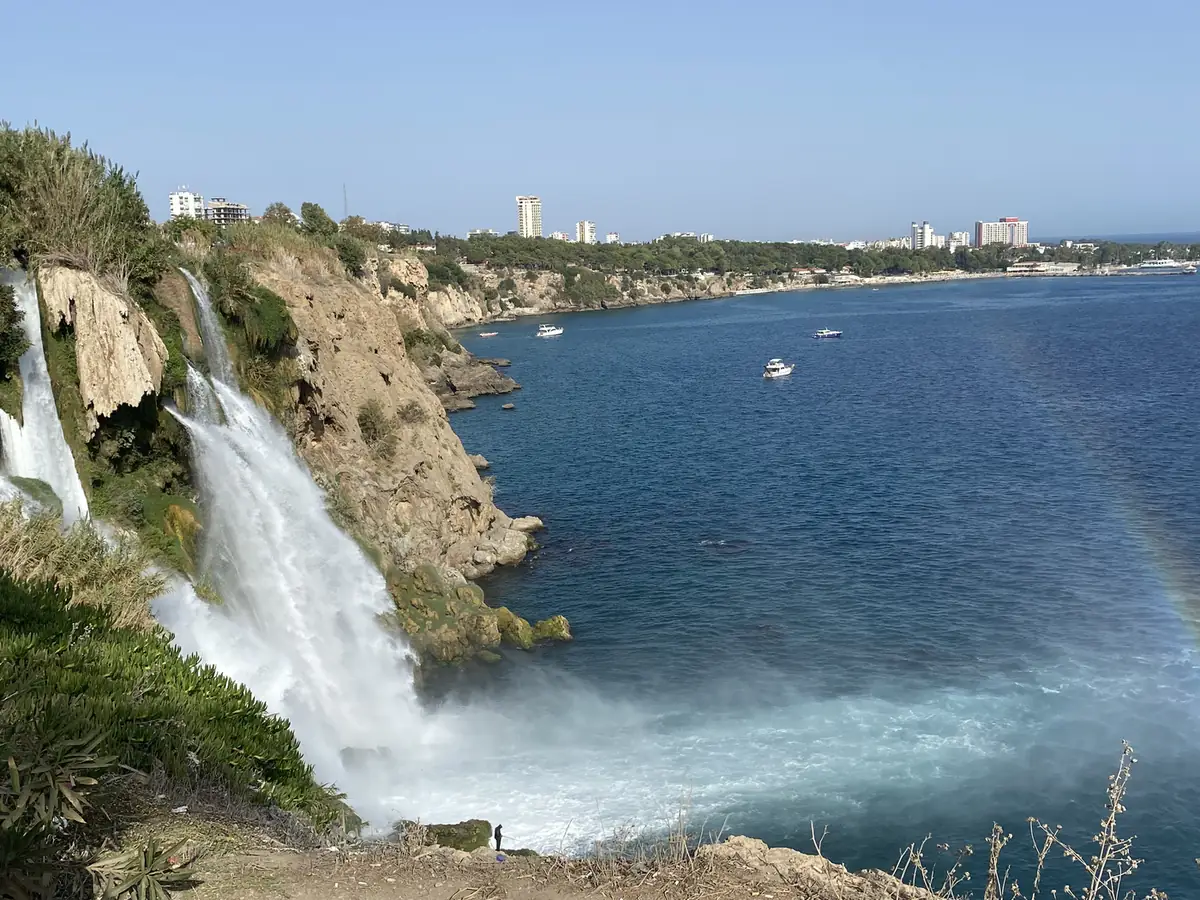
From there, the route ran down to the coast. Antalya is the biggest Turkish city on the Mediterranean, the centre of what people call the Turkish Riviera.
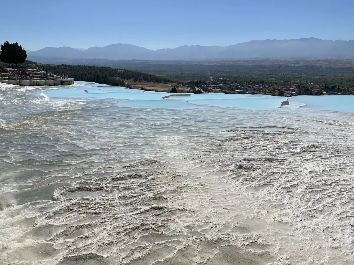
Pamukkale means “cotton castle”, and the name is accurate. Hot spring water rich in calcium has run down the hillside for thousands of years and left terraces of white stone about 2.7 km long and 160 metres high, with pools of warm water in them. The ancient Greek city of Hierapolis was built right on top.
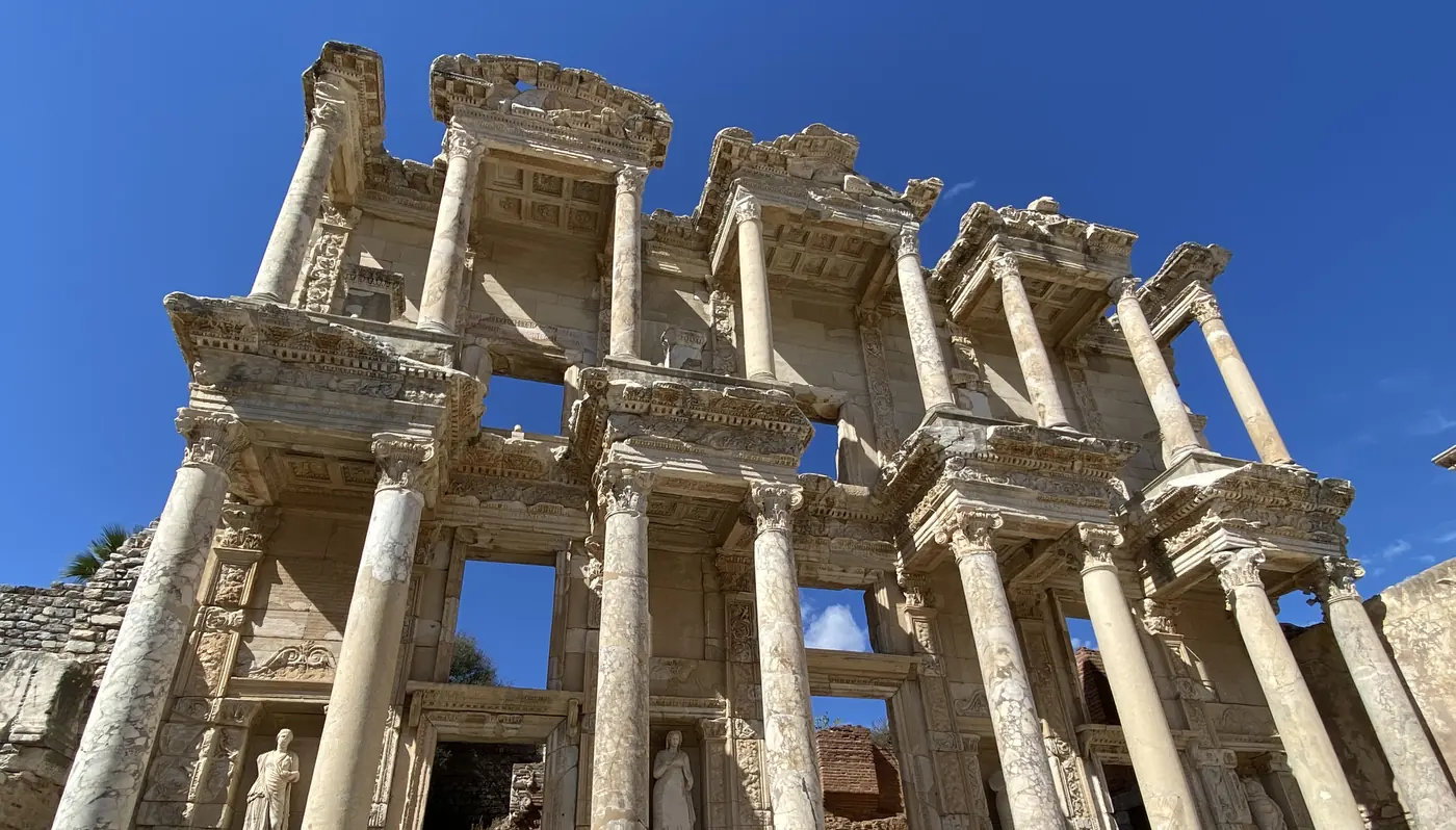
Kusadasi is a resort town on the Aegean coast, and the base for Ephesus, about 20 km away. Ephesus was one of the great cities of the ancient Greek world, home to the Temple of Artemis, one of the Seven Wonders of the Ancient World. Today the ruins include the Library of Celsus and a theatre that held about 24,000 people.
How did the trading fit in?
The same way it does on every trip: about 15 minutes a day on my phone, a watchlist, a few alerts, and nothing that needed me to sit in front of a screen.
What changed along the way was the clock. The US market opens at 9.30 in the morning in New York. In Bishkek and Almaty that was 7.30 in the evening. In Tashkent and Dushanbe it was 6.30. By the time I reached Istanbul, it was 4.30 in the afternoon.
So the check moved a little later or earlier each week, and the routine itself stayed the same.
I wrote up how the routine works on the road, the watchlist, the alerts and the time zones, in how I trade while travelling.
What came next?
Turkmenistan is still the one Stan I am missing.
In 2025, I went to the other side of the Caspian, to Azerbaijan, Georgia and Armenia, which makes a natural sequel to this one.
Have you been to any of the Stans? If you had 5 weeks, would you go for the mountains of Kyrgyzstan or the Silk Road cities of Uzbekistan? Let me know in the comments.
All my other trips are on the travel log, country by country, and more photos are on Instagram, @iamrecneps.
https://synapsetrading.com/wp-content/uploads/2026/10/central-asia-2022-hot-air-balloons-over-the-cappadocia.webp10501400Spencer Lihttps://synapsetrading.com/wp-content/uploads/2026/10/synapse-logo-horizontal-light.pngSpencer Li2022-12-04 22:06:432026-10-22 16:56:48Central Asia and Turkey: 5 Weeks Across Kyrgyzstan, Kazakhstan, Tajikistan and Uzbekistan
In September 2022, a week into 5 weeks across Central Asia, I flew from Almaty to Dushanbe. Kyrgyzstan had been yurts and high pastures. Tajikistan turned out to be something else again: a new capital of giant monuments, then a turquoise lake high in the mountains, then two of the oldest cities on the Silk Road.
We had 4 days, from 11 to 14 September, with a small group and a minibus. We started in Dushanbe in the south and drove north through the Fann Mountains to Khujand. This is that route, from my photos.
Why Tajikistan?
Tajikistan is the smallest of the Central Asian countries, and more than 90% of it is mountains. It was part of the Soviet Union until 1991.
It also sounds different. The Kyrgyz and the Kazakhs speak Turkic languages, but Tajik is a form of Persian. So you might be thinking, does that change much on the ground? It does. The names change, and the heroes on the plinths are Persian poets and kings.
What is Dushanbe like?
Dushanbe means “Monday” in Tajik, after the Monday market that once stood there. Today it is the capital, and the centre is a long run of marble, fountains and gold.
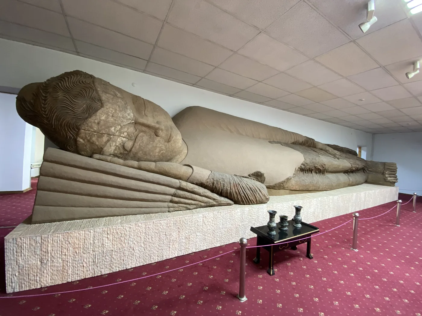
The first stop was the National Museum of Antiquities. Its star is a reclining Buddha, about 12 metres long, found at Ajina Tepa, a Buddhist monastery in the south of the country from about 1,300 years ago. It lies in a room of its own on a red carpet.
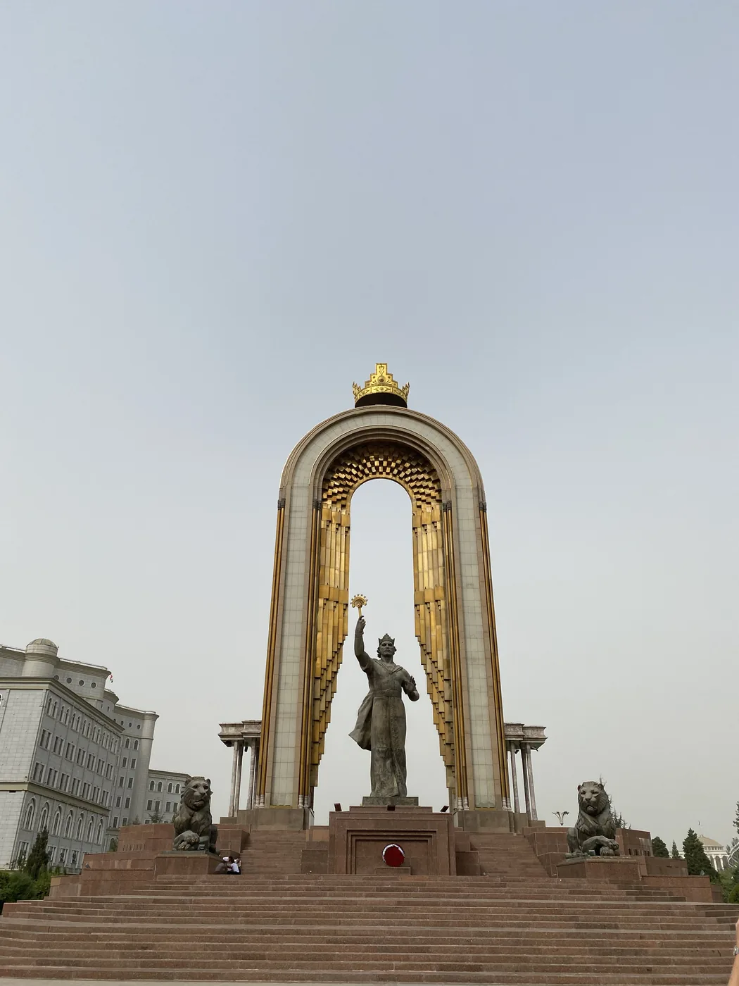
The next morning was the monuments. On Dousti Square, which used to be called Lenin Square, Ismoil Somoni stands under a tall gilded arch, with stone lions at his feet. He ruled the Samanid state at the end of the 9th century, and the Tajiks count him as the father of the nation. The statue went up in 1999 where Lenin used to stand. The country’s currency, the somoni, is named after him too.
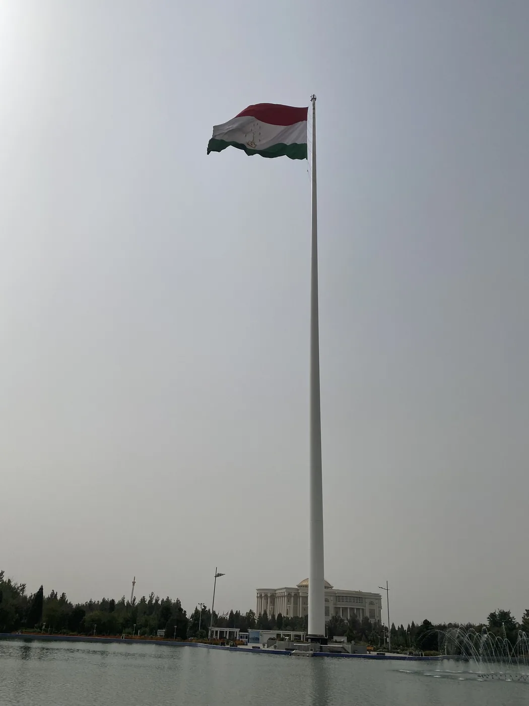
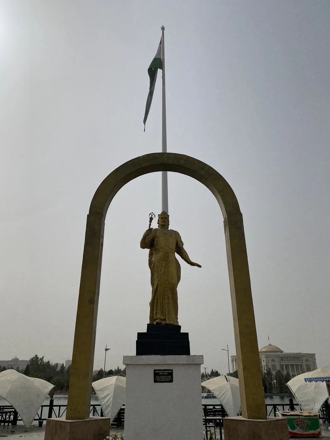
A short walk away is the flagpole. It is enormous. At 165 metres it was the tallest in the world when it went up in 2011, until a taller one went up in Jeddah in 2014. In the park beside it, the poet Rudaki stands in gold under an arch.
What is the Istiklol tower?
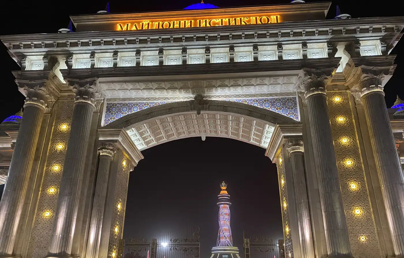
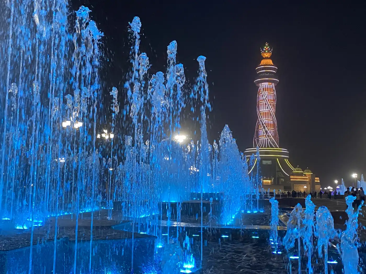
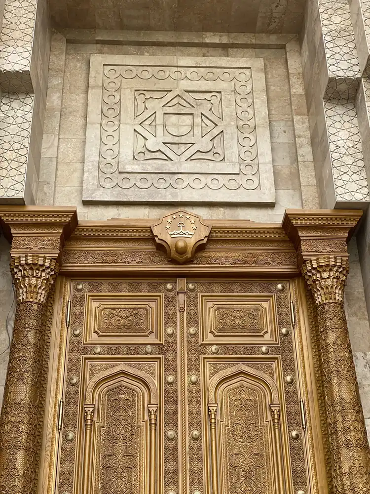
The newest thing in the city. The Istiklol Complex, the Independence tower, is 121 metres tall with a crown on top, and it opened in 2022 for the 31st anniversary of independence. We saw it only days after the anniversary.
At night, the whole square in front of it was lit up blue, with dancing fountains and the tower glowing pink and gold behind them. The next morning, in daylight, I found the carved wooden doors at its base, covered in gold patterns.
How do you get to the Fann Mountains?
By road, straight up.
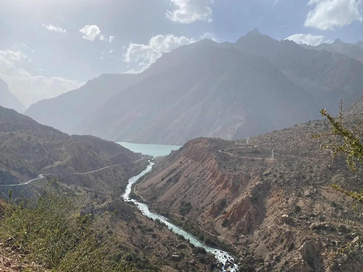
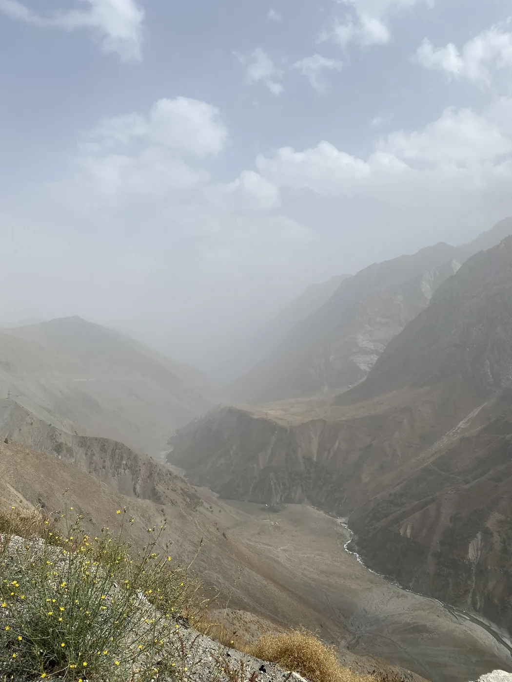
On 12 September we left Dushanbe around midday and drove north into the mountains. The road climbs through steep, bare gorges, and by about 14:00 my phone put us at about 2,600 metres, looking down into a canyon full of haze. Then it drops into a valley of fast turquoise rivers.
What is Iskanderkul?
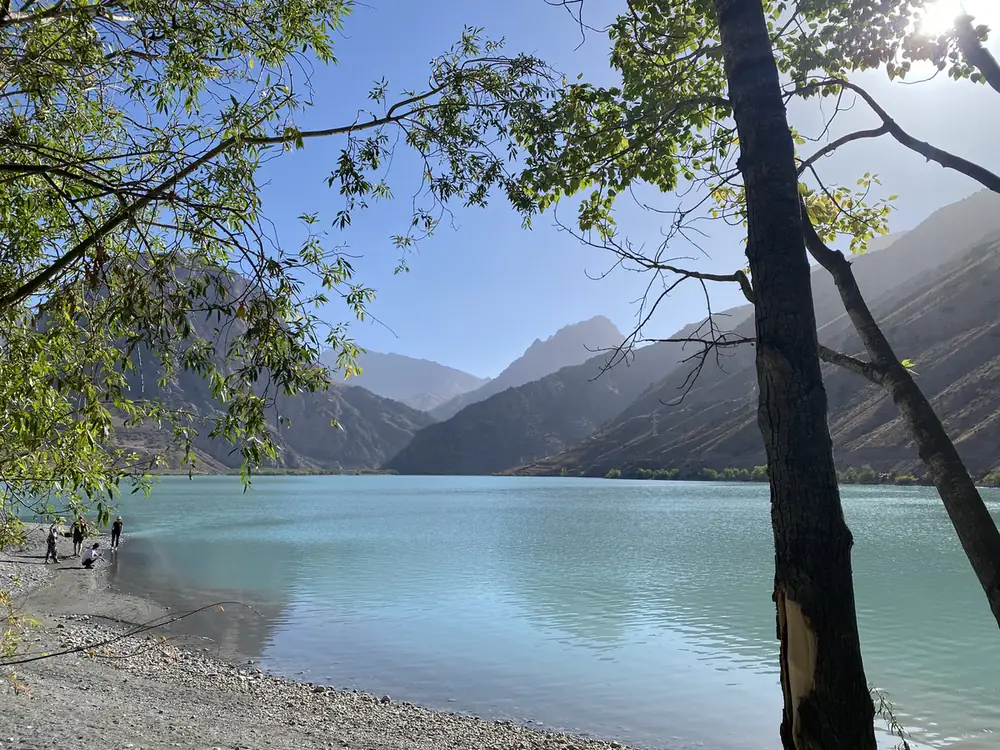
A glacial lake at about 2,195 metres, named after Alexander the Great. Iskander is the Persian form of Alexander, and “kul” means lake. One legend says his horse, Bucephalus, drowned in it.
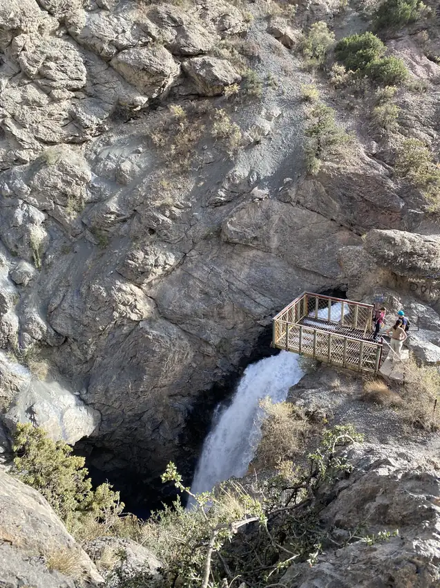
Before the lake, we stopped at the waterfall where it drains. The Fan Niagara drops about 38 metres into a narrow rock gorge, and a small viewing platform hangs out over the drop.
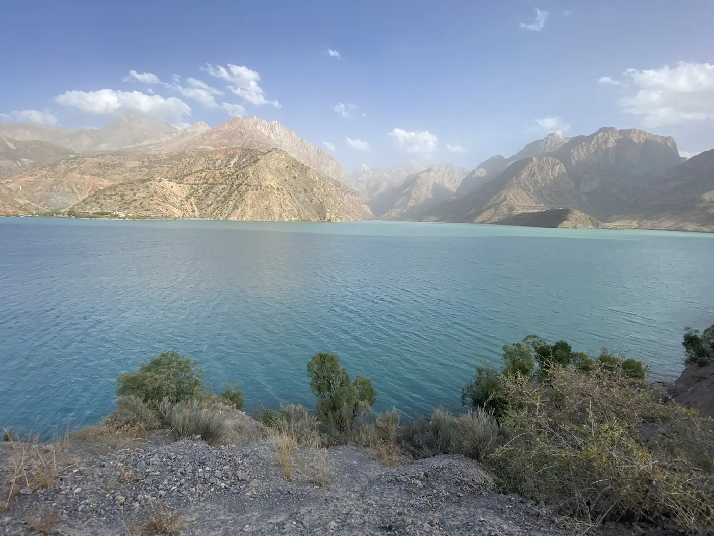
We reached the lake shore at about 17:00. It is a deep turquoise. Bare grey and red mountains rise all the way round it, and on the far side the slopes run straight down into the water.
Where did we sleep?
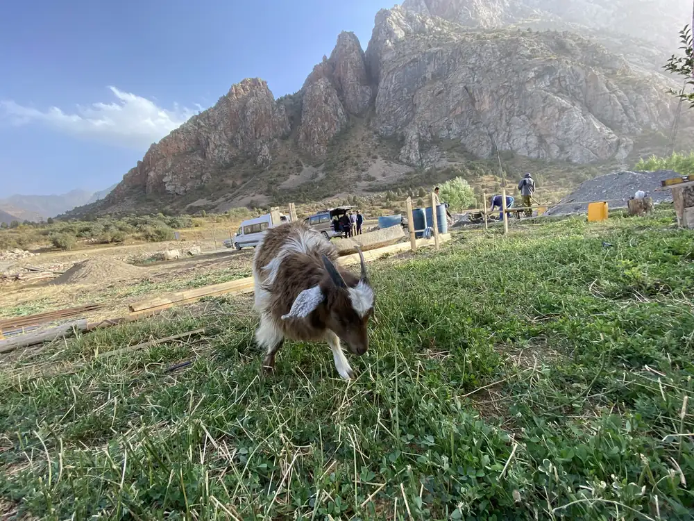
In a village higher up the valley called Sarytag, at about 2,400 metres. It is a few stone and wooden houses on a dirt road, with goats grazing on the grass.
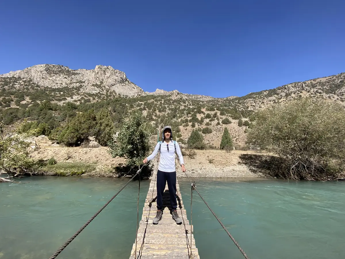
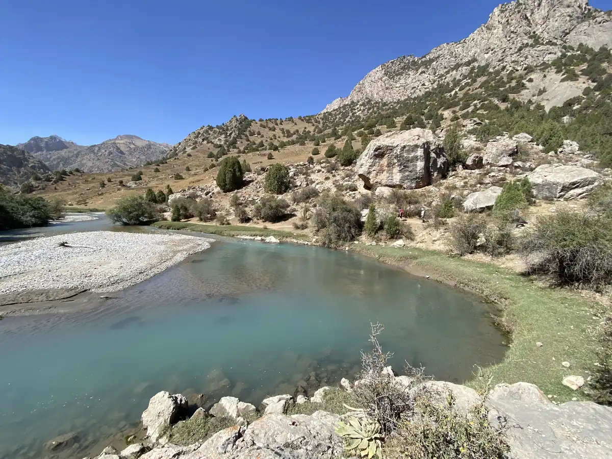
The next morning, we walked further up the valley along the river. We crossed a wooden footbridge strung over the water, and the valley opened out into a wide gravel riverbed with mountains on both sides. The water was so clear you could see every stone on the bottom.
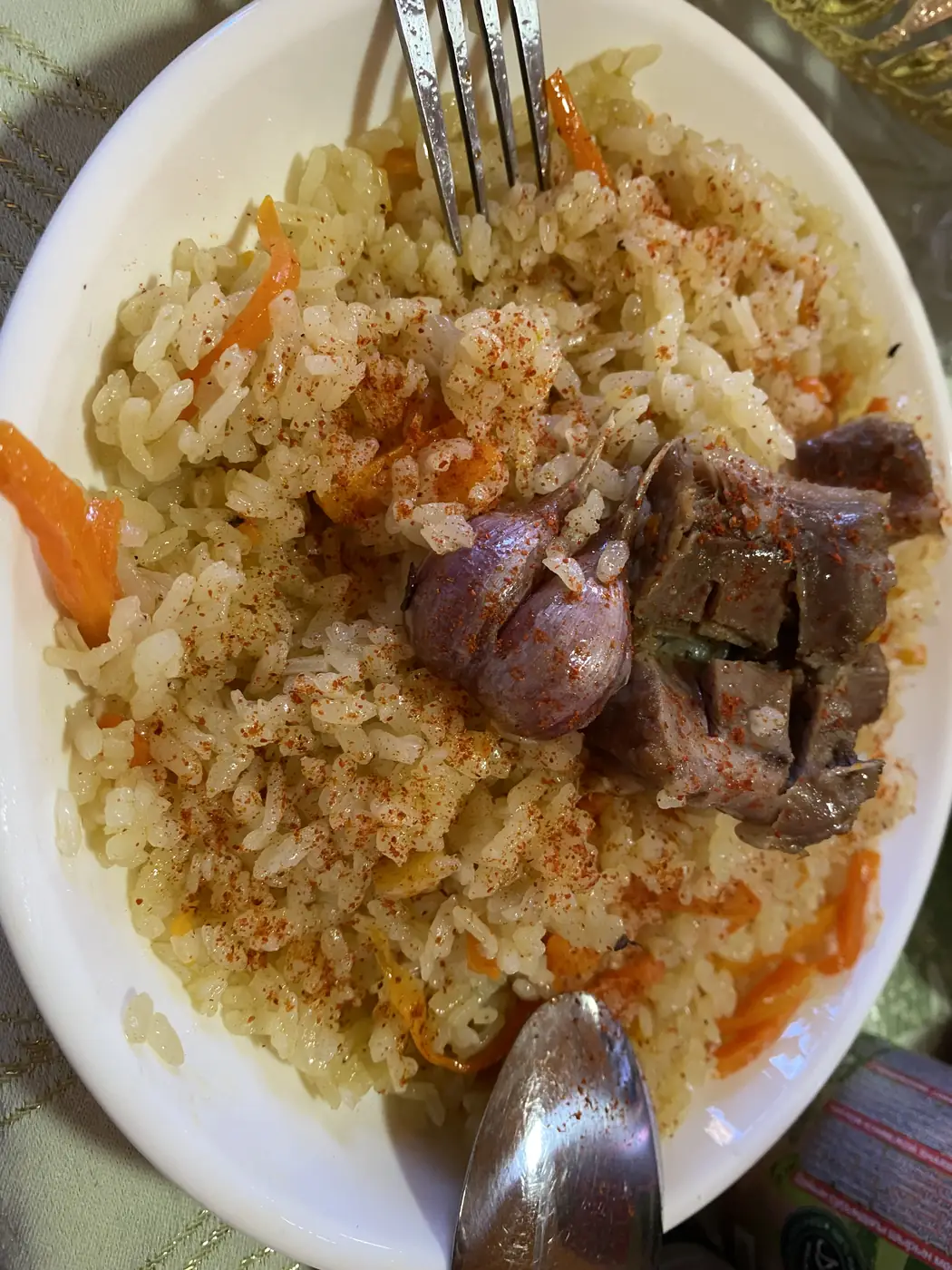
Lunch was plov, the rice dish of Central Asia, cooked with carrots and big pieces of meat. In the afternoon we went back down to Iskanderkul for a picnic on the shore. By 17:14 the water was still enough to hold a perfect copy of the mountains.
What is in Istaravshan?
On 14 September we drove north out of the mountains to Istaravshan, one of the oldest towns in the country.
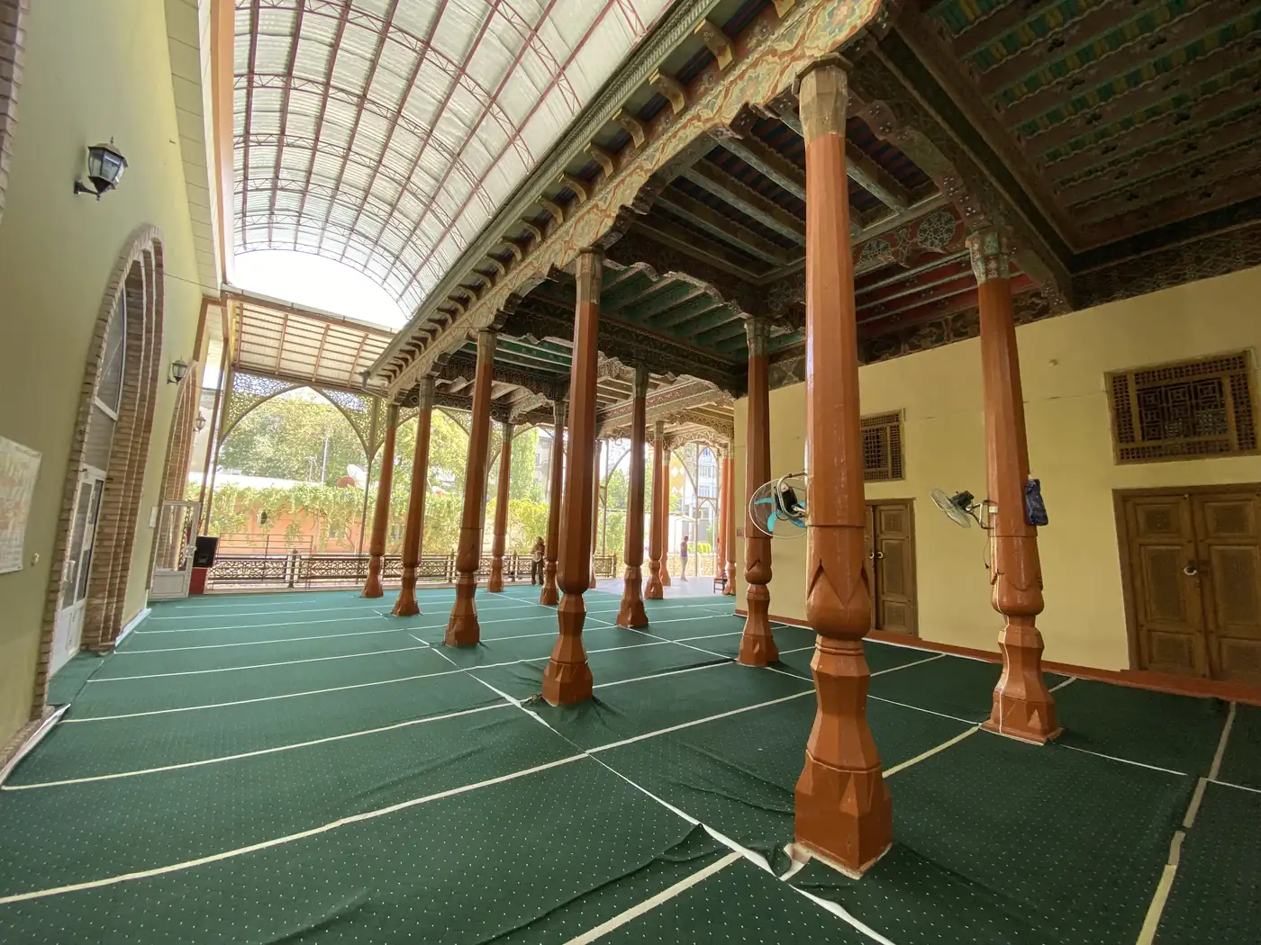
In the centre is a mosque with a tall brick minaret, its prayer hall held up by rows of carved wooden columns.
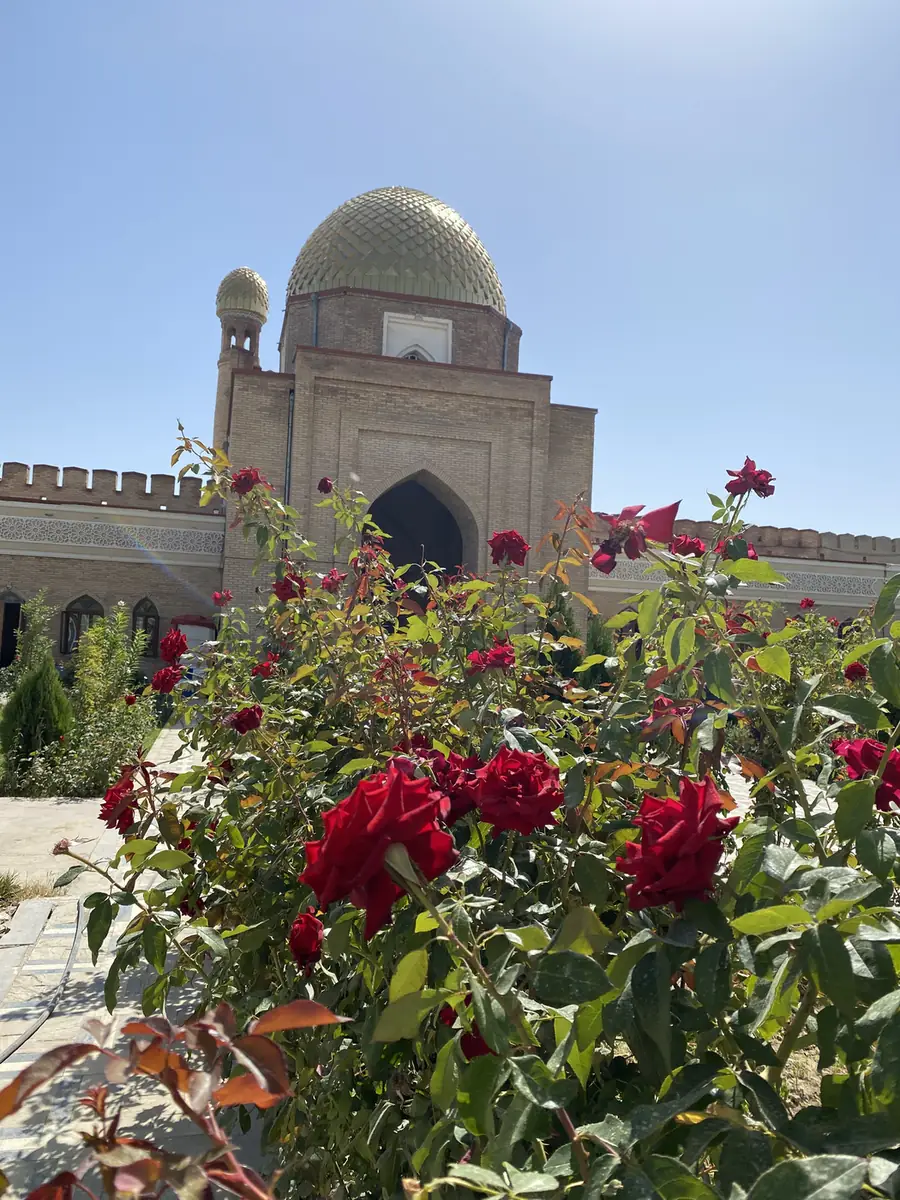
Then Mug Teppe. This is the hill where the old citadel stood. Alexander the Great took it in 329 BC, and the Arabs stormed it in AD 772. Little of the original is left. The gateway on top, with its blue dome, was built in 2002 for the town’s 2,500th anniversary, and in front of it was a bed of red roses.
What is in Khujand?
Khujand, in the far north, is one of the oldest cities in Central Asia. Alexander the Great took it too, and renamed it Alexandria Eschate, “Alexandria the Furthest”. It sits where the Syr Darya river leaves the Fergana Valley.
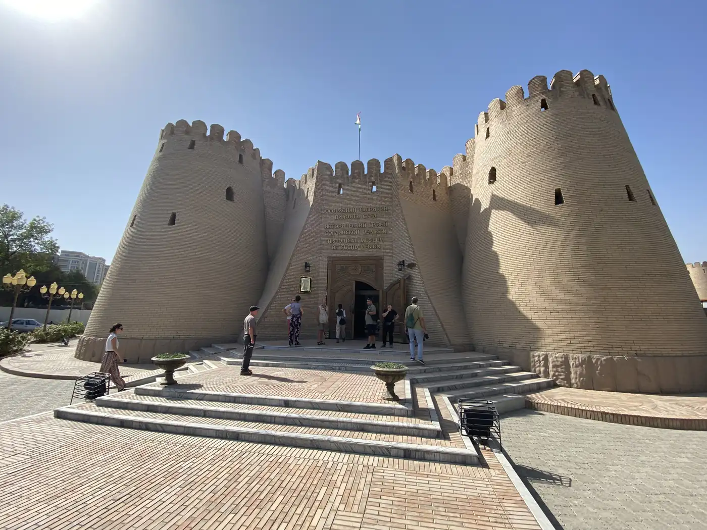
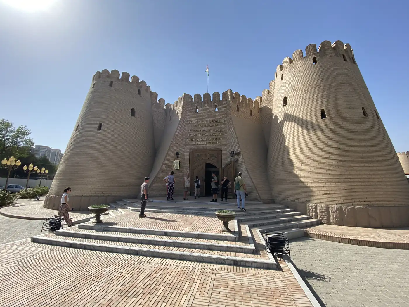
The fortress stands on the bank of the river, with two round towers at its gate. Inside is the Historical Museum of Sughd. It runs in order from ancient history to the recent past, with mosaic battle scenes of Alexander’s army, a cave scene, a map of the Samanid state and a red star of portraits from the Soviet years.
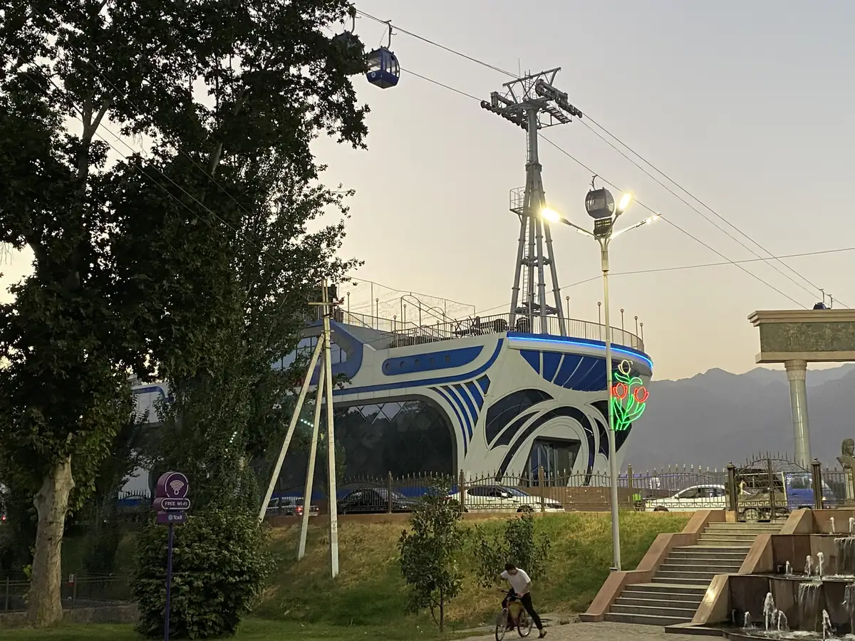
In the evening, a cable car runs over the Syr Darya, from the fortress side to a park on the far bank. That was the last evening in Tajikistan. Next came Uzbekistan.
How did the trading fit in?
The same way it always does, in about 15 minutes a day. In September, Tajikistan is 9 hours ahead of New York, which put the US open at 18:30 local time, after each day’s driving.
One frame from Iskanderkul has my laptop open on a picnic blanket by the lake at 16:29 on 13 September. That was the day a hotter-than-expected US inflation number came out at 17:30 local time, and the S&P 500 fell about 4.3%, its worst day since June 2020.
I wrote up how the routine works, the watchlist, the alerts and the time zones, in how I trade while travelling.
Where does it fit in the trip?
Tajikistan was the third of the 4 Stans. Before it came Kyrgyzstan, which has a post of its own, and Kazakhstan. The rest of the 5 weeks, through Uzbekistan and Turkey, is in Exploring Central Asia. Every trip is on the travel log, and more photos are on Instagram, @iamrecneps.
Would you go for the lake or the old Silk Road cities first? Let me know in the comments.
https://synapsetrading.com/wp-content/uploads/2026/10/tajikistan-2022-iskanderkul-lake-reflecting-the-fann-mountains.webp9001200Spencer Lihttps://synapsetrading.com/wp-content/uploads/2026/10/synapse-logo-horizontal-light.pngSpencer Li2022-09-14 10:00:002026-10-22 16:34:50Tajikistan: Iskanderkul, the Fann Mountains and the Road to Khujand
In September 2022, after almost 3 years without a real trip, I landed in Bishkek at dawn. It was the first stop of 5 weeks across Central Asia, and Kyrgyzstan was the country with the most stops on the route.
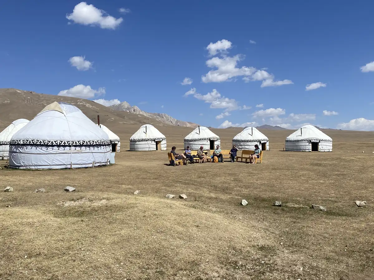
Over the next 5 days, with a small group and a minibus, I went from the capital up to a lake at about 3,000 metres and slept in yurts twice. I watched a yurt go up from bare poles, and finished in a hot spring in Karakol. This is that loop, from my photos.
Why Kyrgyzstan?
About 90% of Kyrgyzstan is mountains, and the Tian Shan range runs right across it. It was part of the Soviet Union until 1991. Its nomad culture is still alive in the summer pastures, where herders bring their animals up and live in yurts until the cold comes back.
So you might be thinking, what is a yurt, exactly? It is a round tent of felt on a folding wooden frame, the home the nomads of Central Asia have carried with them for centuries. By the end of the 5 days I had seen how one is made, piece by piece.
What is Bishkek like?
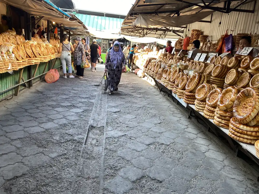
The first morning started at the Osh Bazaar, under a big arch with its name across the top. Inside were rows and rows of round loaves of bread, pyramids of watermelons on the pavement and trays of samsa, the baked pastries filled with meat.
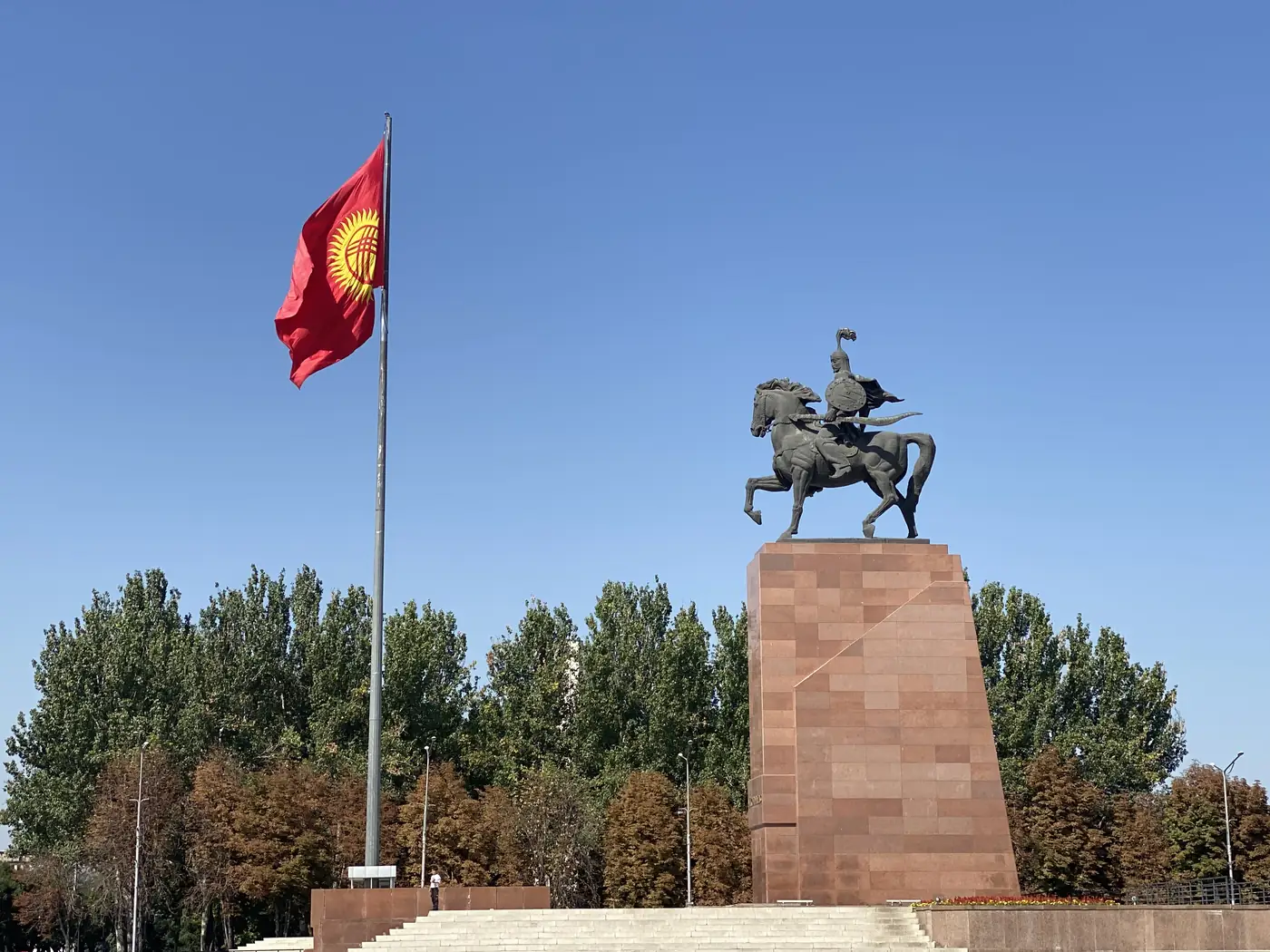
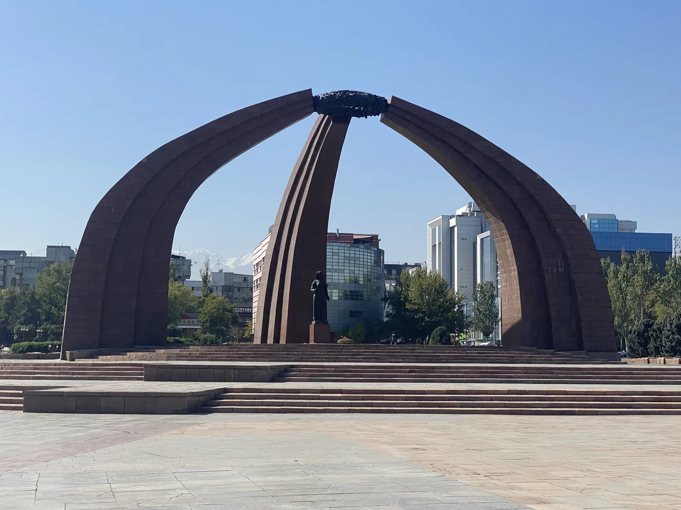
Then the Soviet half of the city. Victory Square has three tall curved arches over an eternal flame, shaped like the frame of a yurt. On Ala-Too Square, the hero Manas rides a horse on a tall plinth, with an honour guard at the flagpole beside it. Lenin used to stand there. He has been moved round to the back of the history museum, still with his arm raised.
In the park nearby there is an old Ferris wheel in red steel, and a red squirrel was eating in the grass under the trees.
What is the Burana Tower?
In the afternoon we drove about 80 km east to the Burana Tower, a brick minaret from the 11th century. It is almost all that is left of Balasagun, a Silk Road city founded at the end of the 9th century. A spiral iron staircase runs up its side to a door halfway up.
Around it, grassy mounds mark where the old walls stood. In a field beside them stand rows of balbals, old stone grave markers carved into rough human figures, some with faces and hands still visible.
What is Chong-Kemin like?
That night we were in the Chong-Kemin valley. It is a national park with a river running through it. The sun went down behind the mountains at about 18:50.
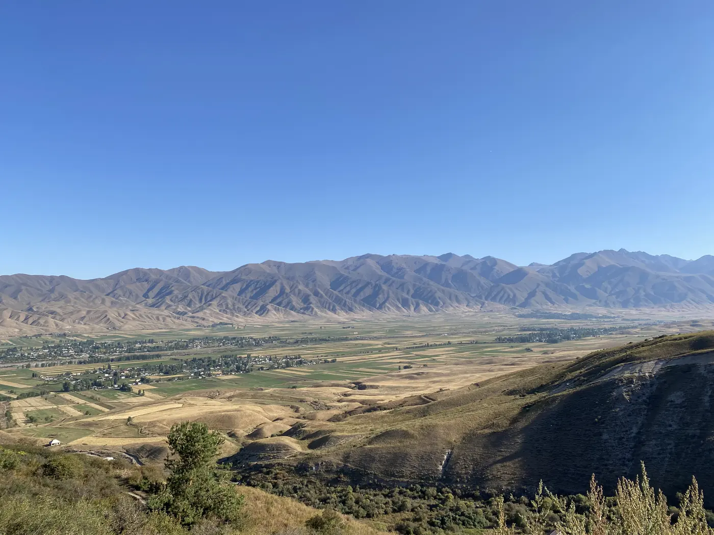
The next morning, a few of us walked up a dirt track along a stream, and a dog came along with us. From the top, the whole valley spread out below, farmland on the floor and bare brown ridges on both sides.
How do you make felt?
Kochkor, a village at about 1,800 metres, is the jumping-off point for Song-Kol. It is also where we stopped at a felt workshop.
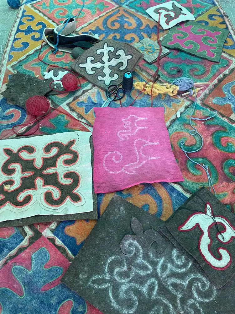
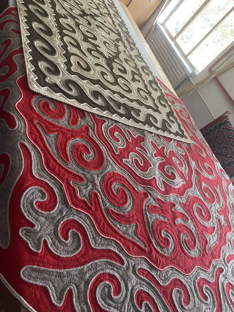
Kyrgyz felt carpets are called shyrdak. The women at the workshop laid out squares of coloured felt, with the patterns cut out and stitched in, mostly curling horn shapes in red, pink, white and grey. Some of us got down on the floor with them and had a go at the pattern.
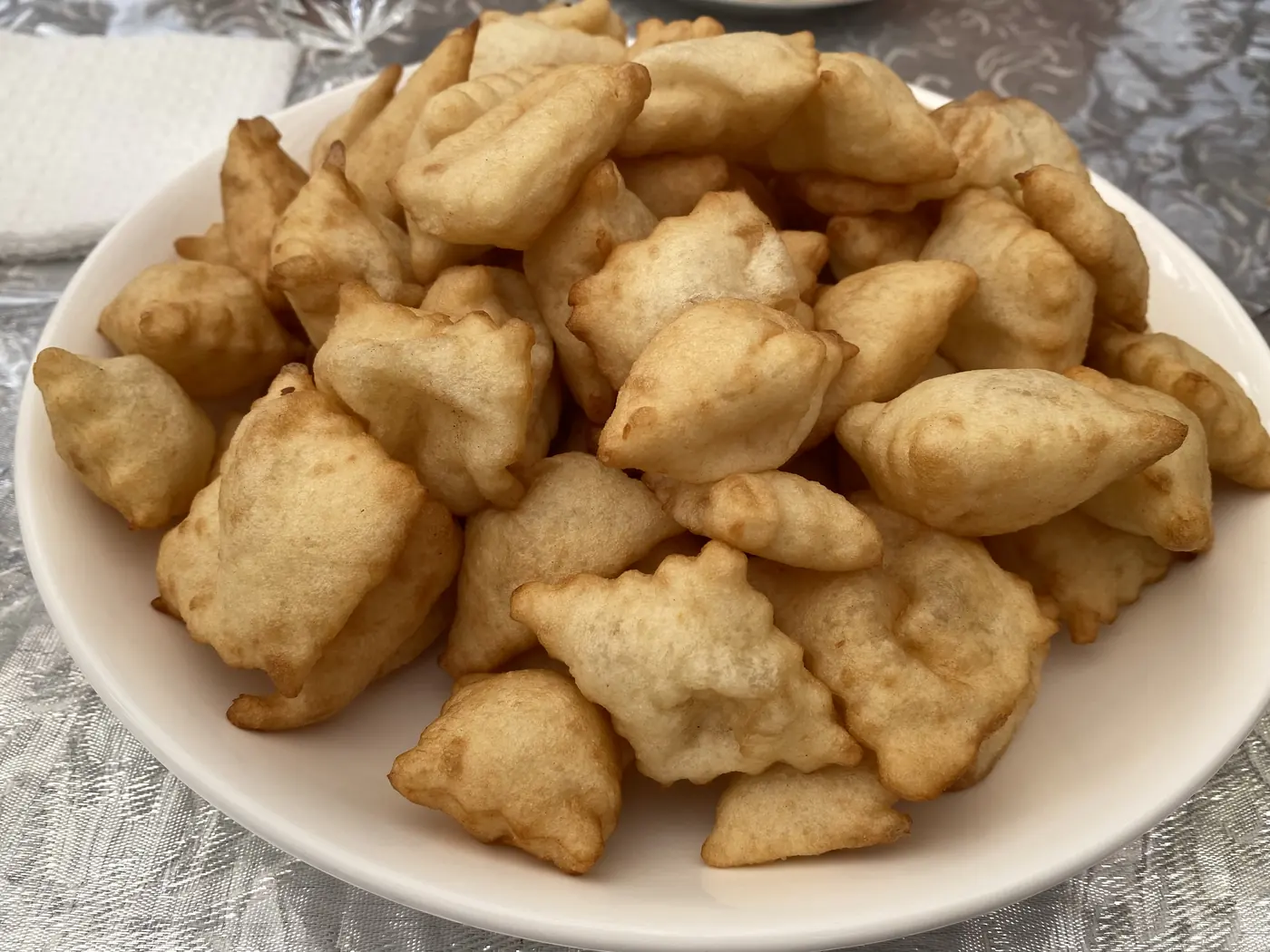
Lunch was at a long table under a chandelier, with plates of salad, noodles, fruit and a tall pile of fried dough twisted into a spiral.
What is Song-Kol Lake like?
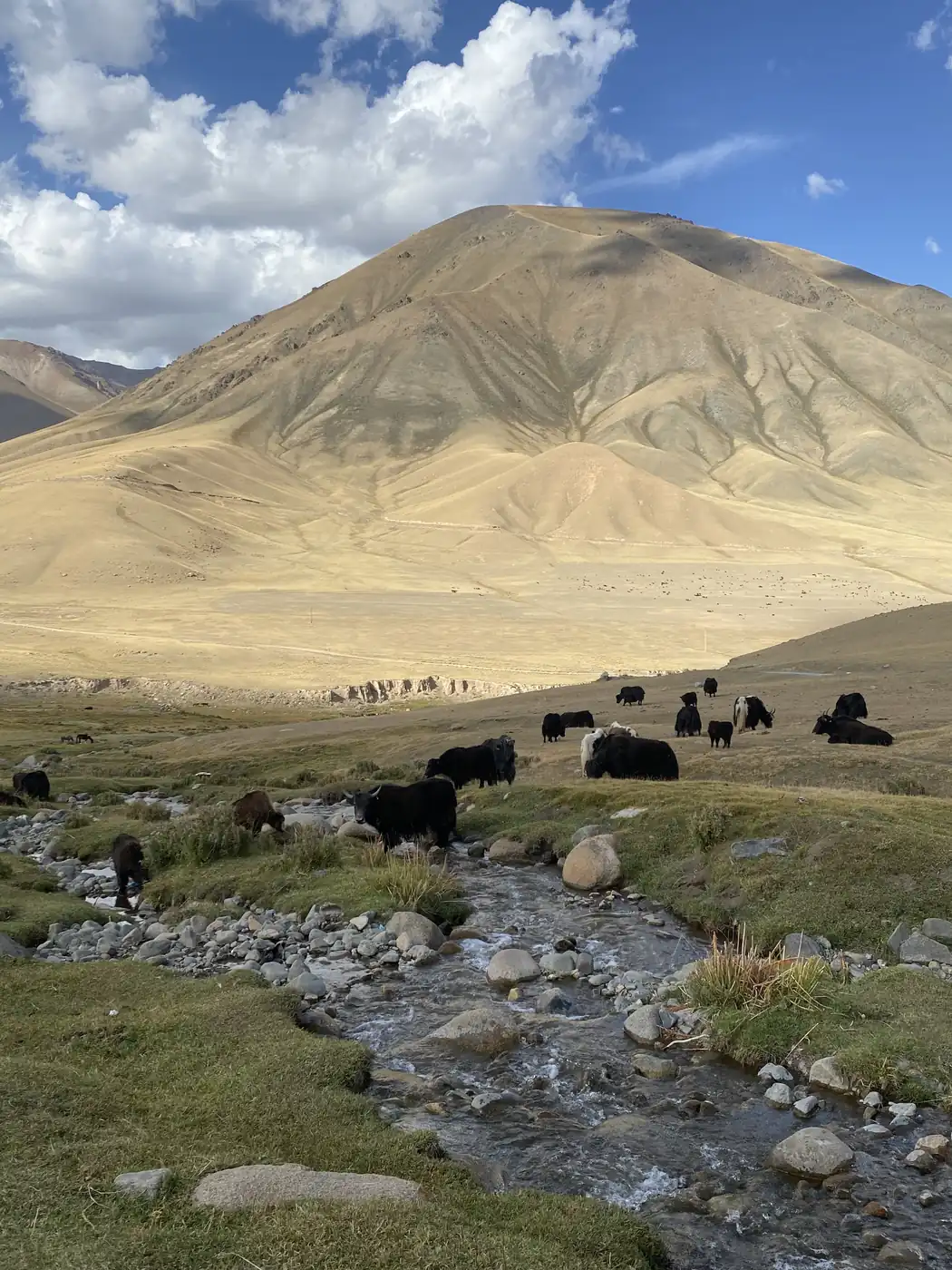
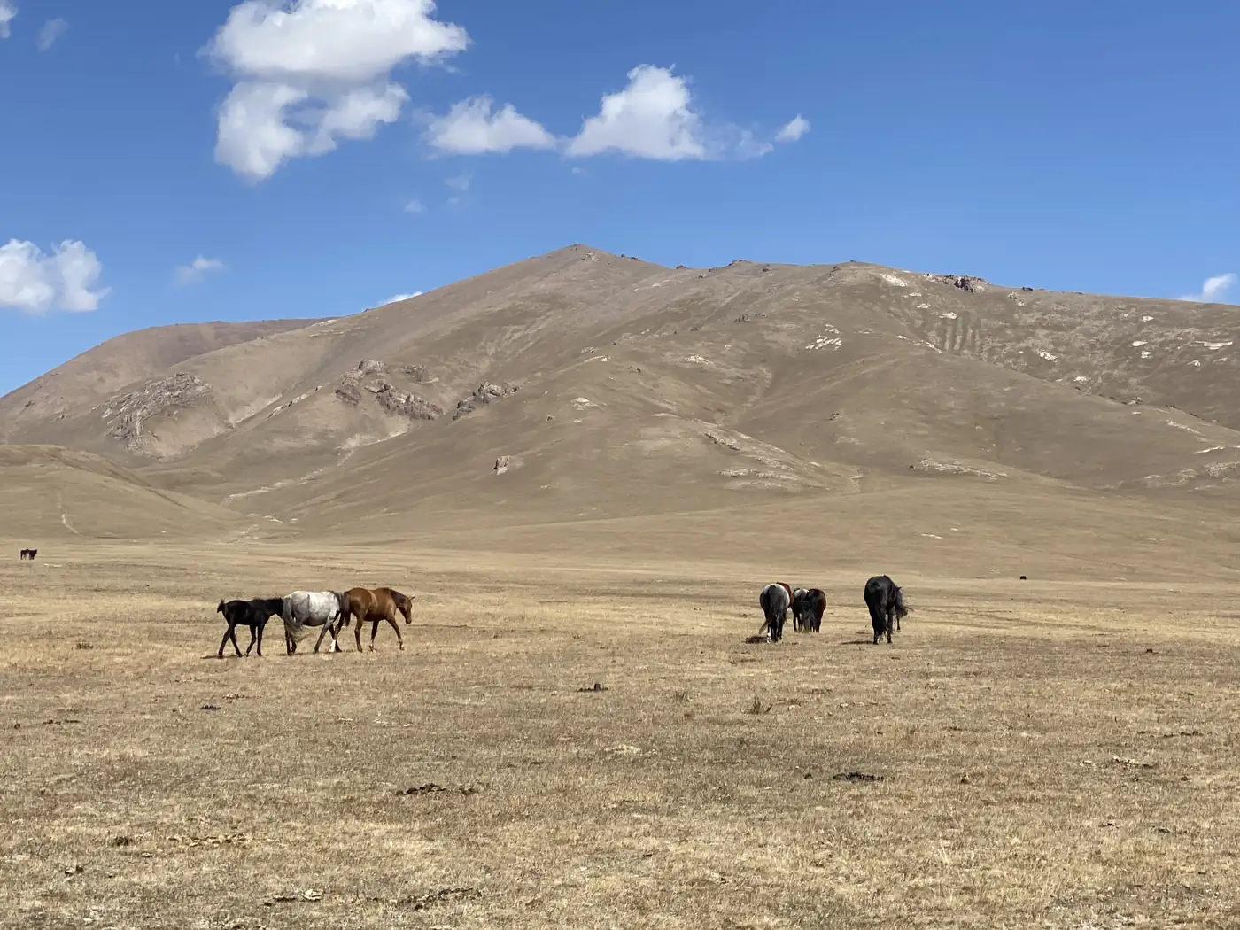
After lunch the minibus climbed into the high pastures. The tarmac gave way to a dirt road, and the land turned gold and brown. Black yaks were grazing along a stream. Higher up, the valley opened out below the road.
Song-Kol sits at about 3,016 metres, and it is the largest freshwater lake in Kyrgyzstan, about 29 km long and 18 km wide, ringed by the summer pastures where herders bring up their horses and sheep. We reached the shore at about 18:00, when the water was so still it held the whole sky and the mountains on the far side.
That night we slept in a yurt camp on the grass above the lake. Dinner was inside one of the yurts, under its roof poles.
The next morning, I walked up a ridge behind the camp. From the top, the lake runs along the whole horizon, deep blue against the dry gold hills. Near the camp, a herd of horses was grazing on the open slope.
How is a yurt made?
On day 4, we came down to the south shore of Issyk-Kul. This is the big lake, the 2nd-largest salt lake in the world after the Caspian Sea, and its name means “warm lake” because, although it sits at about 1,600 metres and the winters are hard, it never freezes. The beach was almost empty, with red hills behind the sand and a row of yurts at the far end.
Then the yurt makers. In a village near the lake, craftsmen still make yurts by hand. We ate first. Lunch was in a finished yurt, with boorsok, little squares of fried dough, and a plate of stewed meat and vegetables.
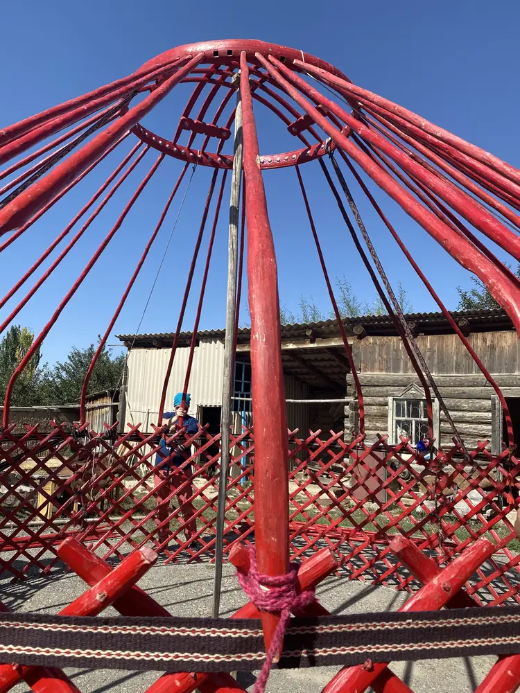
Their workshop is a long room of benches, tools and bent wooden poles. Out in the yard, the group helped put one up. First came the red lattice walls, opened out in a circle. Then the crown went up on a pole in the middle, and the red roof poles were slotted in one by one between the crown and the lattice, until the whole frame stood like a giant red umbrella. Then a reed screen, a blue band and the felt went round the outside. From the inside, looking up, the roof poles meet at the crown in a ring.
That ring is the tunduk. It is the same shape that sits in the middle of the sun on the Kyrgyz flag.
What is Jeti-Oguz like?
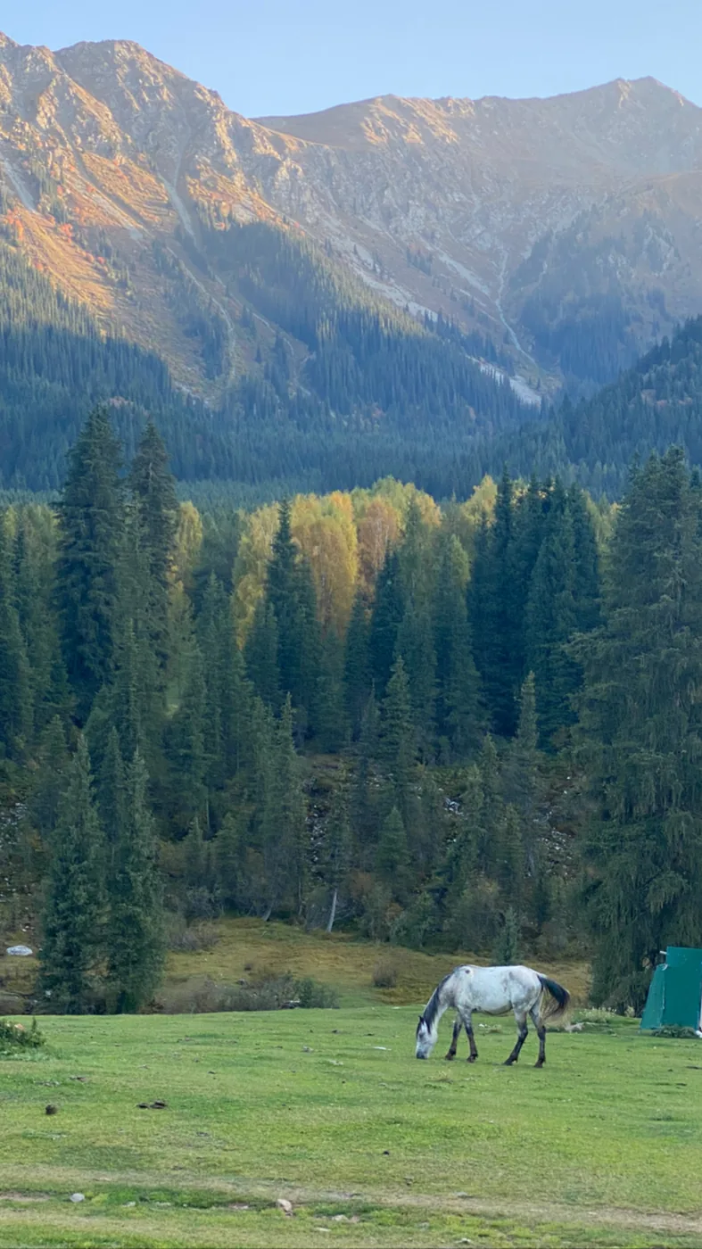
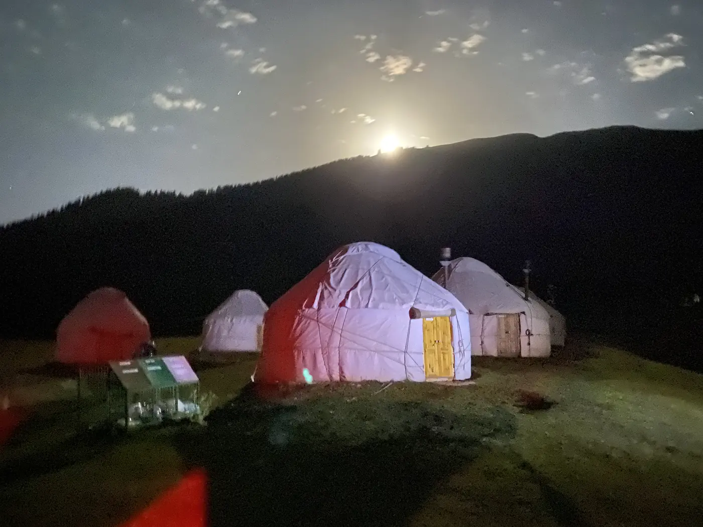
That evening we reached a yurt camp in the Jeti-Oguz valley, among spruce forest. Before dinner, I walked up the valley along a fast grey river, past a white horse grazing in a meadow. By 21:00 the moon had come up over the camp, and the yurts were glowing red and white in the dark.
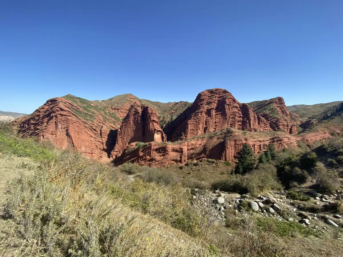
Then the red rocks. Jeti-Oguz means “seven bulls”, and the line of red sandstone cliffs above the village is what the name is talking about. Further on, the cliffs break into big rounded towers of red rock, and one of them is known as the Broken Heart.
What is in Karakol?
Karakol is the 4th-largest city in Kyrgyzstan. It is the base for the eastern end of Issyk-Kul.
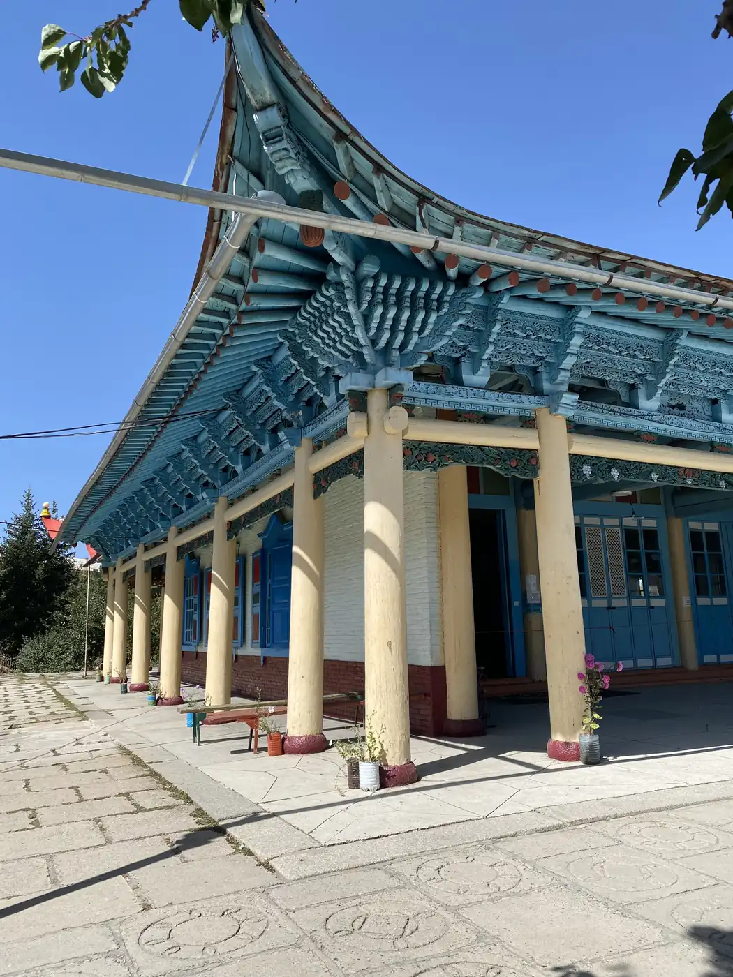
The Dungan Mosque looks more like a Chinese temple than a mosque, with a curved roof and painted wooden brackets in blue, red and green. It was finished in 1910, built by Chinese craftsmen for the local Dungan Muslims out of spruce, walnut and poplar beams joined by grooves and notches, without a single metal nail. Visitors are handed long robes to wear inside the grounds, and on the wall of its porch is a painted picture of the solar system.
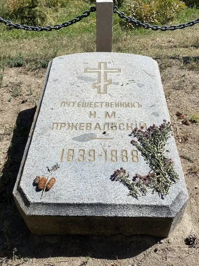
Outside the town is the memorial to Nikolay Przhevalsky, the Russian explorer of Central Asia, with a bronze eagle on top of a stone column. He died in Karakol in 1888. His grave is nearby. The little museum next to it has a giant globe, a stuffed ibex and a marmot.
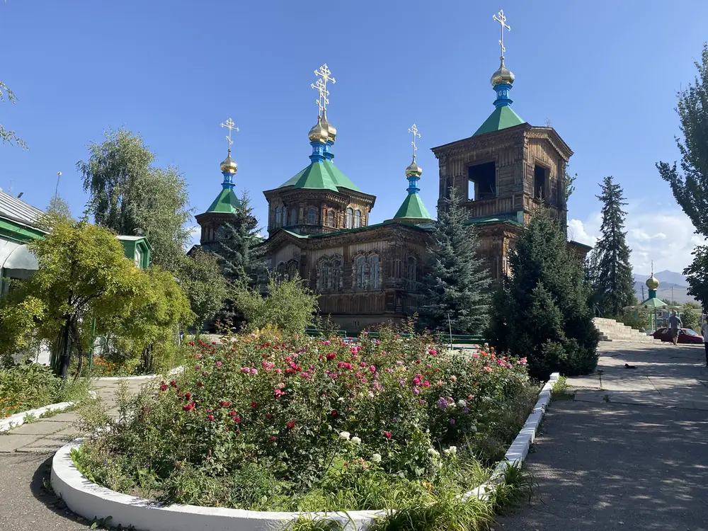
Back in town, the Holy Trinity Cathedral is built of wood, with green domes and gold crosses. The building that stands today was finished in 1895, after an earthquake destroyed the church before it.
The loop ended that night in the open-air pools of a hot spring in the hills, lit by floodlights after dark.
How did the trading fit in?
The same way it always does, in about 15 minutes a day. I wrote up how that works, the watchlist, the alerts and the time zones, in how I trade while travelling.
Where does it fit in the trip?
From Karakol, I went on into Kazakhstan. The rest of the 5 weeks, through the Stans and Turkey, is in Exploring Central Asia. Every trip is on the travel log, and more photos are on Instagram, @iamrecneps.
Would you sleep in a yurt at 3,000 metres? Let me know in the comments.
https://synapsetrading.com/wp-content/uploads/2026/10/kyrgyzstan-2022-song-kol-lake-reflecting-the-sky.webp10501400Spencer Lihttps://synapsetrading.com/wp-content/uploads/2026/10/synapse-logo-horizontal-light.pngSpencer Li2022-09-08 10:00:002026-10-22 14:44:47Kyrgyzstan: 5 Days of Yurts, Song-Kol and Issyk-Kul
Last night, over pizza, drinks, and poker, we had some interesting discussions about crypto, NFTs, and the Metaverse which really piqued my curiosity and got me thinking.
Food for thought:
How close are we to achieving the Metaverse?
What will the Metaverse look like?
What currency or financial system will we be using?
Which company/companies will be running the systems?
What are the latest trends in blockchain and crypto?
What are the potential future developments in this space?
What are the best areas to invest my time and money?
https://synapsetrading.com/wp-content/uploads/2026/10/poker-crypto-nft-metaverse-card.webp6301200Spencer Lihttps://synapsetrading.com/wp-content/uploads/2026/10/synapse-logo-horizontal-light.pngSpencer Li2021-09-14 02:18:332026-08-25 12:56:19Crypto/NFT Poker Night – Pondering the Metaverse…