• Link to Facebook
  • Link to X
  • Link to Instagram
  • Link to Youtube
  • Link to LinkedIn
  • Link to Mail
Free PDF: The 15-Minute Swing Trader's Checklist, the daily routine of a trader since 2007
Synapse Trading
  • Mentoring
    • Trading Mastery Program
    • All mentoring options
  • Signals
    • Daily trading signals
    • Signals trade log
  • Results
    • Student results and testimonials
    • Public trade log, losses left in
  • Free guides
    • Start here
    • Trading foundations
    • Technical analysis
    • Strategies and systems
    • Risk and money
    • Trading psychology
    • Markets and products
    • Free trading guides
    • Tools and resources
    • Blog
  • About
    • My background
    • My trading journey
    • Media and interviews
    • Travel log
  • Contact
    • Contact me
    • Partnerships
  • Start free
  • Click to open the search input field Click to open the search input field Search
  • Menu Menu

Trading & travelling across the world!

Spencer Li

Eastern Europe and the Balkans: 14 Countries in 5 Weeks, From Chernobyl to Sarajevo

Travel & Lifestyle
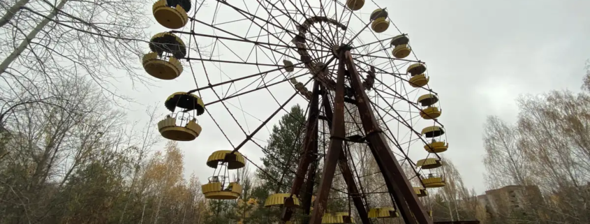
The abandoned Ferris wheel in Pripyat

At the end of 2019, I spent about 5 weeks crossing Eastern Europe and the Balkans, from Belarus in the north down to Albania and back up to Slovakia. That came to 14 countries, if you count Transnistria, which most of the world does not.

I went to learn about communism, and about what is left of it 30 years after the Berlin Wall came down. What I found was a long list of strange places: abandoned towns still marked by radiation, a nuclear missile bunker, buildings still scarred by war, museums full of weapons, fairy-tale castles, and a hundred small Soviet quirks that nobody has bothered to remove.

A note from today: this trip was in late 2019, before Russia’s full-scale invasion of Ukraine in February 2022. Several of these places are now off-limits or changed. Check your government’s travel advice before planning any of these stops.

What stood out?

The gap. Within a single day’s drive, the standard of living could change completely, and the countries inside the European Union looked far better off than the ones outside it.

The route ran roughly like this: Belarus, Ukraine, Transnistria, Moldova, Romania, Bulgaria, North Macedonia, Kosovo, Albania, Montenegro, Serbia, Bosnia and Herzegovina, Croatia, and Slovakia. I did it on a group tour, which, for places like Transnistria and the Chernobyl zone, is close to the only sensible way in.

Belarus

Minsk
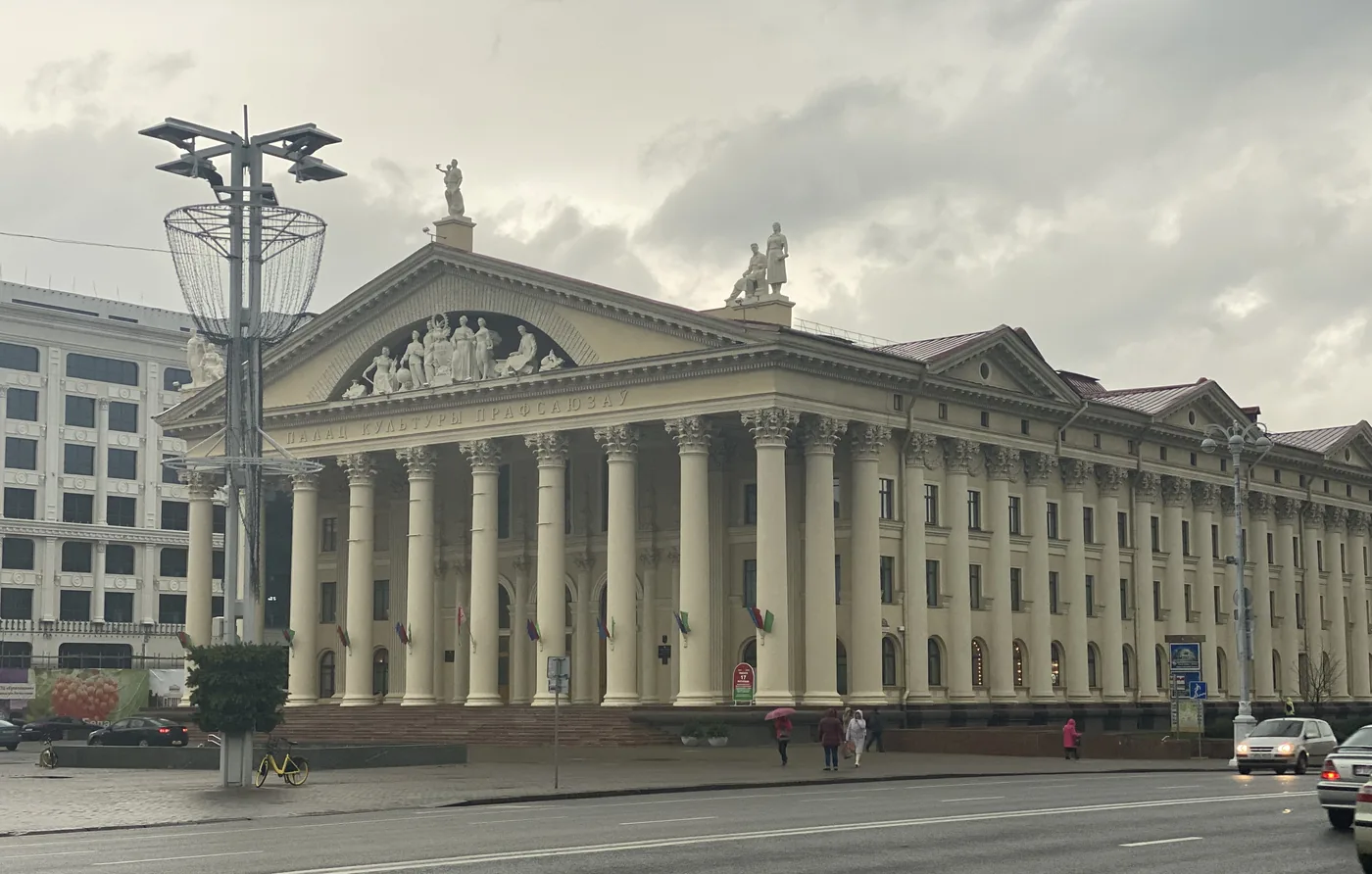
A Stalinist colonnaded palace on a wide avenue, Minsk

Minsk is a city that was almost erased and then rebuilt to one man’s taste. During the Second World War, its population fell from about 300,000 to 50,000, and about 80% of the city was destroyed. It was rebuilt in the 1950s the way Stalin liked it, with wide avenues and huge, heavy buildings, and its centre still looks the way he wanted it.

A practical note: English is rarely spoken, and everyone speaks Russian. A few key Russian phrases go a long way.

The Stalin Line and Khatyn
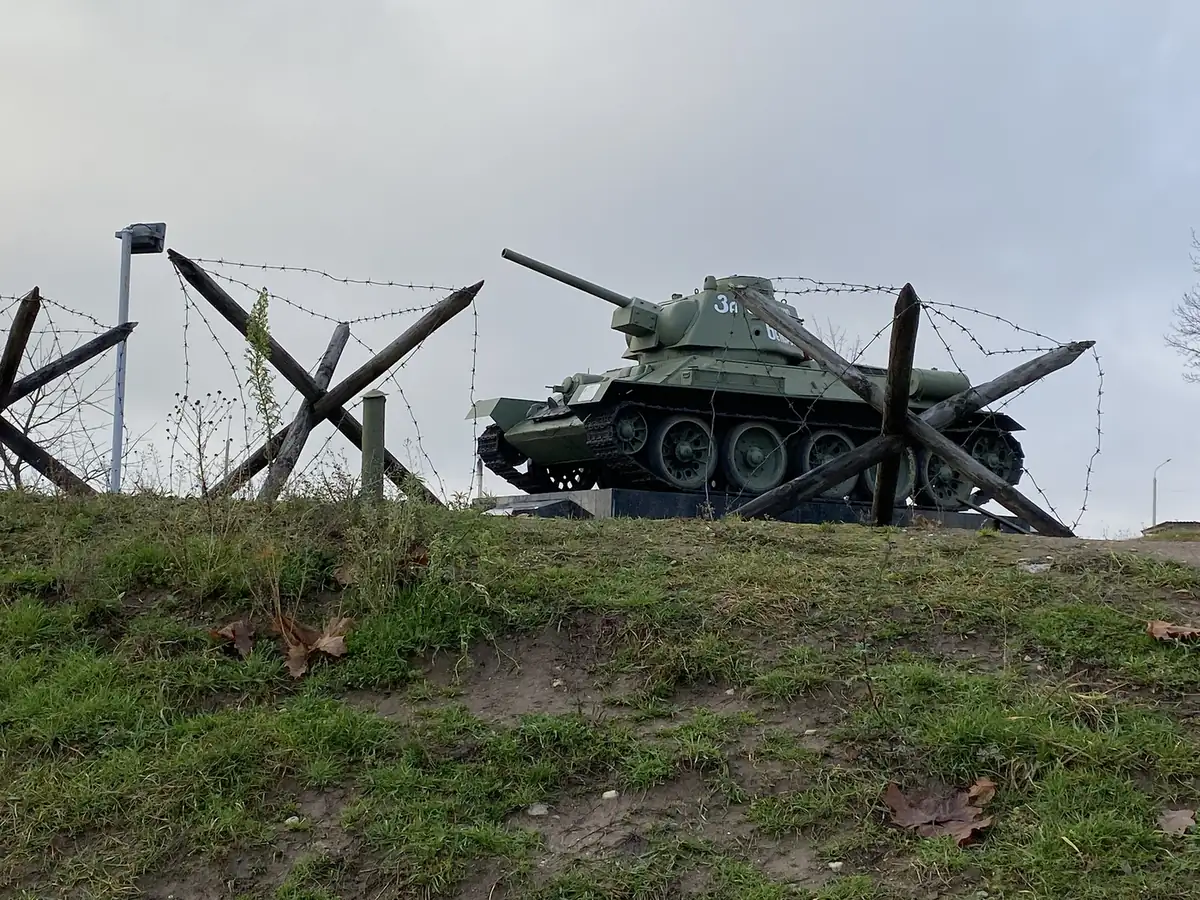
A T-34 tank behind barbed wire and anti-tank hedgehogs, the Stalin Line

Outside Minsk is a stretch of the Stalin Line, the chain of concrete bunkers and gun positions the Soviet Union built along its western border from the 1920s. Today it is an open-air museum, full of old tanks, artillery and aircraft, and visitors can climb into most of them.

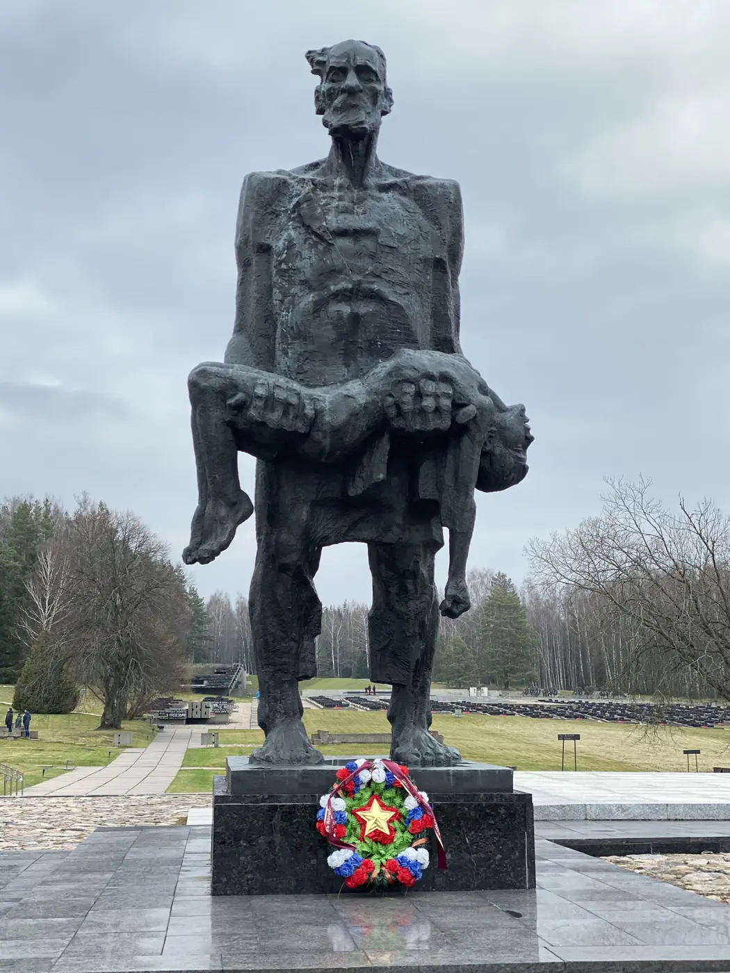
I also stopped at the Khatyn memorial, for a Belarusian village whose people were killed by German forces in 1943.

Nesvizh and Mir
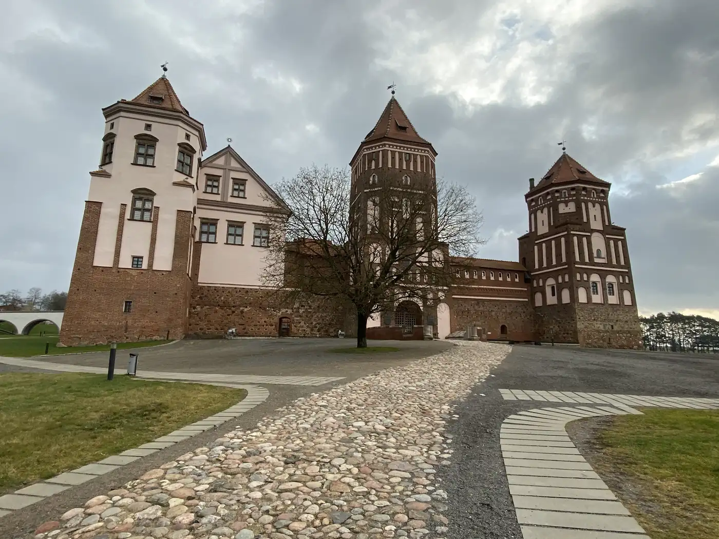
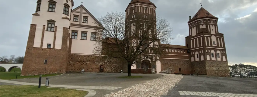
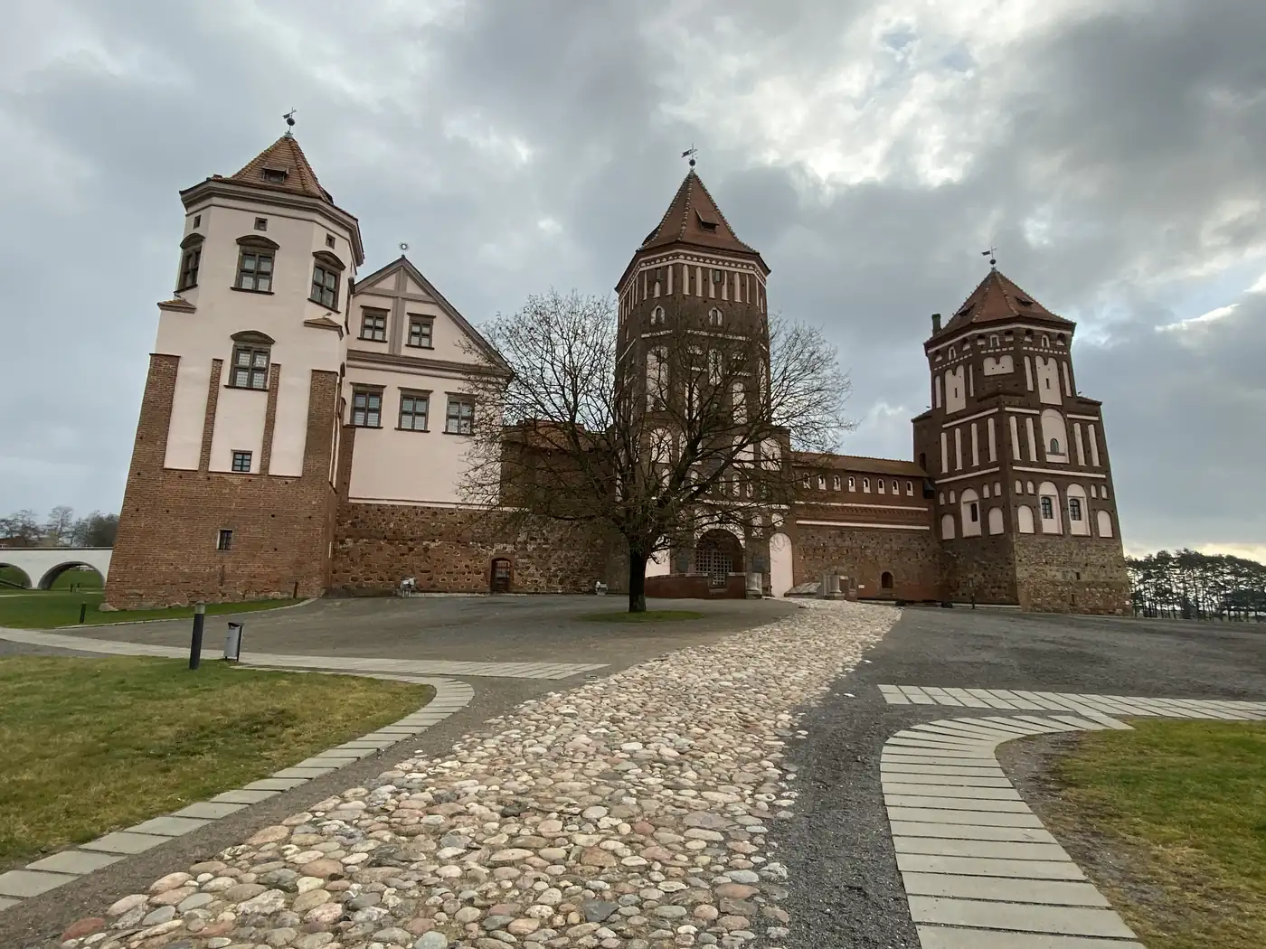
Mir Castle, Belarus
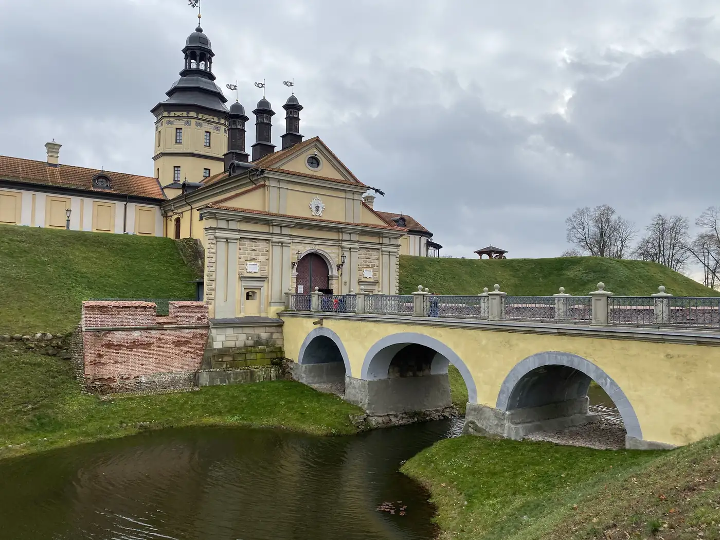
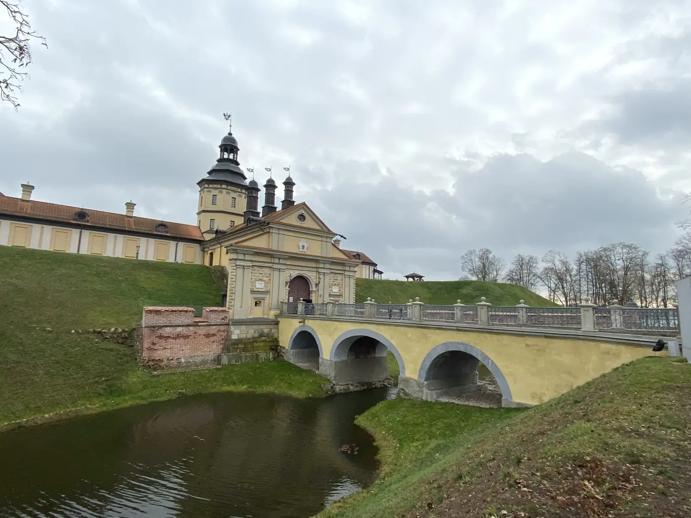
Nesvizh Castle's gate and bridge over the moat

Belarus also has 2 castles on the UNESCO list, about 29 km apart. Mir Castle is the fairy-tale one, red brick with towers. Nesvizh Castle was the home of the Radziwill family, one of the great noble families of the old Polish-Lithuanian state. Between 1921 and 1939, both sat inside Poland.

I wrote up all 3 days in Belarus, from the castles of Mir and Nesvizh to the bunkers of the Stalin Line and the memorial at Khatyn, in Belarus: Minsk, the Stalin Line, Khatyn and the Castles of Mir and Nesvizh.

Ukraine

Chernobyl
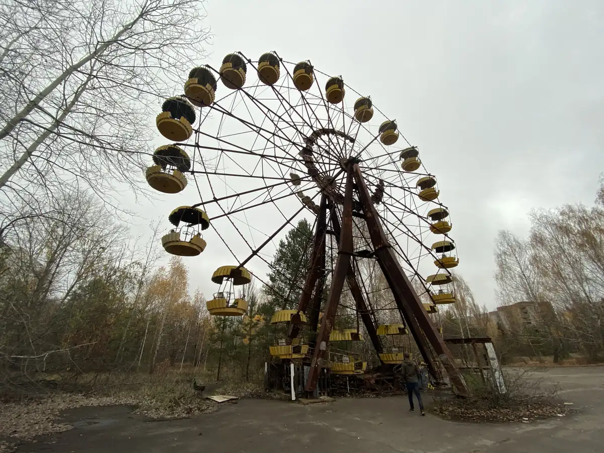
The abandoned Ferris wheel in Pripyat
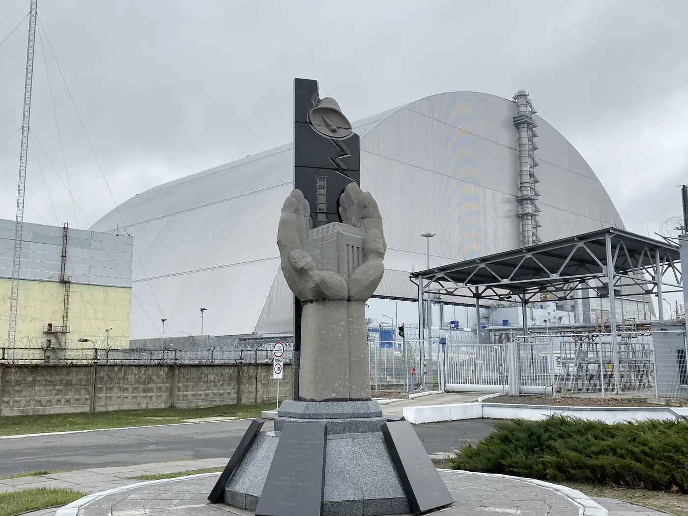
Chernobyl's Reactor 4 under its new arch, with the memorial

On 26 April 1986, reactor No. 4 at the Chernobyl nuclear plant exploded. It is still the worst nuclear disaster in history, and one of only 2 rated 7, the maximum, on the international scale. The other is Fukushima in 2011.

Today, with a guide, you can walk through the exclusion zone and the abandoned city of Pripyat, where about 50,000 people left in a hurry and never came back.

The nuclear missile base
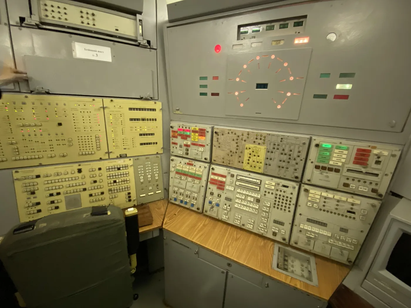
The underground launch control console at the nuclear missile base

Somewhere in the countryside between Kyiv and Odessa, near the small town of Pervomaisk, is a former Soviet missile base. It held intercontinental ballistic missiles, the kind built to cross continents, and its underground launch control centre is still there.

The highlight of a visit is going down into that launch control centre, where visitors can sit at the console for a simulated launch.

I wrote up both days, with the dosimeter readings and the launch room, in Chernobyl and a Nuclear Missile Base: Two Days in Cold War Ukraine.

Kyiv and Odessa
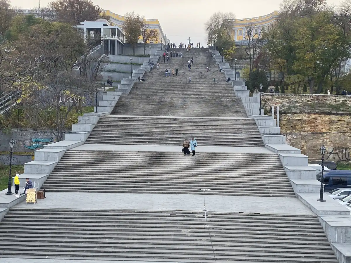
The Potemkin Stairs, Odessa

Kyiv, the capital, sits on the Dnieper River and was home to almost 3 million people in 2015. Odessa, on the Black Sea, is the port city of the south, known for its 19th-century buildings, its opera house, and the Potemkin Stairs, made famous by the 1925 film Battleship Potemkin.

Transnistria: the country that does not exist

Transnistria is a thin strip of land on the east bank of the Dniester River. On paper, it is part of Moldova. In practice, it has run itself since a short war in 1992, with its own government, army, currency and border posts, and almost no other country recognises it.

Tiraspol
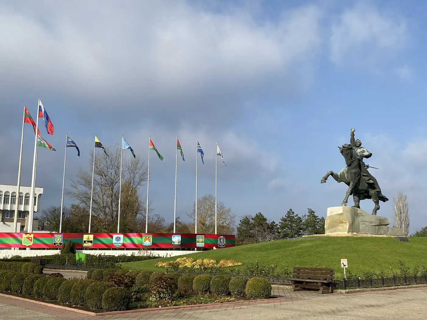
The Suvorov statue and a row of flags, Tiraspol
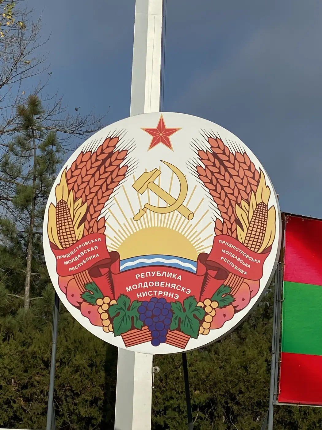
Transnistria's state emblem with the hammer and sickle

Tiraspol is its capital. It was founded in 1792 by the Russian general Alexander Suvorov, whose statue still stands there, and the hammer and sickle still appear on the state symbols.

Chitcani and Bender
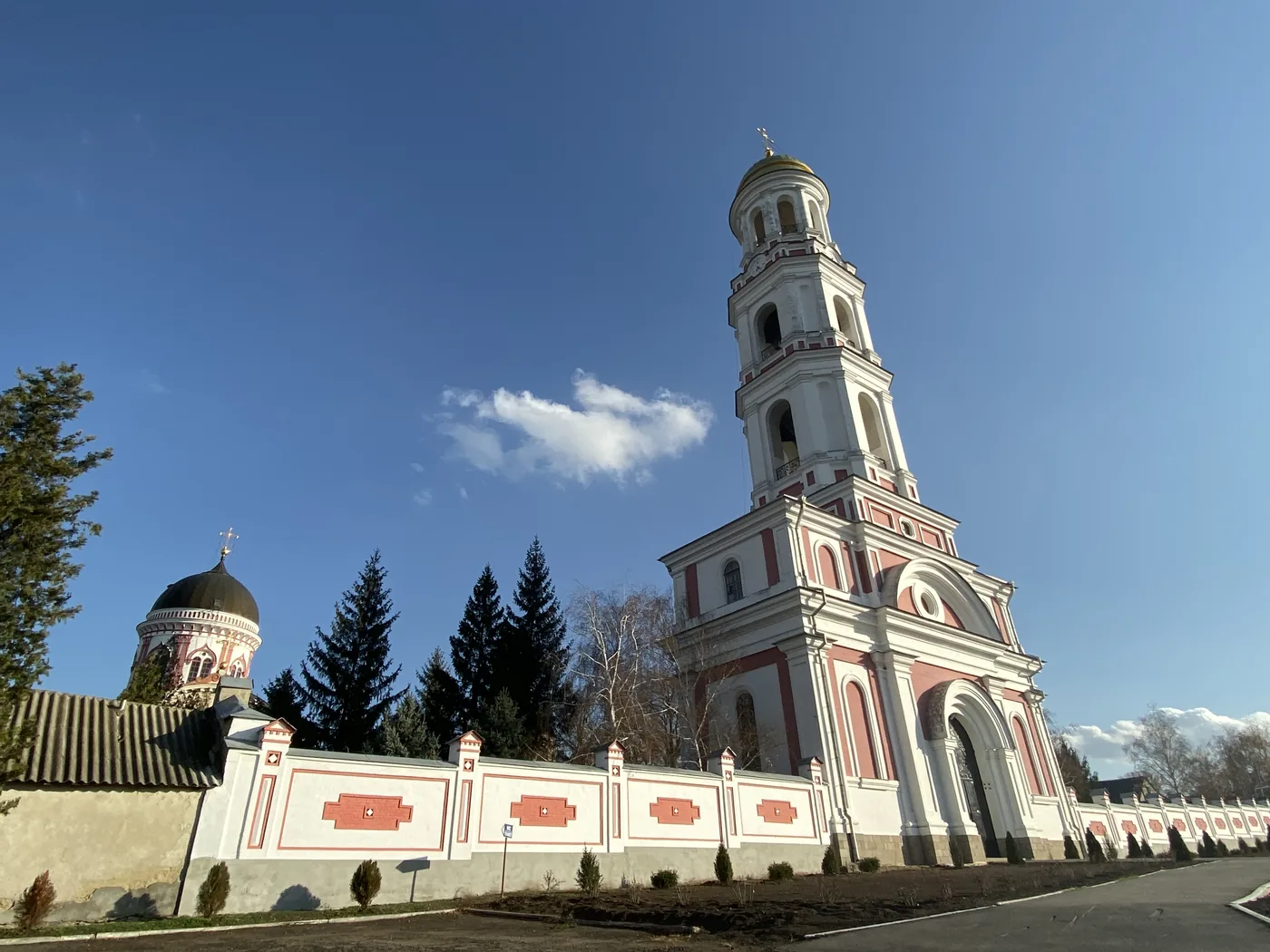
The Noul Neamt Monastery bell tower, Chitcani

Chitcani is one of the oldest villages recorded in Moldova, dating back to 1367, and the home of the Noul Neamt Monastery. Under Soviet rule the monastery was closed and used as a hospital, a storehouse and then a museum.

Bender sits on the other bank of the river, inside the buffer zone set up at the end of the 1992 war. Its fortress, Tighina, was one of the important strongholds of the old Principality of Moldova.

I wrote up all 3 days, with the exchange board, the quarry tunnels and the old fairground, in Transnistria: 3 Days in the Country That Does Not Exist.

Moldova

Chisinau and the Cricova cellars
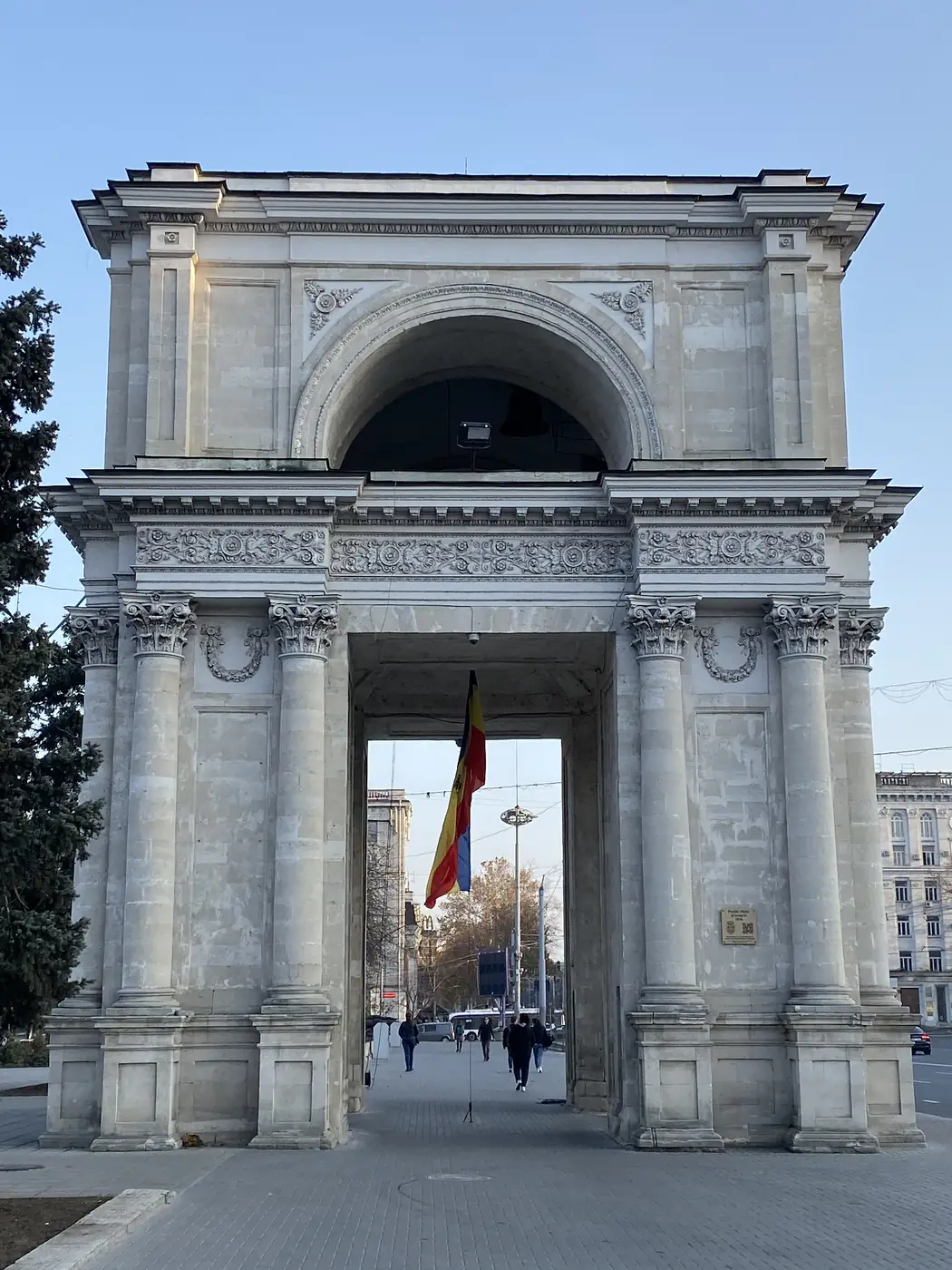
The Arc of Triumph, Chisinau
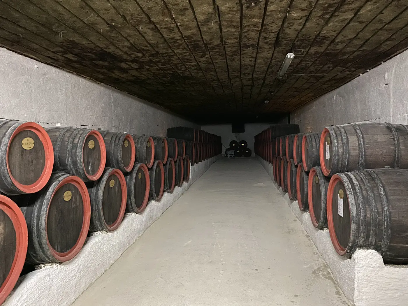
A barrel-lined underground road in the Cricova cellars

Chisinau, the capital, is the most prosperous part of Moldova, which tells you how big that gap I mentioned can be. About 15 km north of it, under the town of Cricova, are some of the largest wine cellars in the world: about 120 km of underground roads, cut from old limestone tunnels and turned into a wine store in the 1950s.

The legend is that the cosmonaut Yuri Gagarin went in on a visit in 1966 and came out, with some help, 2 days later.

Romania

Bucharest
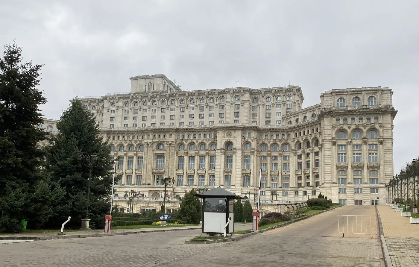
The Palace of the Parliament, Bucharest

Bucharest’s landmark is the Palace of the Parliament, a communist-era government building with about 1,100 rooms, one of the heaviest buildings in the world. Nearby, the old Lipscani quarter has the nightlife, and the ruins of the Old Princely Court, where Vlad III, “the Impaler”, once ruled.

Transylvania
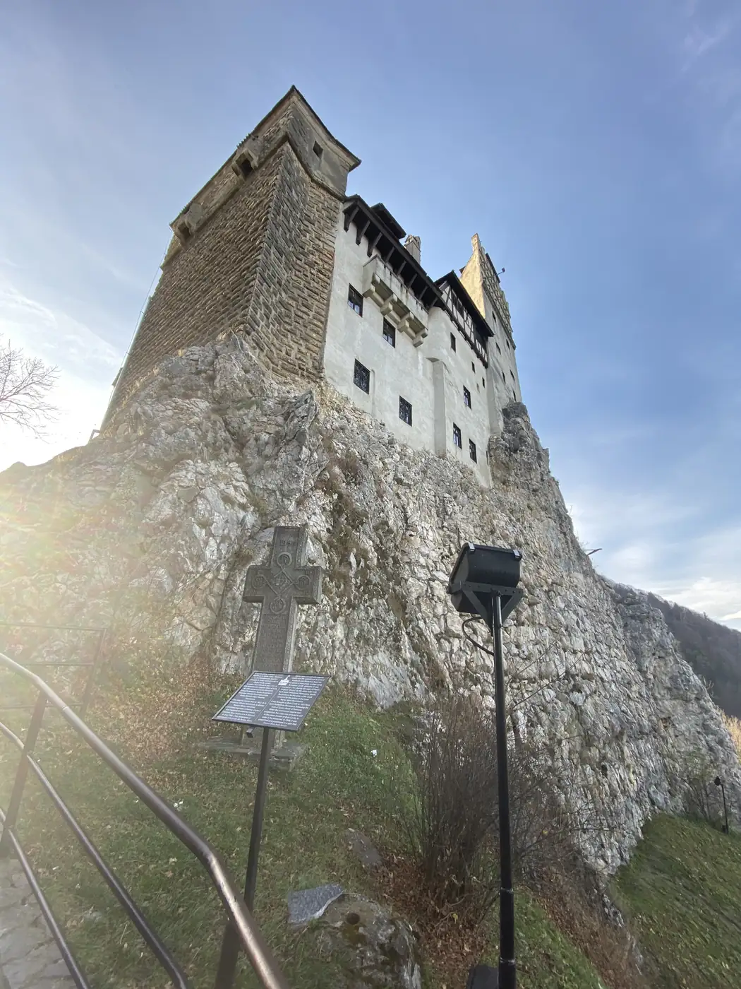
Bran Castle on its rock
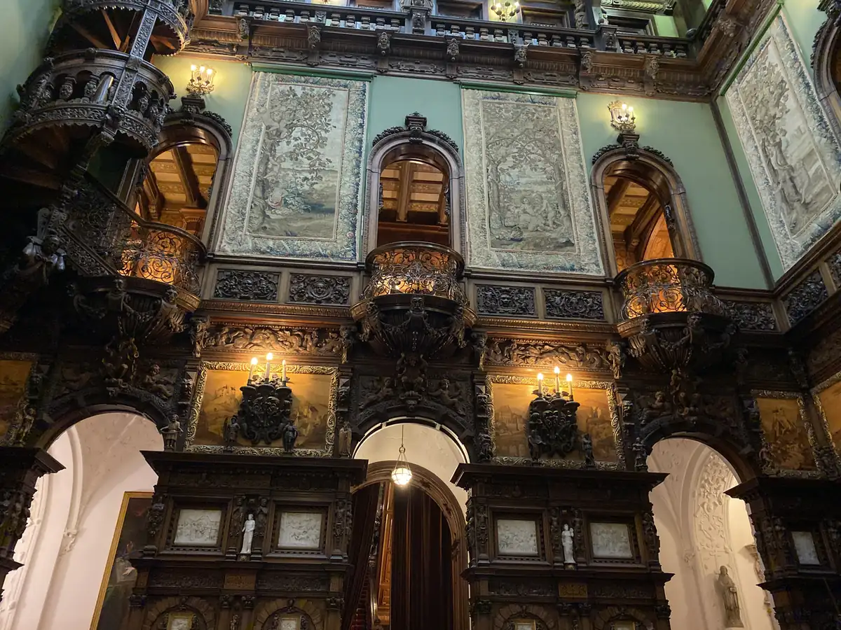
The carved wooden hall inside Peles Castle

Transylvania is the region everyone knows from Dracula, thanks to Bram Stoker’s novel and every film since. Bran Castle, the Gothic fortress tied to the legend, and Peles Castle, a 19th-century royal palace in the mountains, were both on my route, along with Brasov, a medieval Saxon town with its walls, its big square and its Black Church.

Bulgaria

Sofia
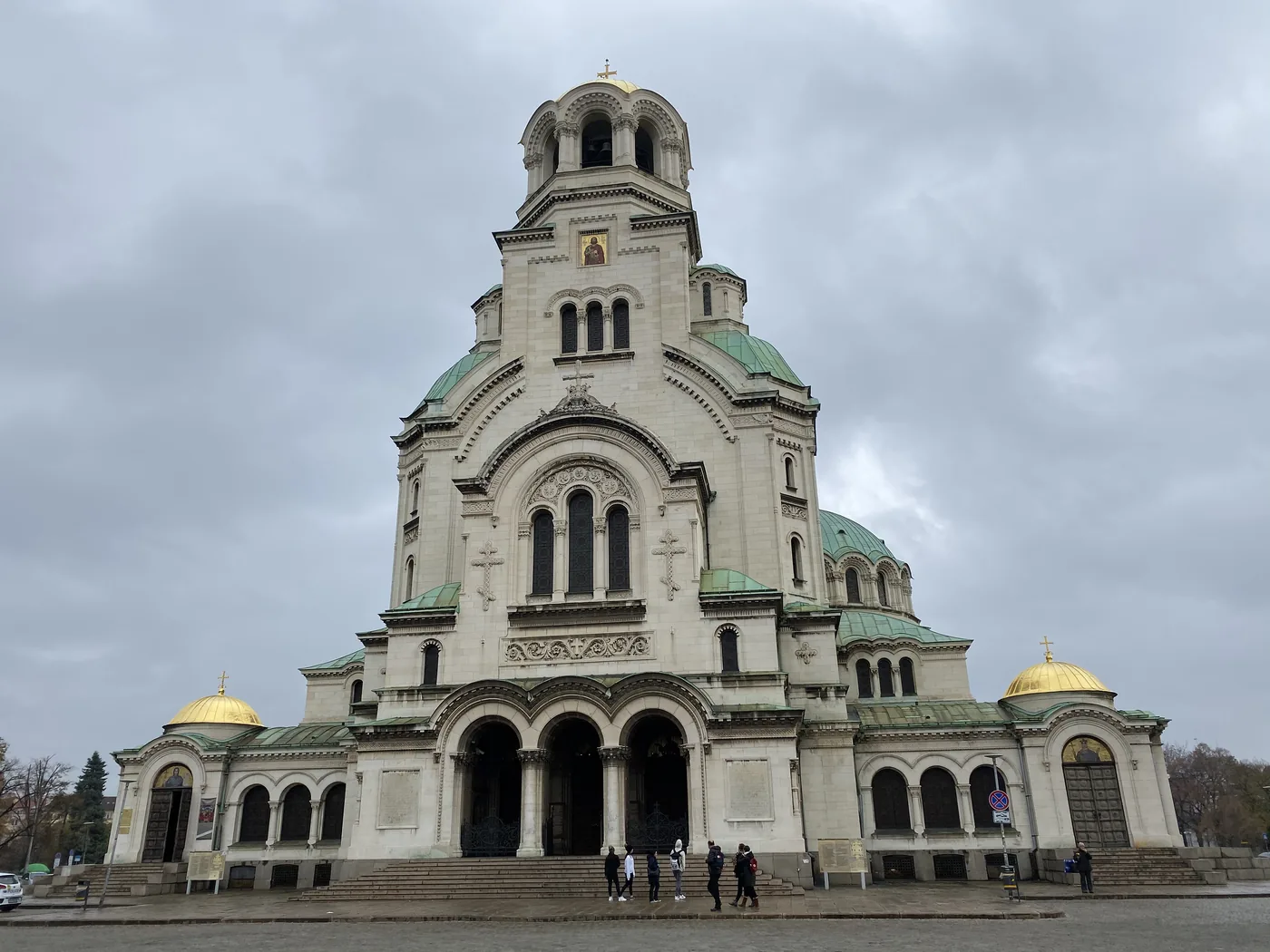
Alexander Nevsky Cathedral, Sofia

Sofia sits at the foot of Vitosha mountain, in the middle of the Balkans, and its landmarks cover over 2,000 years: Greek, Roman, Ottoman and Soviet. It is sometimes called a “triangle of religious tolerance”, because a church, a mosque and a synagogue stand within a few minutes’ walk of each other in the centre.

North Macedonia

Skopje and Matka Canyon
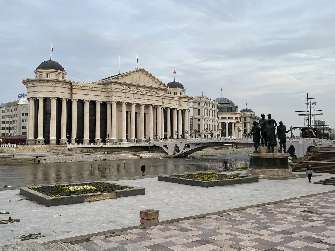
The Archaeological Museum on the Vardar, Skopje
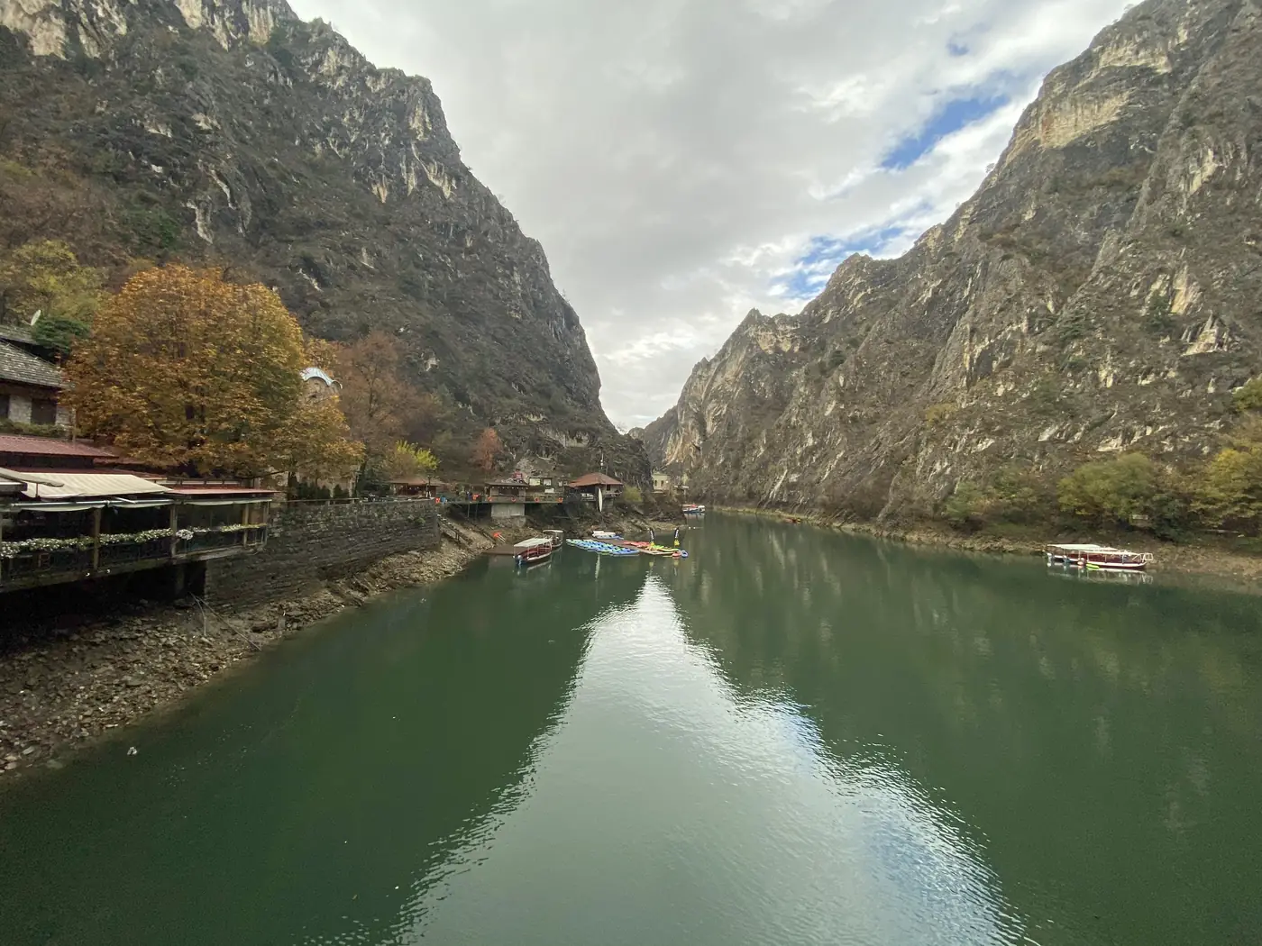
The lake in Matka Canyon

Skopje was hit by a huge earthquake in 1963 and rebuilt.

A short drive west is Matka Canyon, about 5,000 hectares of cliffs with medieval monasteries, 10 caves and the oldest artificial lake in the country.

Kosovo

Pristina, Brod and Mitrovica
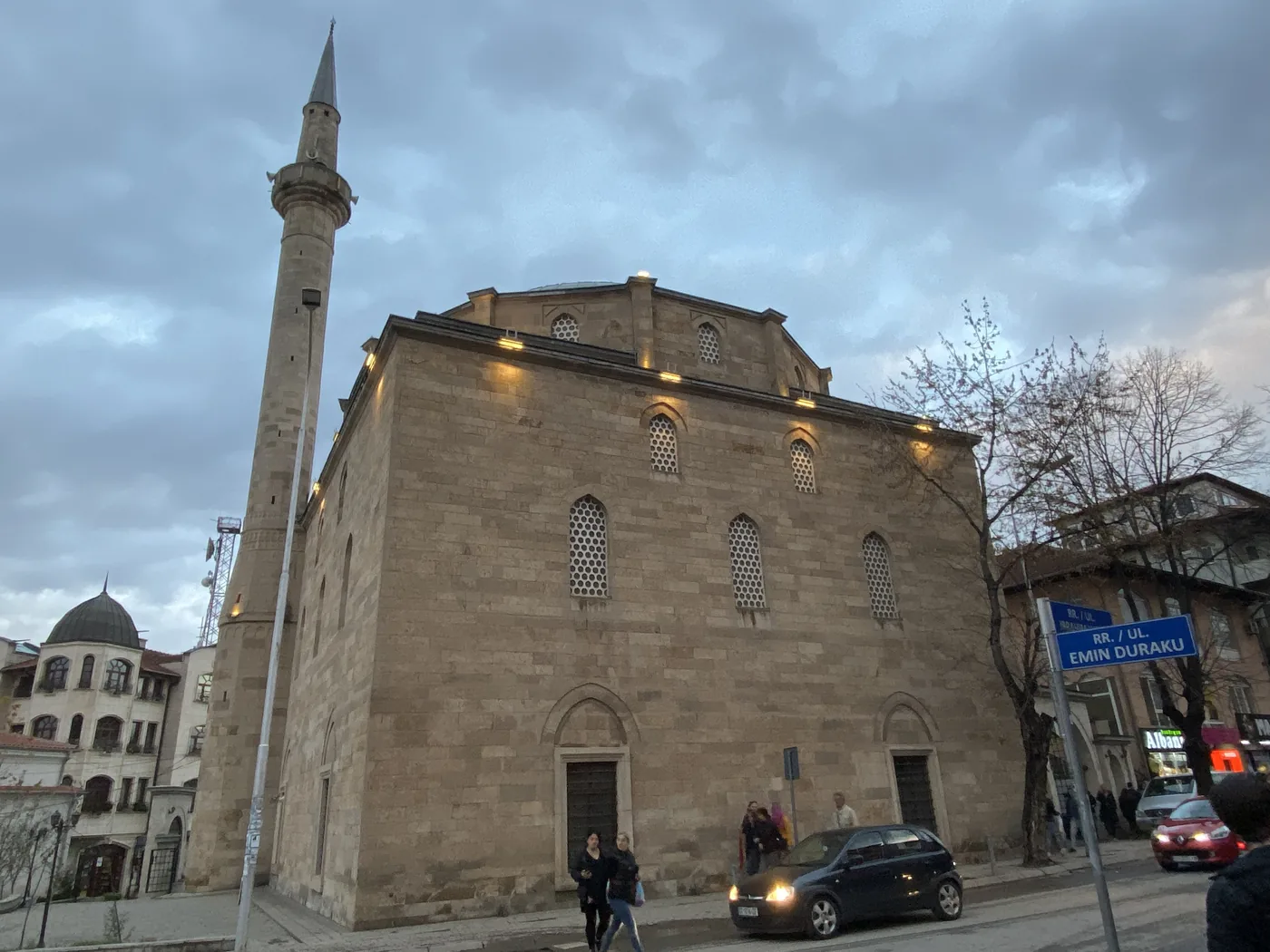
An Ottoman mosque at dusk, Pristina
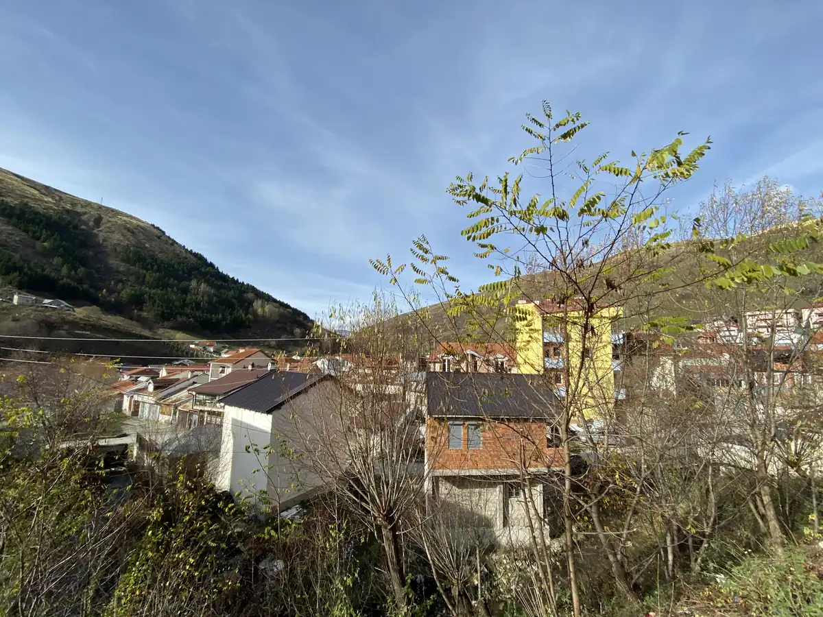
Village houses under the mountains, Brod
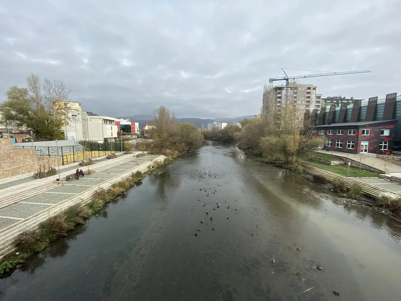
The Ibar river from the bridge, Mitrovica

Pristina, the capital, is a young city in a young country. Kosovo declared independence from Serbia only in 2008, and many countries still do not recognise it.

Brod, in the far south, is a mountain village of about 900 houses in the Gora region, home to the Gorani people, who are known for their sweets and confectioners.

Mitrovica is a divided city. It is split by the Ibar River, with Albanians on one side and Serbs on the other, and the bridge between them was guarded for years after the 1999 war. In March 2004, riots there left at least 8 people dead and about 300 injured, the worst unrest in Kosovo since the war ended.

Albania

Tirana
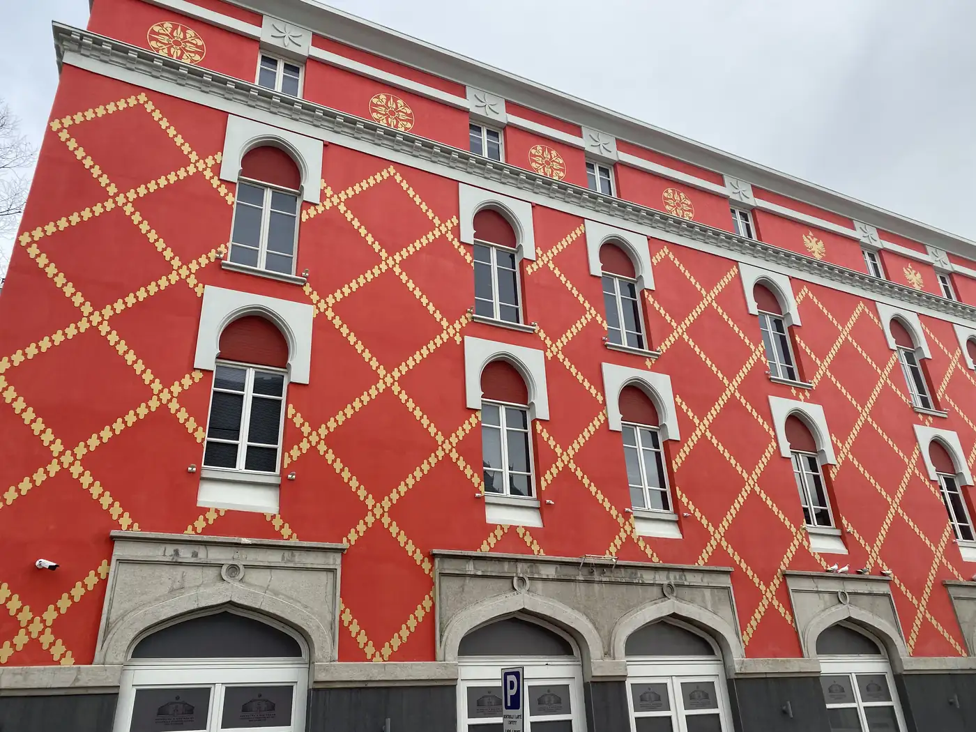
A red and gold patterned facade, Tirana

Tirana only became Albania’s capital in 1920. It is one of the sunniest cities in Europe, with about 2,500 hours of sun a year, and since the end of communism, many of its grey blocks have been painted in bright colours, which makes the city look nothing like its past.

Montenegro

Budva, Tivat, Kotor and Sveti Stefan
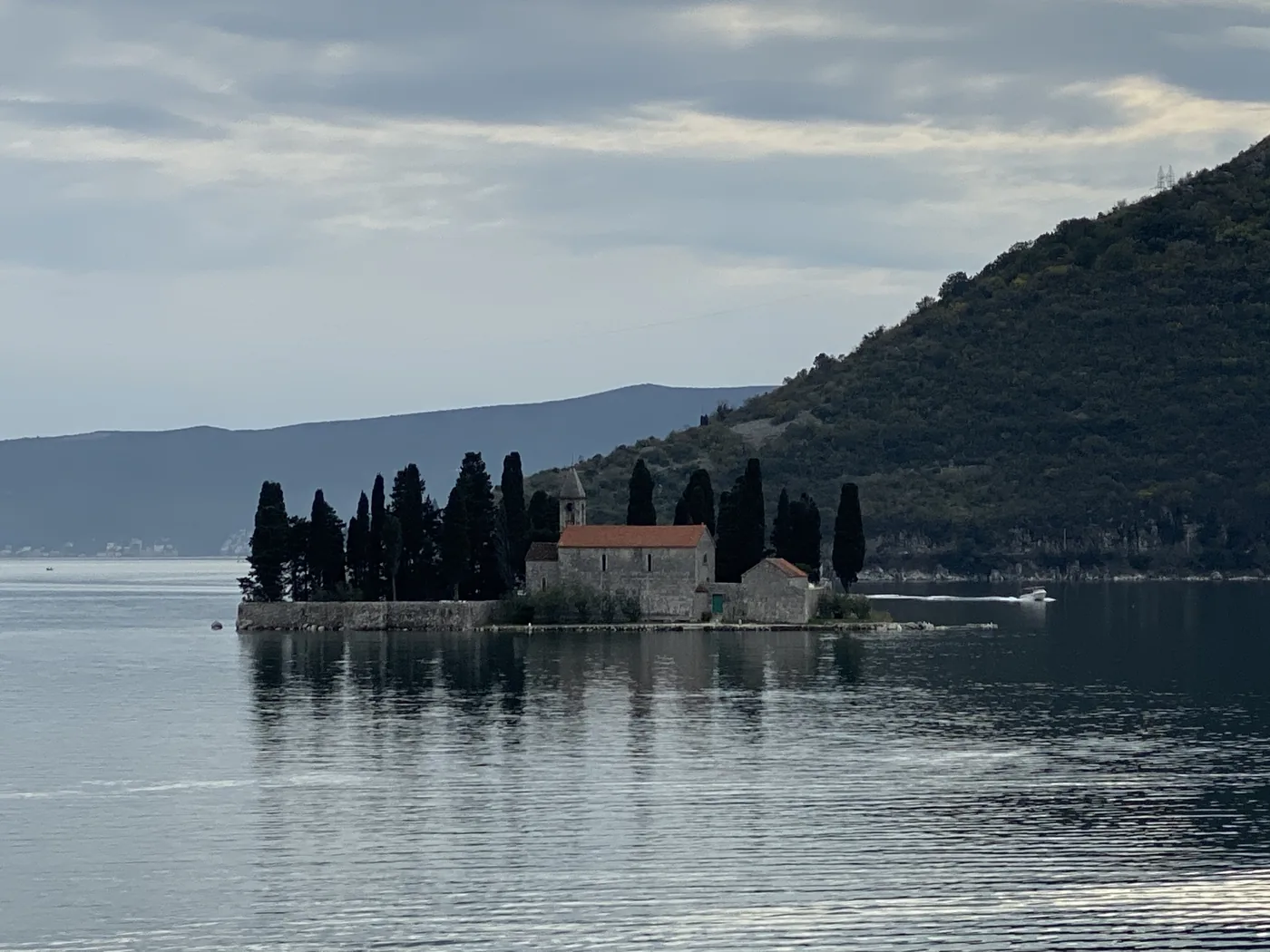
The island church in the Bay of Kotor
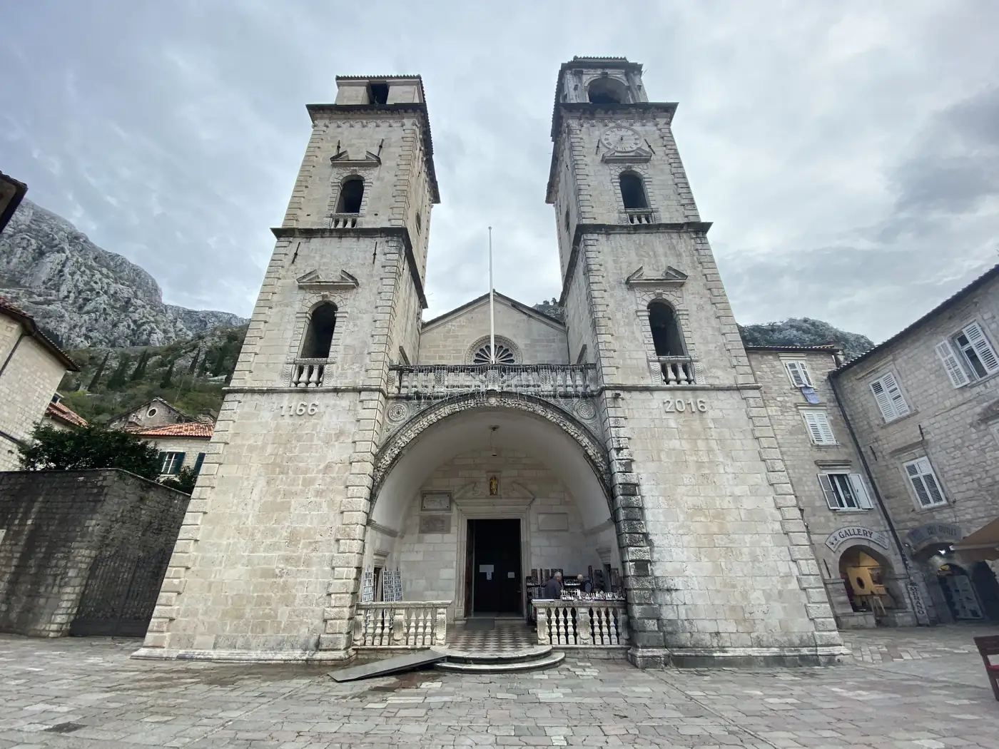
St Tryphon Cathedral, Kotor

Montenegro is a small country on the Adriatic coast that only became independent in 2006, when a referendum ended its union with Serbia. My route took in Budva, Tivat, Kotor, with its walled old town at the head of a long bay, and Sveti Stefan, a tiny island village joined to the shore by a strip of sand.

Serbia

Belgrade
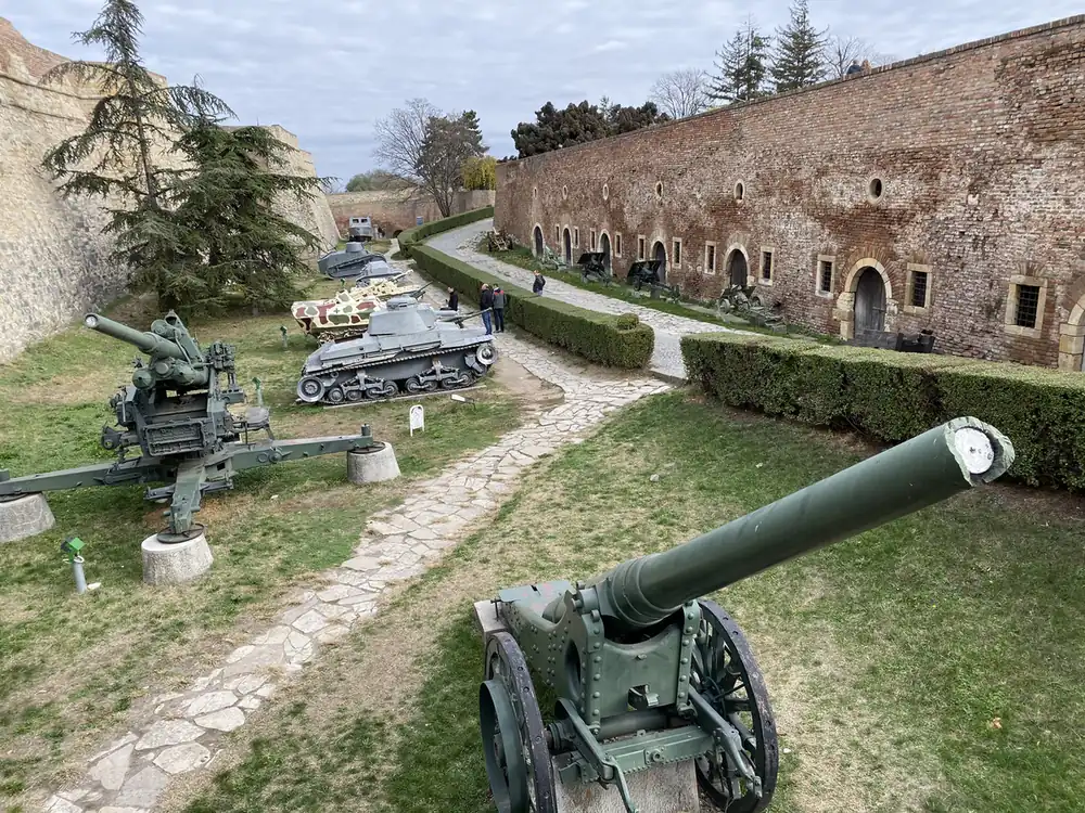
Kalemegdan fortress walls with old guns and tanks, Belgrade

Belgrade may be the most fought-over city in Europe: by one count, it has been fought over in 115 wars and razed 44 times. It was the capital of Yugoslavia from 1918 until the country finally broke apart.

Bosnia and Herzegovina

Sarajevo
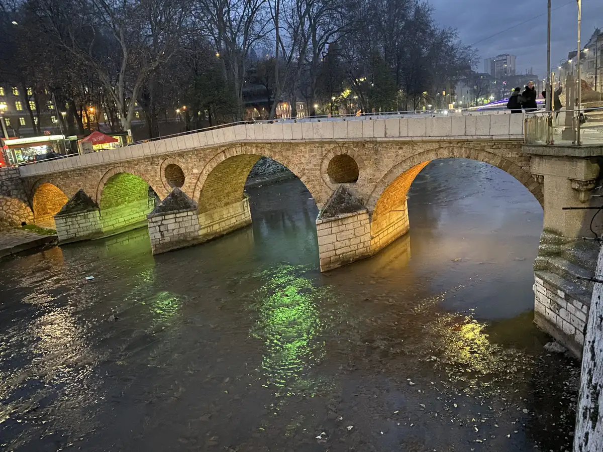
The Latin Bridge lit at dusk, Sarajevo

Sarajevo is the city where the 20th century turned twice. In 1914, the assassination of Archduke Franz Ferdinand on one of its streets set off the First World War. Seventy years later, it hosted the 1984 Winter Olympics, a high point for the city. Then from April 1992 to February 1996, it lived through the longest siege of a capital city in modern warfare: 1,425 days.

It is also called the “Jerusalem of Europe”, because a mosque, a Catholic church, an Orthodox church and a synagogue stand in the same neighbourhood.

The tunnel and the Olympic bobsleigh track
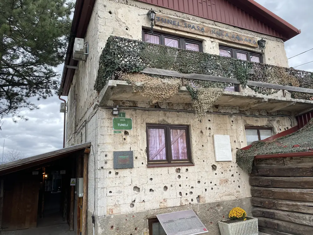
The shell-marked house at the Tunnel of Hope, Sarajevo
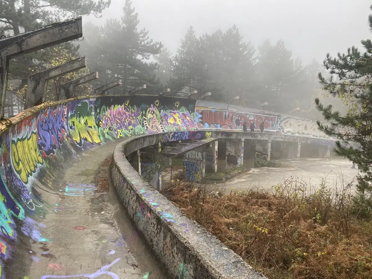
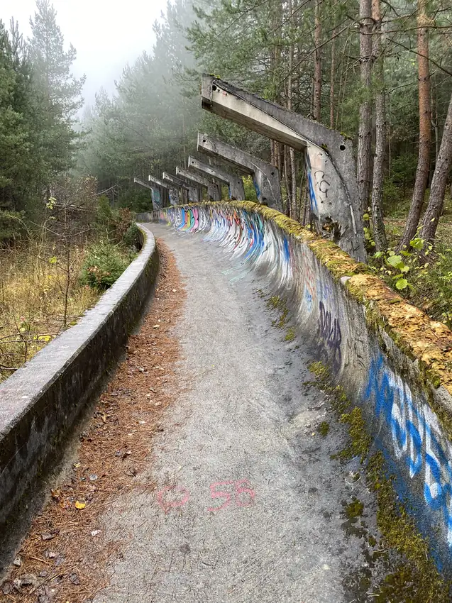
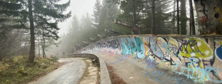
A graffiti-covered curve of the Olympic bobsleigh track in fog

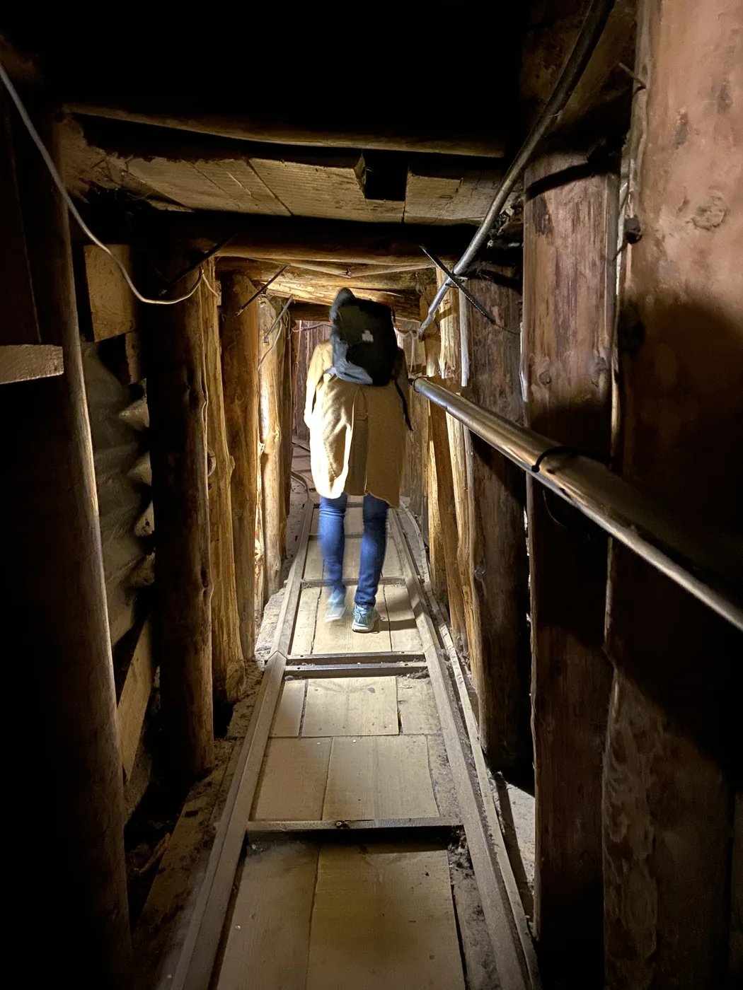
During the siege, the city was cut off on all sides except one, under the airport. In 1993, the Bosnian army dug a tunnel about 800 metres long under the runway to the free territory beyond it. Food, aid and weapons came in through it, and people got out. Part of it is now a museum, the Tunnel of Hope.

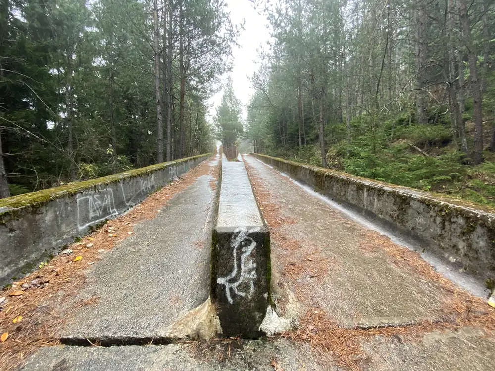
Up on Mount Trebevic is the bobsleigh and luge track from the 1984 Olympics. During the siege it was used as an artillery position, and today it is a long, empty concrete snake covered in graffiti.

I wrote up both days in Sarajevo, the tunnel, the track and the Sarajevo roses, in Sarajevo: The Siege Tunnel, the Olympic Bobsleigh Track and the Spite House.

Croatia and Slovakia

Zagreb
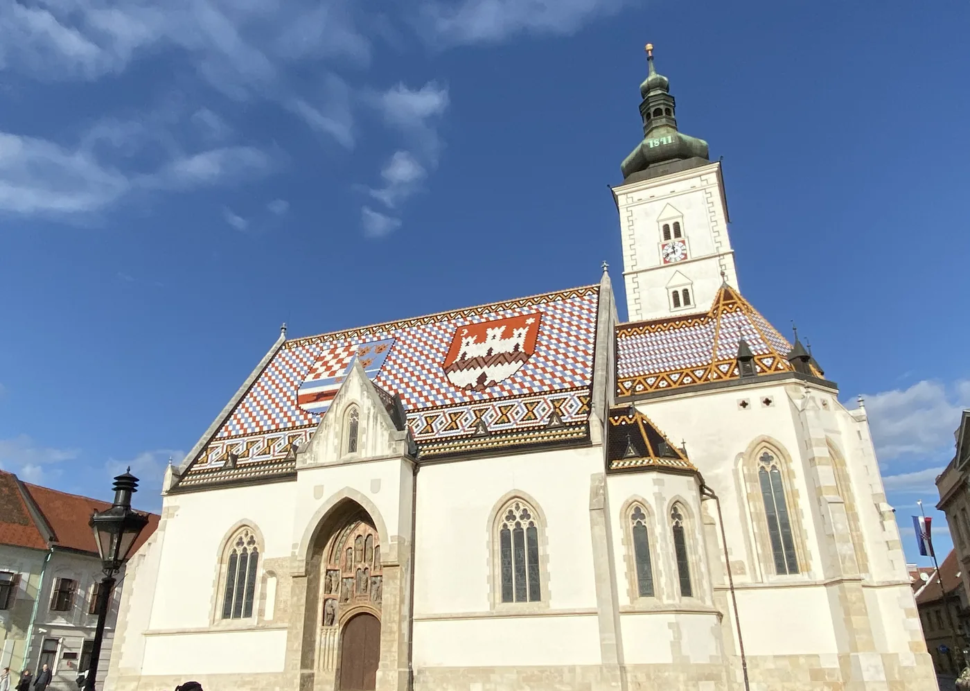
St Mark's Church and its tiled roof, Zagreb

Zagreb is the capital of Croatia, on the Sava river, with a good quality of life and plenty of museums. (I had been to Croatia before, in 2010, and went back again in 2025 for a very different trip.)

Bratislava, Devin Castle and the TV tower
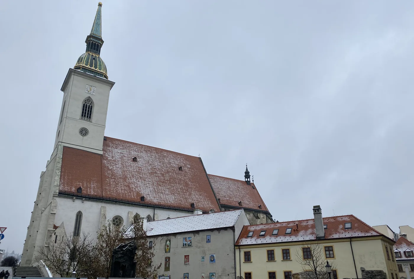
St Martin's Cathedral, Bratislava
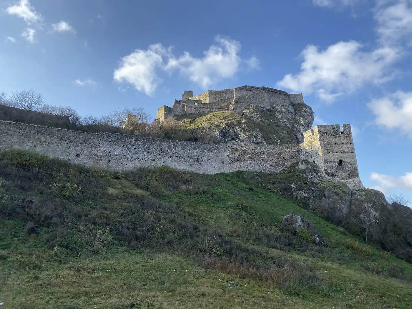
Devin Castle ruins on the rock
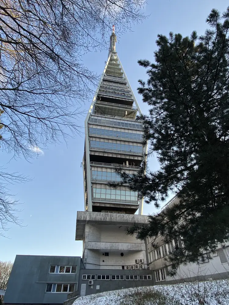
The Kamzik TV tower, Bratislava

Bratislava, the capital of Slovakia, is small for a capital, with about 430,000 people, on the Danube right at the borders of Austria and Hungary. From 1536 to 1783 it was where the kings of Hungary were crowned.

Just outside it, Devin Castle stands on a rock above the point where the Morava meets the Danube, with its tiny Maiden Tower balanced on a separate rock. And on Kamzik hill is the TV tower, about 196 metres tall, built in 1975, with a deck from which you can see Austria, Hungary and the Czech Republic on a clear day.

From Bratislava, I flew home through Dubai.

How did the trading fit in?

One of the biggest advantages of swing trading is that it does not ask you to watch the market all day. A few minutes on my phone each day was enough to manage my positions, and I spent the rest of the day in bunkers and castles.

The clock was easy too. Most of this route sits 1 to 2 hours ahead of London, which put the US market open at about 4.30 or 5.30 in the afternoon, local time, right around the time each day’s touring ended.

I wrote up how that routine works on the road, the watchlist, the alerts and the time zones, in how I trade while travelling.

Could you do this trip today?

Only part of it. The missile base and Chernobyl sit in a country at war, and Belarus is a very different place to visit than it was in 2019.

In 2022, I did the Central Asia half of the old Soviet Union too, in 5 weeks across the Stans.

Have you been to any of these countries? Which one would you pick first: Transnistria, Chernobyl or Sarajevo? Let me know in the comments.

All my other trips are on the travel log, country by country, and more photos are on Instagram, @iamrecneps.
Spencer Li

by Spencer Li
https://synapsetrading.com/wp-content/uploads/2026/10/eastern-europe-2019-the-abandoned-ferris-wheel-in-pripyat.webp 900 1200 Spencer Li https://synapsetrading.com/wp-content/uploads/2026/10/synapse-logo-horizontal-light.png Spencer Li2020-02-13 17:07:322026-10-22 16:56:50Eastern Europe and the Balkans: 14 Countries in 5 Weeks, From Chernobyl to Sarajevo
Spencer Li

Sarajevo: The Siege Tunnel, the Olympic Bobsleigh Track and the Spite House

Travel & Lifestyle
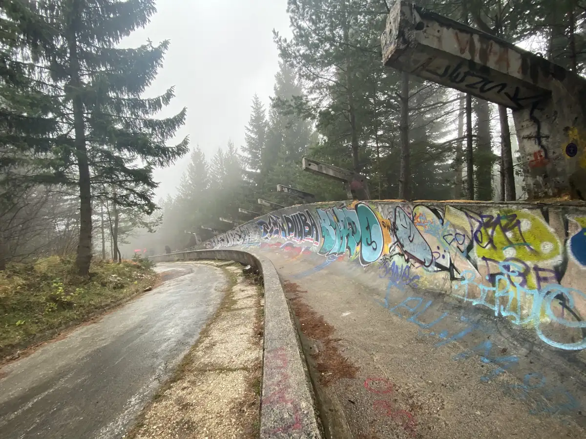
A graffiti-covered bend of the 1984 Olympic bobsleigh track on Mount Trebevic in fog

In late November 2019, near the end of 5 weeks across Eastern Europe and the Balkans, I spent 2 nights in Sarajevo, the capital of Bosnia and Herzegovina.

It was a short stop with a lot packed into it. In 2 days I walked through the tunnel that kept the city alive during the siege, walked down an Olympic bobsleigh track in the fog, and ate dinner in a house that was moved across a river out of spite. This is that stop, from my photos.

Why Sarajevo?

Sarajevo is the city where the 20th century turned twice. In 1914, the shooting of Archduke Franz Ferdinand on one of its street corners set off the First World War. Seventy years later, it hosted the 1984 Winter Olympics.

Then came the siege. From April 1992 to February 1996, the city was surrounded and shelled from the hills for 1,425 days, the longest siege of a capital city in modern warfare.

So you might be thinking, what is left of all that today? More than you would expect. The scars are still in the pavements, on the walls and up on the mountain, and the city has turned many of them into places you can visit.

How do you get in?

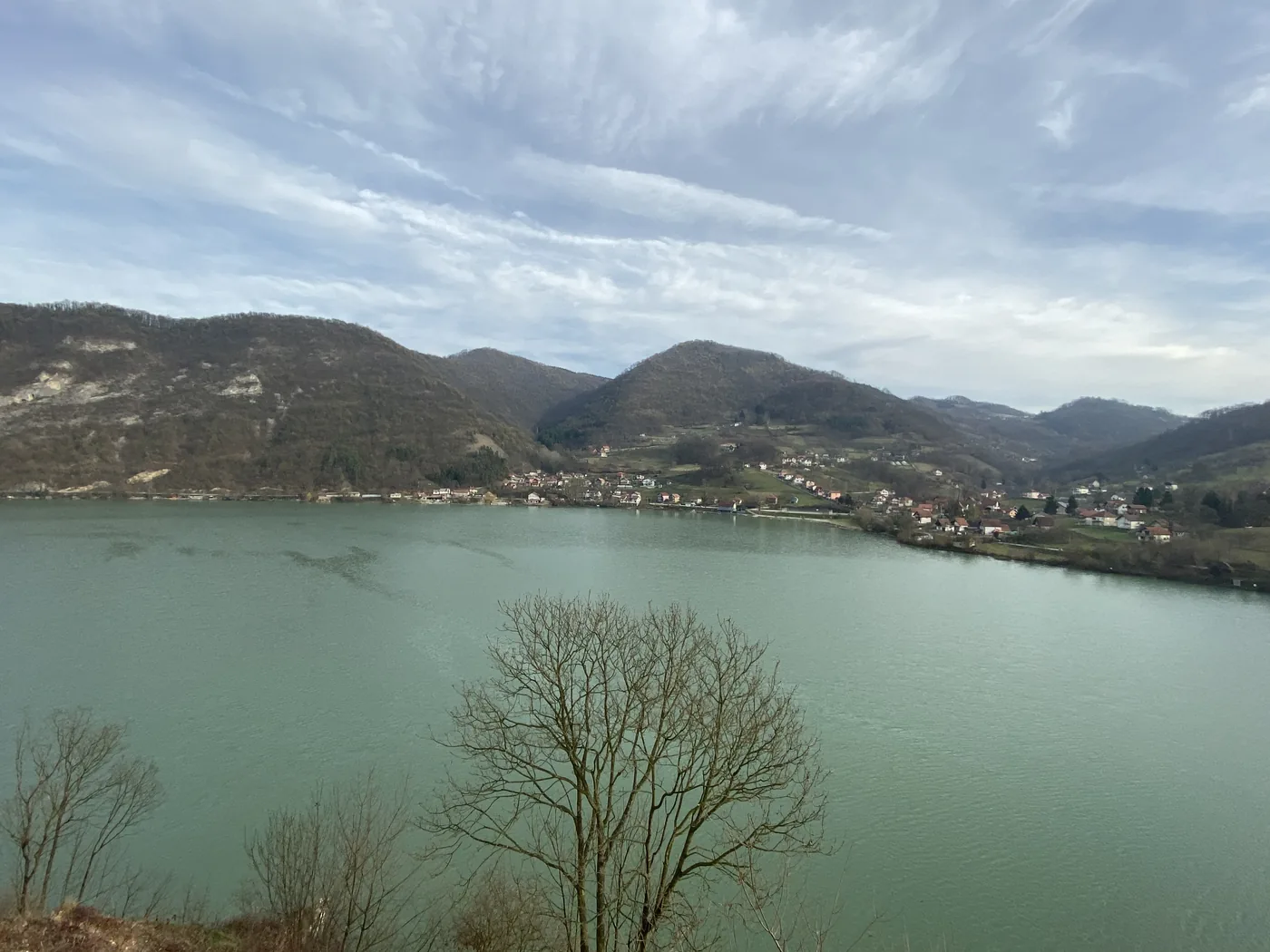
We came in by road from Serbia on 27 November. The border post sat at the end of a bridge over a wide green river, and the road then followed a long reservoir between steep wooded hills.

A long green reservoir between wooded hills on the road into Bosnia and Herzegovina

By late afternoon we were in the old town.

What is Bascarsija like?

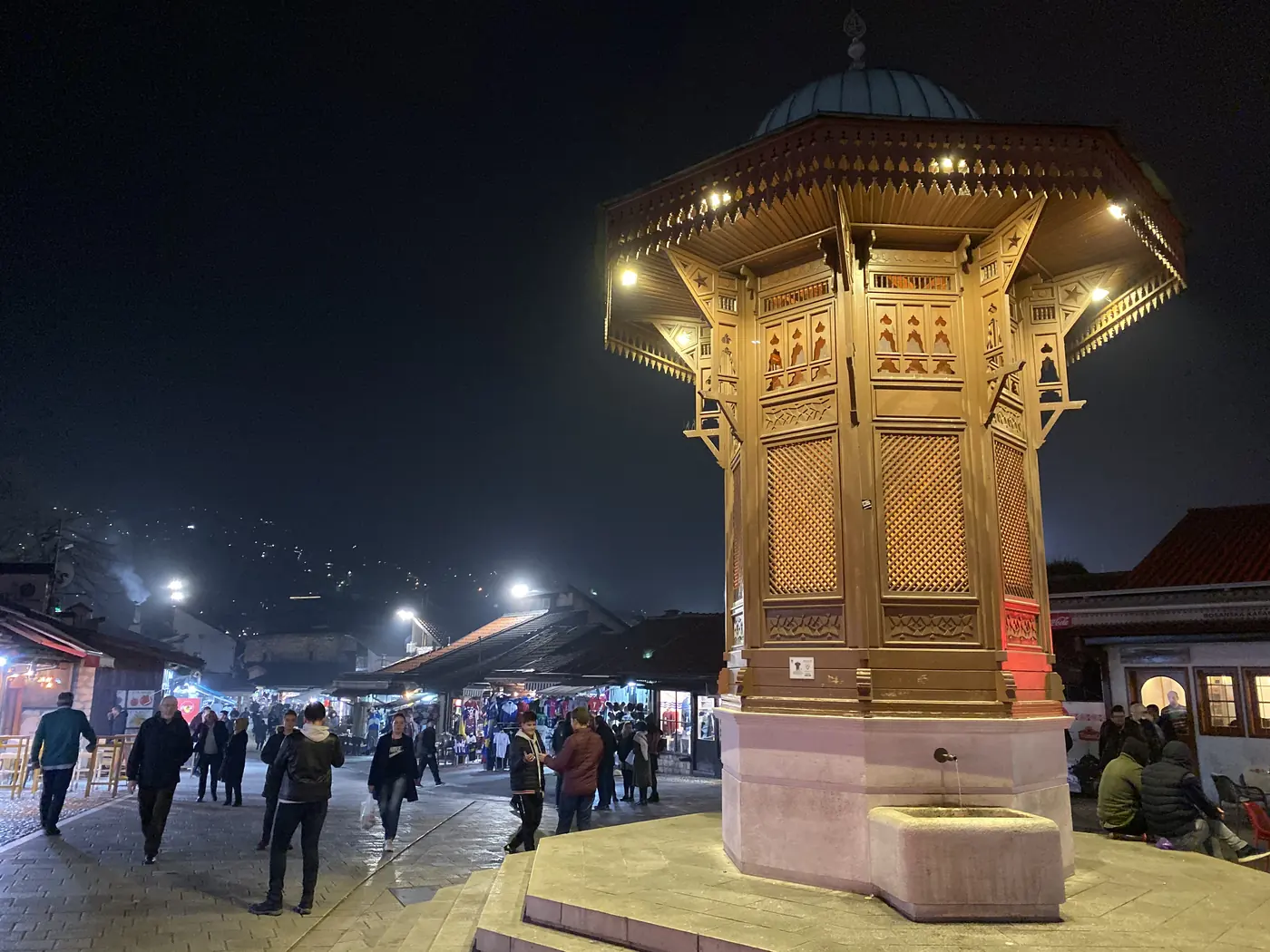
Bascarsija is the old Ottoman bazaar, a grid of low wooden shops selling copper, carpets and lamps, with minarets above the rooftops. At its centre is the Sebilj, a wooden fountain with a copper dome, first built in 1753 and rebuilt in 1891. By the next morning, the square around it was covered in pigeons.

The wooden Sebilj fountain lit up at night in Bascarsija, Sarajevo

Walk west from the bazaar and the city changes style in a few hundred metres, from Ottoman domes to the tall Austro-Hungarian buildings the empire put up after it took over in 1878. That change is the “Jerusalem of Europe” idea in practice: a mosque, a Catholic cathedral, an Orthodox church and a synagogue all stand within a short walk of each other.

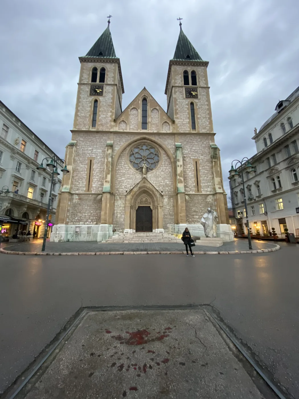
The Sacred Heart Cathedral, finished in 1889, has two tall towers over a small square. On the pavement right in front of it is a Sarajevo rose, which I will come back to.

The twin towers of the Sacred Heart Cathedral in Sarajevo, with a Sarajevo rose on the pavement in front

Where was Franz Ferdinand shot?

On the corner by the Latin Bridge, over the Miljacka river.

On 28 June 1914, a 19-year-old called Gavrilo Princip shot the Archduke and his wife Sophie as their car turned there. The building on that corner is now a small museum about the city under Austria-Hungary, from 1878 to 1918. We reached it just before dusk.

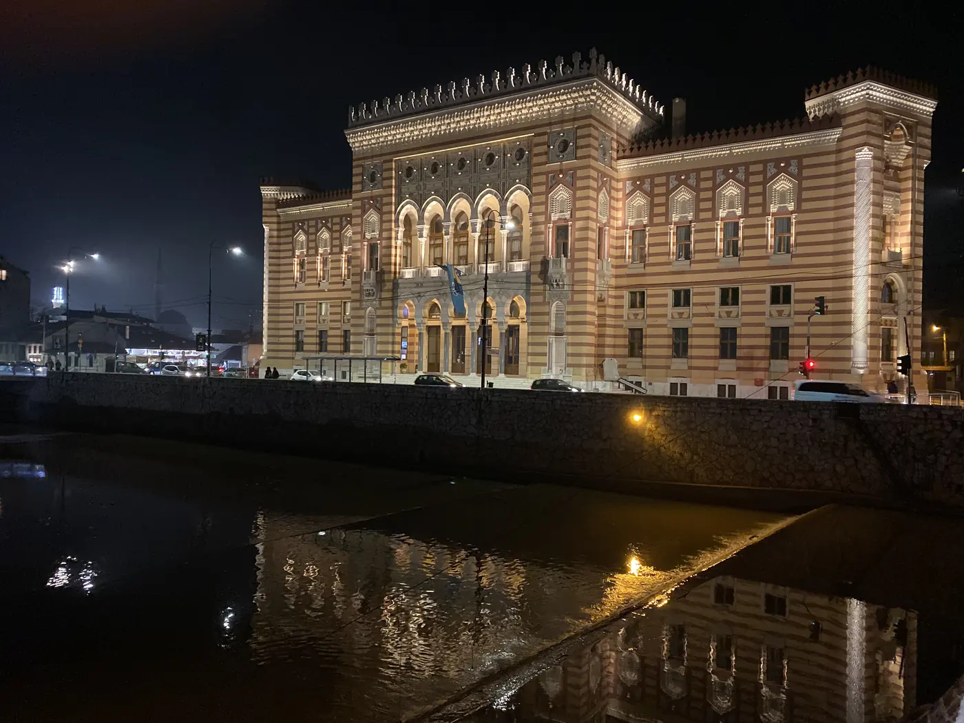
A short walk up the river is the City Hall, the Vijecnica, a striped building in the pseudo-Moorish style that opened in 1896. It later became the national library. On the night of 25 to 26 August 1992, it was shelled and burned, and most of the collection, around 2 million books by one count, went with it. It reopened in 2014, rebuilt from the original plans, and at night it is lit up gold over the river.

Sarajevo City Hall, the Vijecnica, lit up at night over the Miljacka river

What is the Spite House?

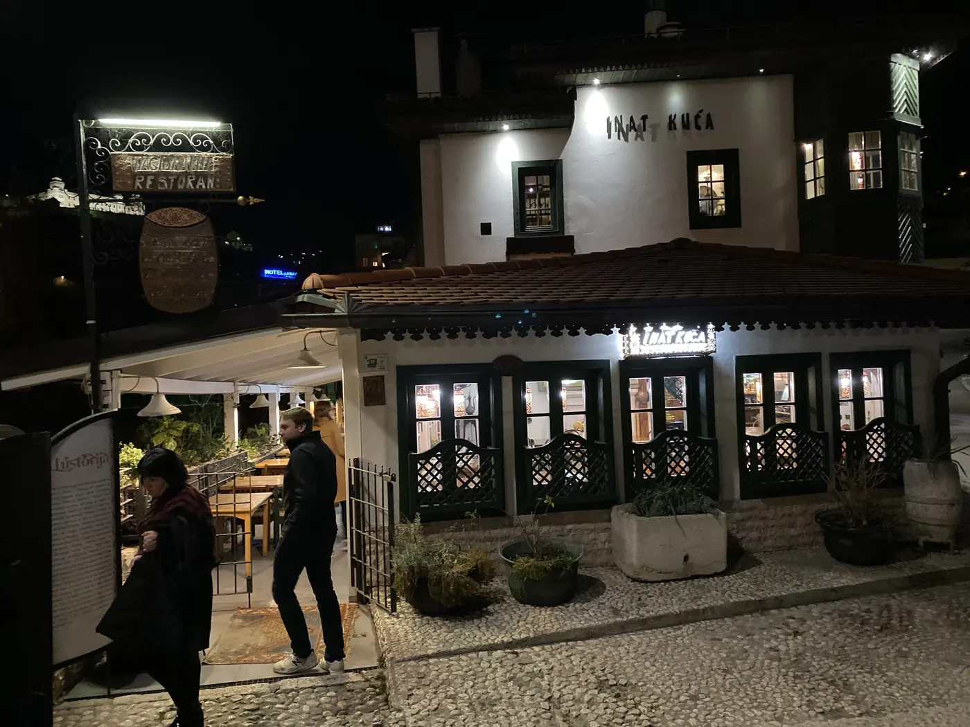
Right across the river from the City Hall is a small white house with a dark wooden roof. It is called Inat Kuca, the Spite House, and the story is on the first page of the menu inside.

The Spite House, Inat Kuca, a white house with a dark wooden roof in Sarajevo

When the Austro-Hungarians wanted to build the City Hall, the exact spot on the right bank of the Miljacka belonged to an old man who would not sell. After long talks, he gave in on two conditions: a bag of gold coins, and his house moved, brick by brick, to the other side of the river. According to the menu, they did exactly that, in 1895.

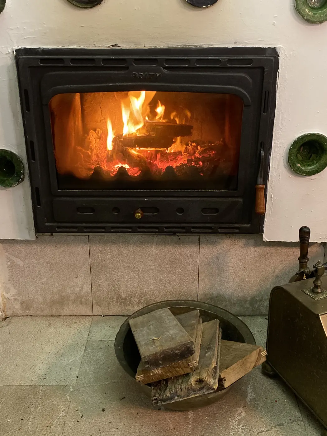
It has been a traditional Bosnian restaurant since 1997. Dinner was a platter of grilled meats and flatbread, with small sausages, patties and chicken, and a copper tray of stews with rice and sour cream, one of them baked in foil. A wood fire was going in the corner.

A wood fire burning in a tiled stove inside the Spite House, Sarajevo

How did the city survive the siege?

Through a tunnel under the airport.

During the siege, the city was cut off on every side but one. The airport was held by the UN, and beyond its runway lay free territory. So in 1993, the Bosnian army dug a tunnel about 800 metres long under the runway, from the city side to a family house on the far side. Food, aid and weapons came in through it, and people got out.

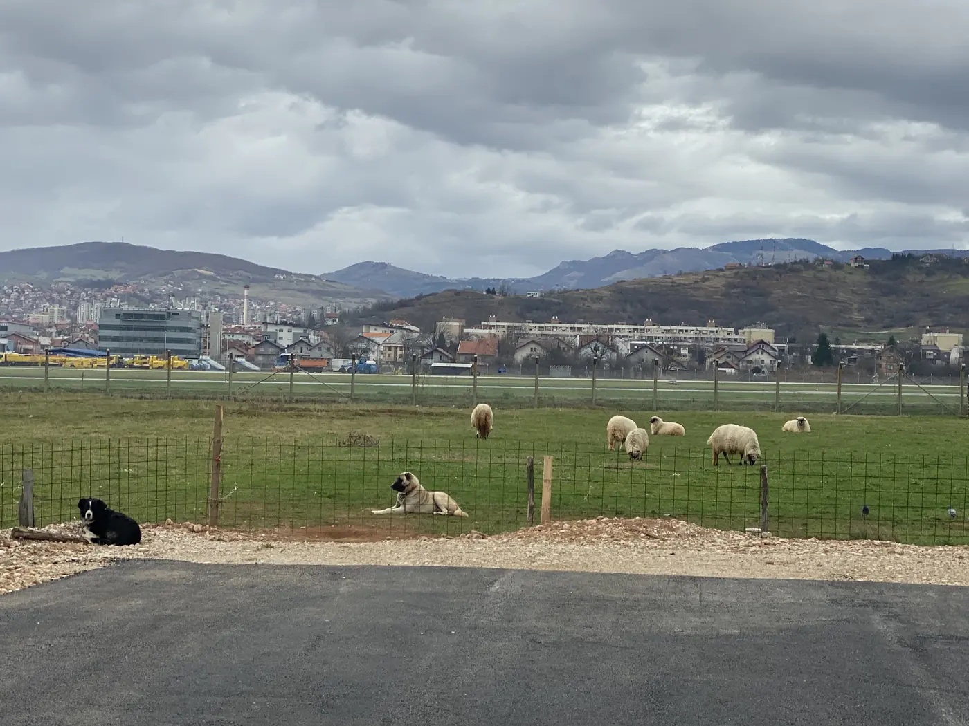
We went on the morning of 28 November. The museum sits in that same house, still pocked with shell and bullet marks, at the edge of open fields. Across the fields you can see the airport, and when we were there a small flock of sheep was grazing between us and the runway.

Sheep grazing in a field beside Sarajevo airport, near the Tunnel of Hope

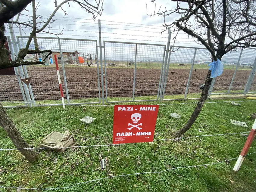
One panel shows Yugoslavia breaking apart into its 7 pieces. Behind a wire fence is a patch of grass with red signs, “Pazi mine”, which means “Watch out, mines”. Old bombs hang from the ceiling of the shed inside.

A red Pazi Mine warning sign behind a wire fence at the Tunnel of Hope museum

Then the tunnel itself. Only a short stretch is open to visitors, and it is low, narrow and propped up with timber on every side. During the siege, people carried supplies along the full 800 metres of it, in both directions, for more than 2 years.

The low, timber-lined passage of the Sarajevo siege tunnel

What is a Sarajevo rose?

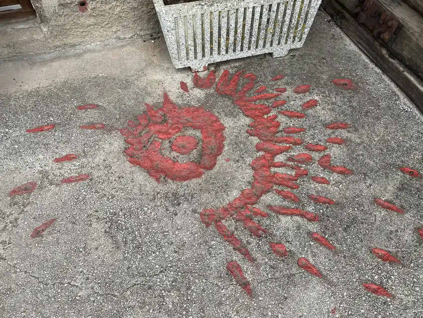
On the ground outside the tunnel museum are splashes of red set into the concrete, and the sign beside them explains what they are.

A Sarajevo rose, a shell scar filled with red resin, on the ground at the Tunnel of Hope

During the siege, the UN counted an average of 330 shell impacts a day on Sarajevo. On a single day, 22 July 1993, the city took 3,777 shells. Every shell left a scar on the roads and pavements, shaped a bit like a flower, and many of them wounded or killed someone. In some places, those scars were filled in with red resin. Those are the Sarajevo roses. The same sign gives the toll of the siege: 11,541 people killed, and 1,601 of them children.

That is what the red mark in front of the cathedral is. About 100 were marked at first, and many have since gone in repairs.

What is on Mount Trebevic?

The 1984 Olympics.

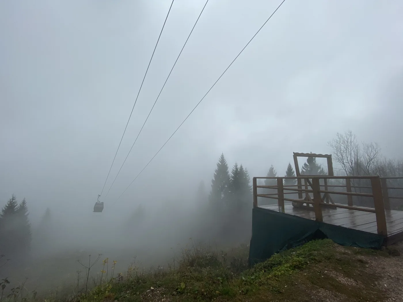
By 12:25 we were up on Mount Trebevic, the mountain right above the city, and it was in thick fog. We walked past the shell of a building covered in graffiti and along a road that faded into white a short way ahead. The cable car up from the old town, which runs again since 2018 after the war destroyed it, slid past overhead in the cloud.

The Trebevic cable car passing overhead in thick fog above Sarajevo

Then the bobsleigh and luge track. Building started in 1981, and it hosted the Olympic events in 1984. During the siege, the mountain was a front line, and the track was used as an artillery position.

Today it is a long concrete channel winding down through the pine forest, and almost every metre of it is covered in graffiti. Some stretches are dead straight. On the curves, the walls bank up until they are almost vertical.

A straight stretch of the abandoned Olympic bobsleigh track in the pine forest on Trebevic
A banked graffiti-covered curve of the Sarajevo bobsleigh track

Why is there a war memorial in the Jewish cemetery?

Further down the mountain, on the slope looking over the city, is the Old Jewish Cemetery. It was founded in 1630 by Sephardic Jews, and one source calls it the second-largest Jewish burial ground in Europe after Prague.

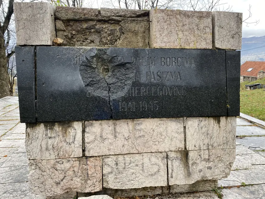
During the siege, it sat on the front line. Its high ground was used as an artillery position, and it was mined before the fighting ended. The stones still show it: a memorial on the hillside to the Jewish fighters and victims of fascism from 1941 to 1945 has a hole blasted through the middle of its granite plaque.

A shell-damaged granite memorial plaque for 1941 to 1945 in the Old Jewish Cemetery, Sarajevo

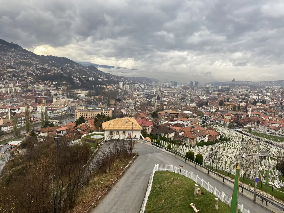
Lower down, the whole valley opens out, red roofs all the way across, with white gravestones on the slopes.

Red roofs across the Sarajevo valley seen from the hillside

What else is there to see?

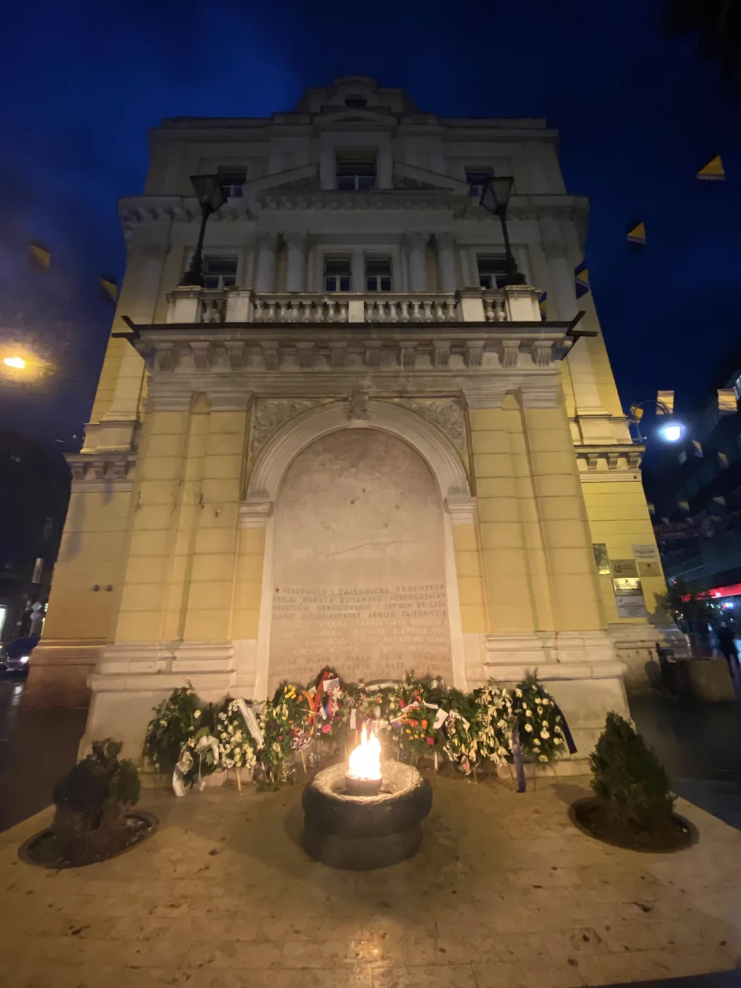
That afternoon we were back in the centre. The Eternal Flame, lit in 1946 for the victims of the Second World War, burns in an archway on the main street. It is still burning.

The Eternal Flame burning in an archway in central Sarajevo

At the market there were piles of dried meat and pumpkins bigger than a football.

Then 2 museums about the 1990s war. The first, a museum of crimes against humanity and genocide, opens with a panel that dates the war from April 1992 to November 1995. The second, the War Childhood Museum, opened in 2017. Every object in it was given by someone who was a child during the war, with a short note about what it meant to them.

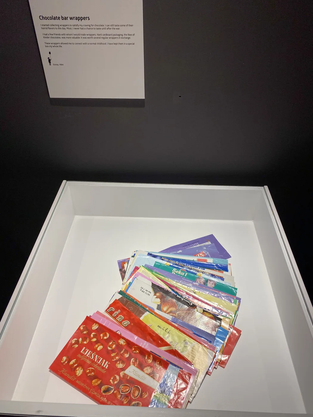
I saw a pile of chocolate bar wrappers, a school chalkboard with a shrapnel hole through it, a diary, a ball and a wall of children’s drawings. Each one has its note beside it.

Wartime chocolate bar wrappers on display at the War Childhood Museum, Sarajevo

How did the trading fit in?

The same way it always does, in about 15 minutes a day. Most of this route sits 1 to 2 hours ahead of London, which put the US market open at about 4.30 or 5.30 in the afternoon, local time, right as each day’s touring ended. I wrote up how that works, the watchlist, the alerts and the time zones, in how I trade while travelling.

Where does it fit in the trip?

On the morning of 29 November, the coach left Sarajevo through the mountains and headed north for Croatia. The rest of the 5 weeks, from Belarus to Slovakia, is in Exploring Eastern Europe: 14 countries in 1 month. Every trip is on the travel log, and more photos are on Instagram, @iamrecneps.
Have you been to Sarajevo? Would you walk the tunnel or the bobsleigh track first? Let me know in the comments.

Spencer Li

by Spencer Li
https://synapsetrading.com/wp-content/uploads/2026/10/sarajevo-2019-a-graffiti-covered-bend-of-the.webp 900 1200 Spencer Li https://synapsetrading.com/wp-content/uploads/2026/10/synapse-logo-horizontal-light.png Spencer Li2019-11-29 10:00:002026-10-22 15:00:20Sarajevo: The Siege Tunnel, the Olympic Bobsleigh Track and the Spite House
Spencer Li

Transnistria: 3 Days in the Country That Does Not Exist

Travel & Lifestyle
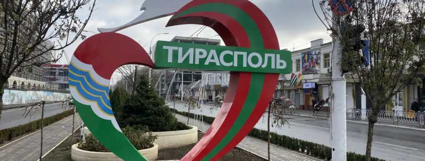
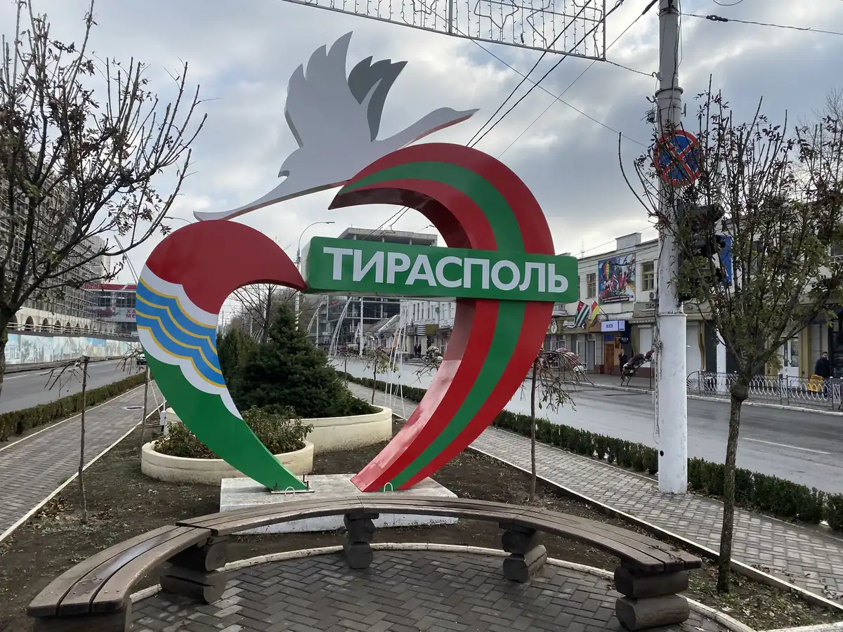
Red and green Tiraspol city sign in Transnistria

In November 2019, on a month-long trip through 14 former communist countries, I spent 3 days in a place most maps do not show. Transnistria has its own government, its own army, its own border posts and its own money. Almost no country in the world recognises it.

I crossed in on the evening of 10 November and left on the evening of the 12th. This is what those 3 days looked like, from my photos.

What is Transnistria?

Transnistria is a thin strip of land on the east bank of the Dniester River. On paper, it is part of Moldova. In practice, it has run itself since a short war in 1992, with its own government, army, currency and border posts.

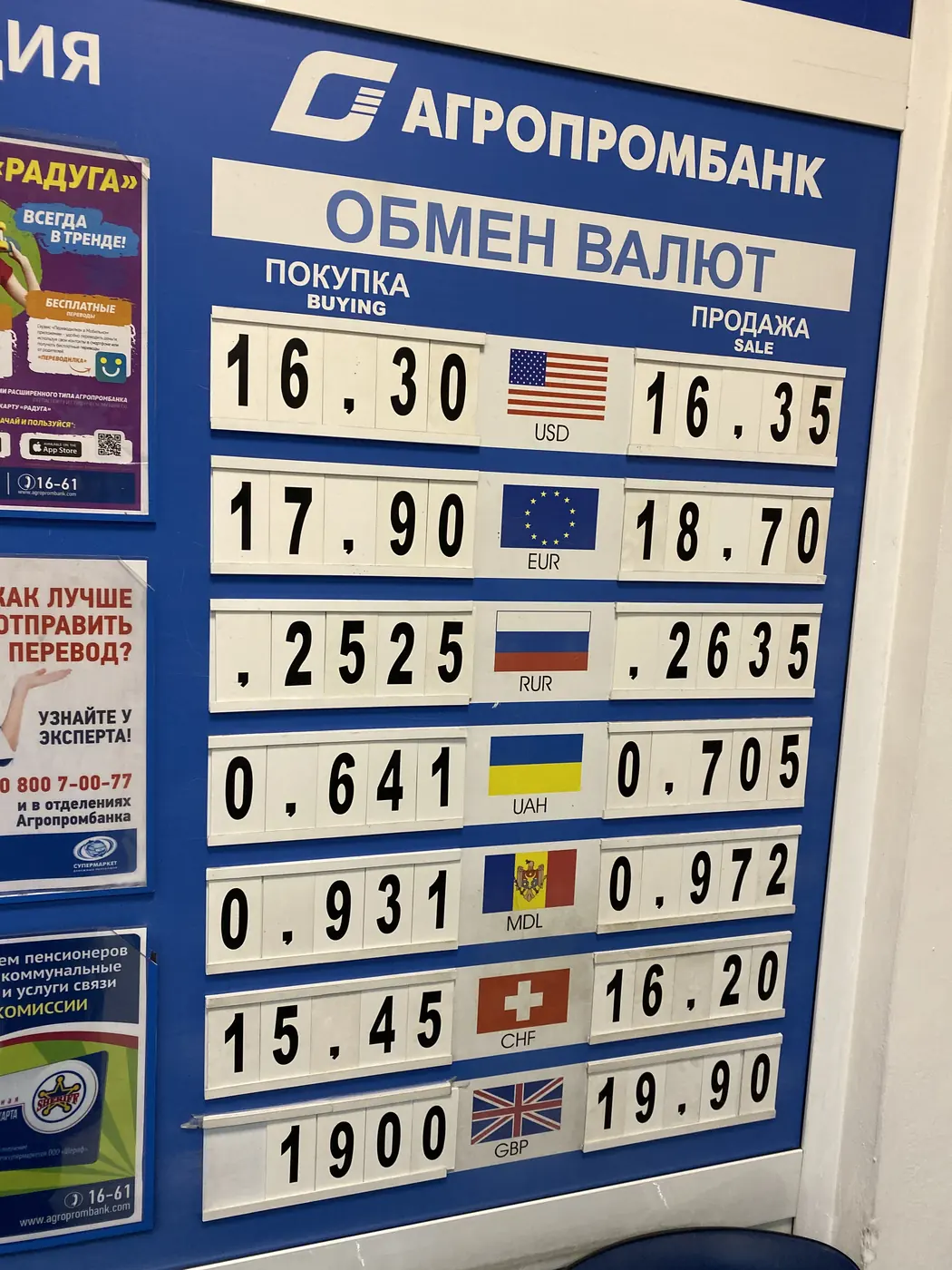
So you might be thinking, is it a real country or not? That depends on who you ask. To the United Nations, it is Moldova. To anyone changing money in Tiraspol, it is very real, and the banks have exchange boards to prove it.

What money do they use?

The Transnistrian rouble. It exists nowhere else, so you change money when you arrive and spend it before you leave. Our tour notes even made a point of it: there are ATMs, “even Transnistria!”

On my first evening, at 19:40, I took a photo of a bank’s exchange board. A US dollar bought 16.30 roubles. A euro bought 17.90. The board listed only three currencies against the rouble, each with a buy and a sell price, and the Moldovan leu, the money of the country Transnistria officially belongs to, was the only one worth less than a single rouble.

Bank exchange board in Tiraspol with Transnistrian rouble rates

The same evening we walked past a big Sheriff supermarket. The name Sheriff kept turning up. Over the next 2 days I photographed its name on a supermarket and on a poster for its own tennis club.

What is Tiraspol like?

Tiraspol is the capital. The next morning started at a big red and green sign with the city’s name on it, in the colours of the Transnistrian flag.

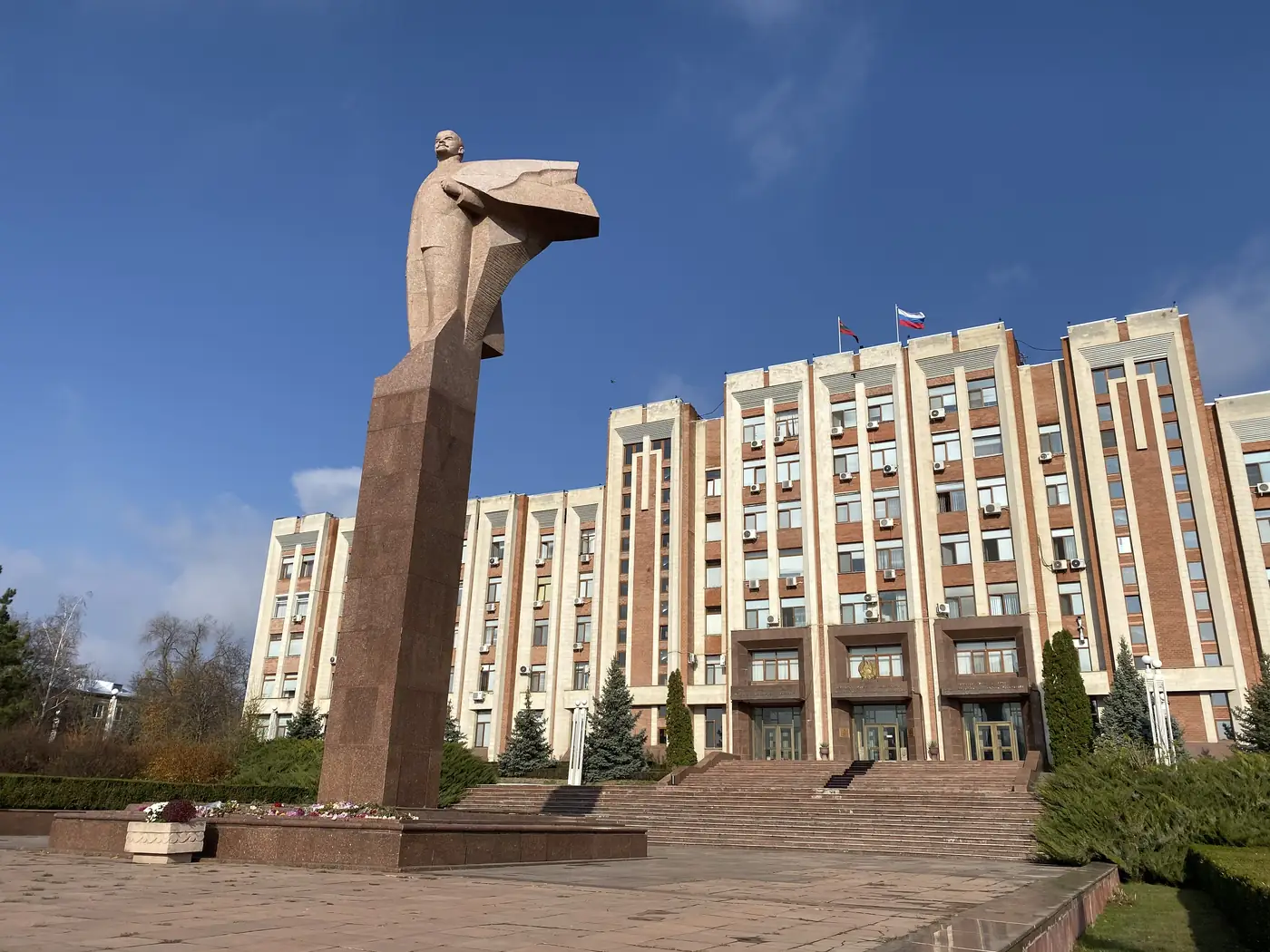
From there it was a walk through the Soviet Union, more or less. A tall Lenin stands in front of a long government block, arm swept back. A row of flags lines the square in front of the statue of General Suvorov, who founded the city in 1792. The state emblem still carries the hammer and sickle.

Lenin statue in front of the government building in Tiraspol

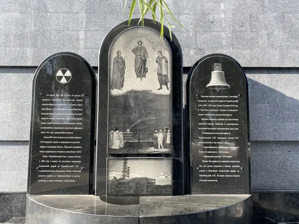
The war memorial has an eternal flame, a memorial wall dated 1990 to 1992, rows of graves and a T-34 tank on a plinth. Beside it, a black stone carries the radiation symbol and a picture of the Chernobyl plant. I had been at Chernobyl itself 3 days before.

Chernobyl memorial stone at the Tiraspol war memorial

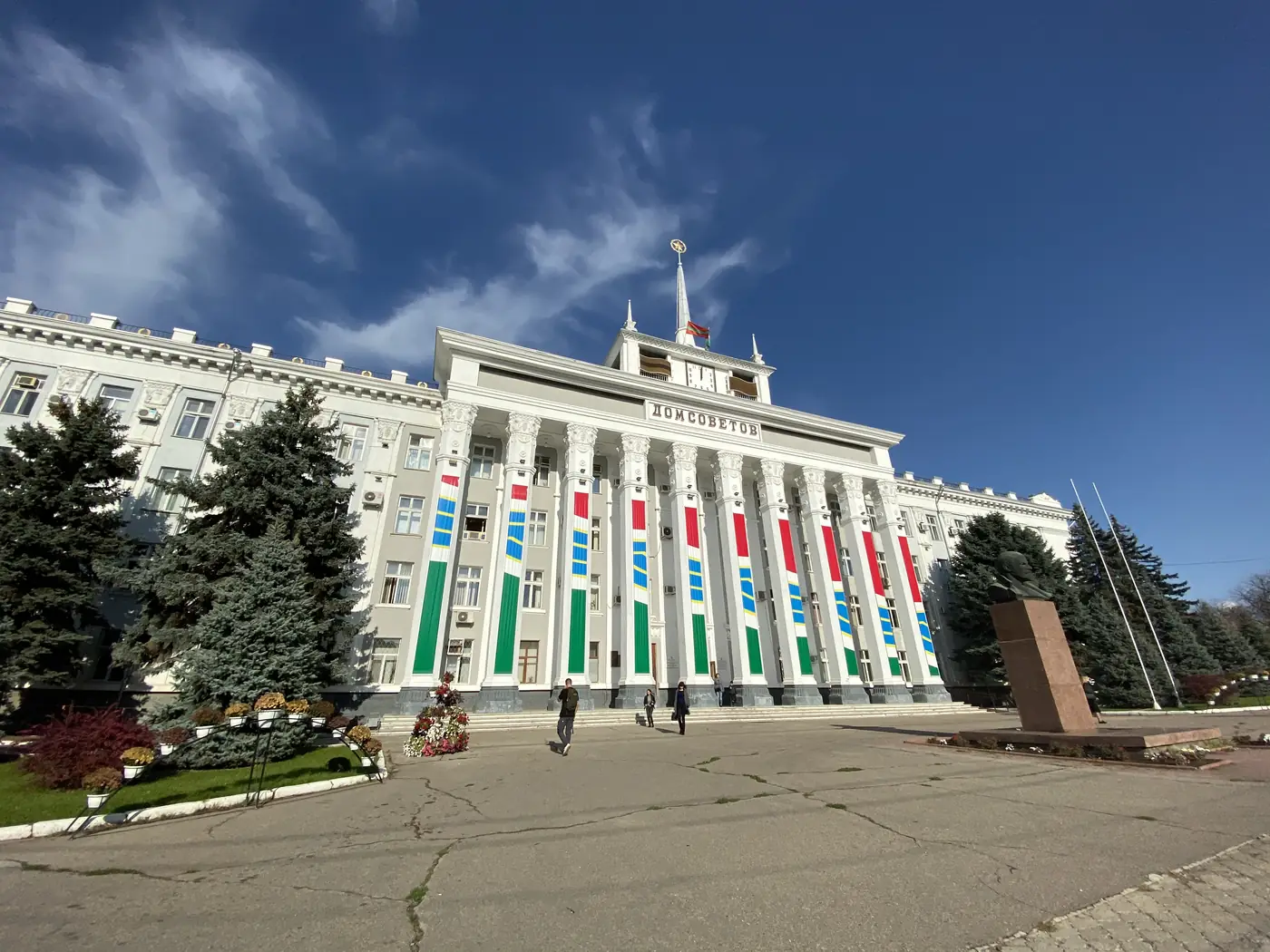
Around midday we reached the House of Soviets. Its name is written in big letters under a clock tower, a bust of Lenin stands at the front, and the columns are painted in red, green and blue stripes.

House of Soviets in Tiraspol with a Lenin bust

What is outside the capital?

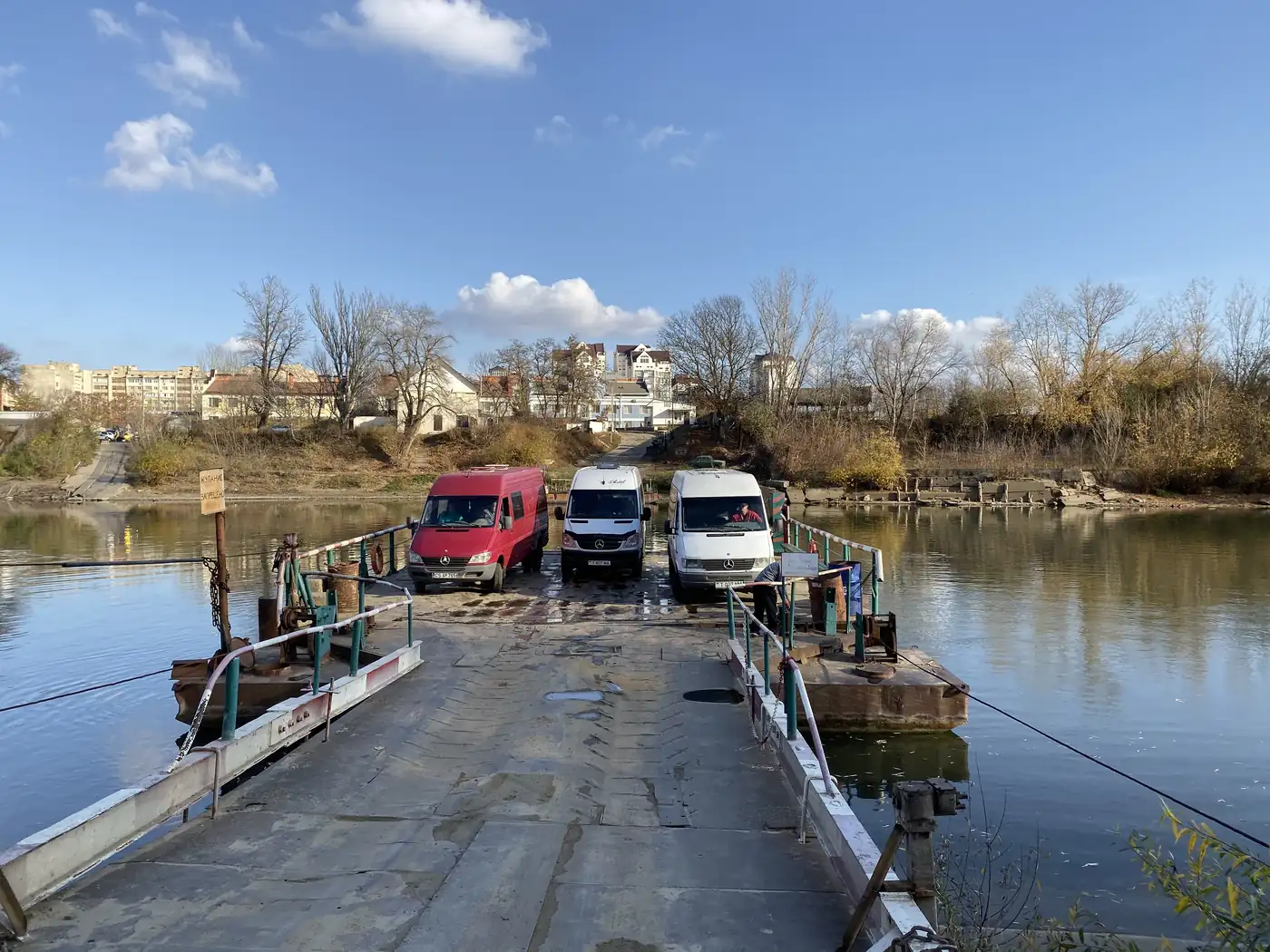
In the early afternoon we crossed the river on a small car ferry, a floating deck with 3 vans parked on it.

Small car ferry crossing the Dniester River

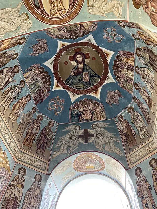
Then came Chitcani and the Noul Neamt Monastery. Chitcani is one of the oldest villages recorded in Moldova, dating back to 1367. Under Soviet rule the monastery was closed and used as a hospital, a storehouse and then a museum. Today the ceiling of its gate is painted from edge to edge, with Christ in the centre and saints all around.

Painted gate ceiling at Noul Neamt Monastery in Chitcani

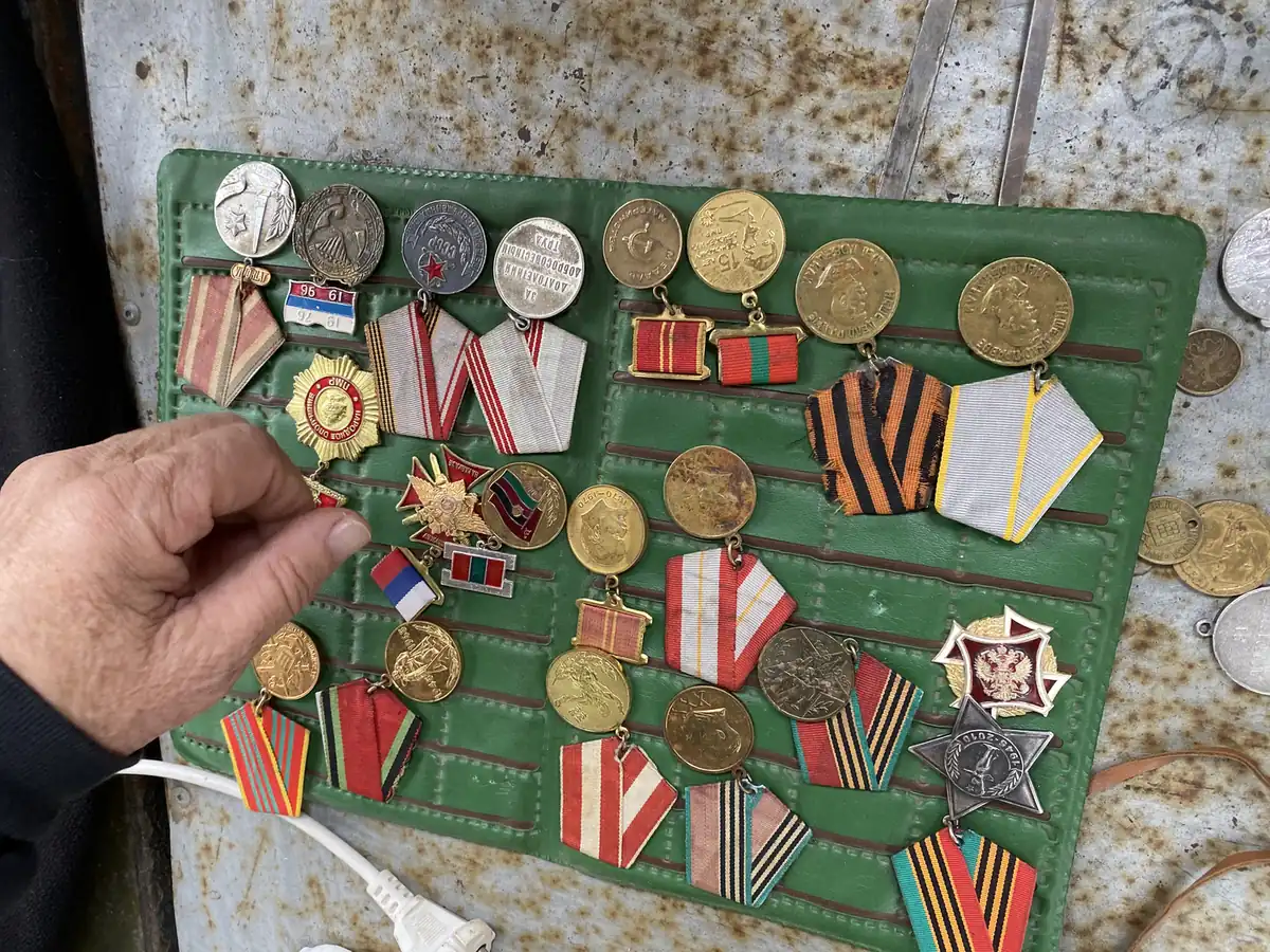
The next morning, on the way to Bender, we stopped at a street market. One seller had a whole board of Soviet medals and ribbons for sale.

Soviet medals for sale at a street market in Transnistria

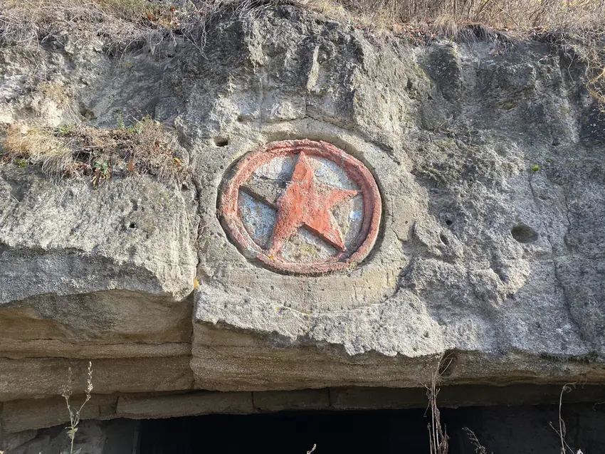
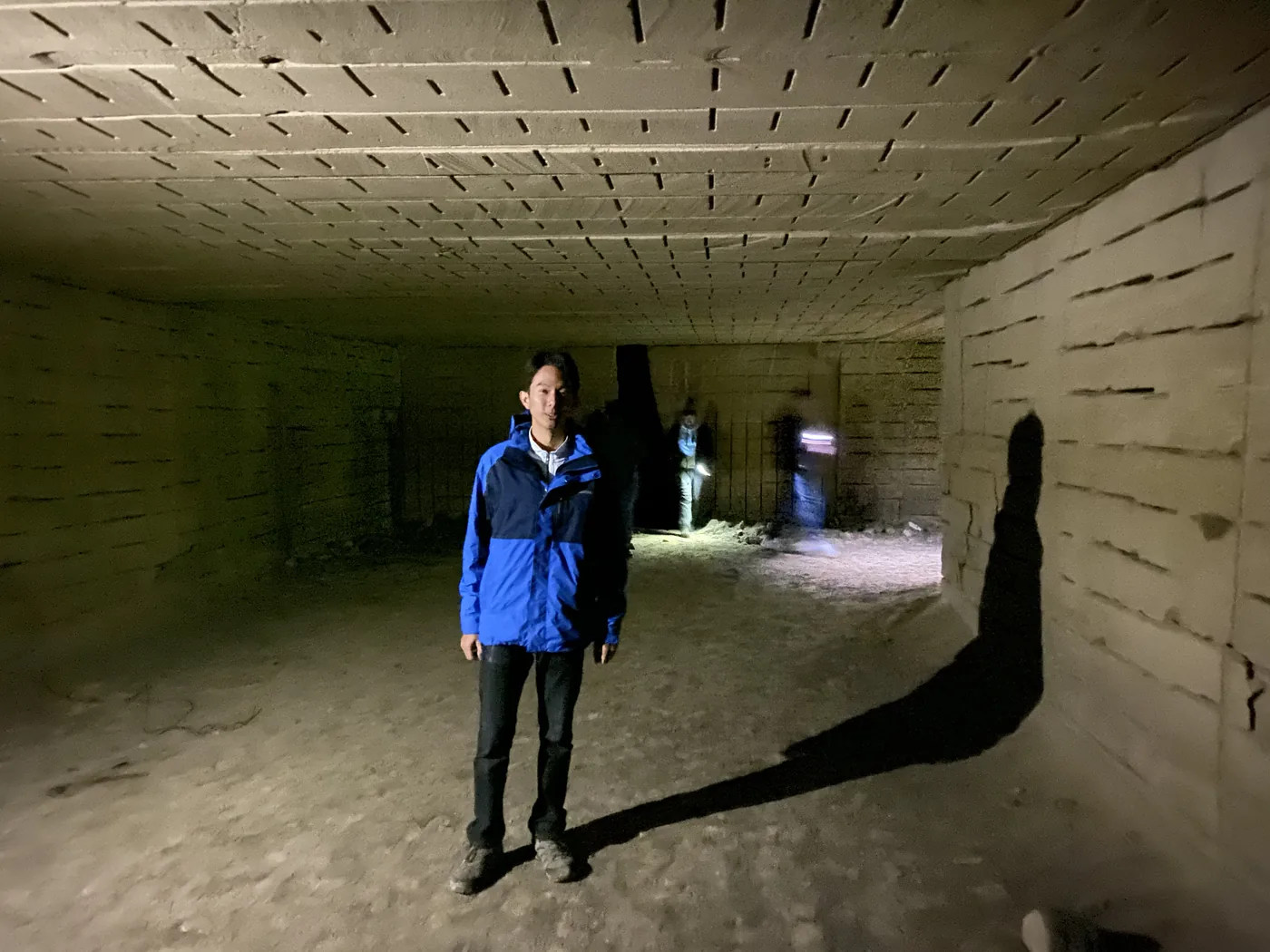
Then a limestone cliff with a red star carved into the rock above a row of dark openings. Behind them is an old quarry, and you walk through its tunnels with torches. The ceilings are low and the walls are stacked with cut stone.

Red star carved into a limestone quarry cliff in Transnistria
Inside the old quarry tunnels in Transnistria

What is Bender like?

Bender sits on the other bank of the river, inside the buffer zone set up at the end of the 1992 war. Its fortress, Tighina, was one of the important strongholds of the old Principality of Moldova.

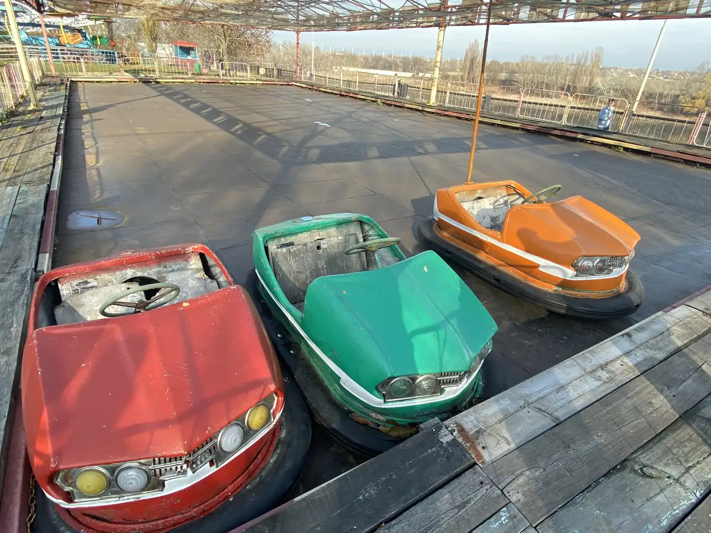
The town’s amusement park was the strangest stop. The bumper cars are still in the rink, red, green and orange, with their bonnets cracked. There is a little Ferris wheel and a ride of swinging chairs, all faded. Nobody was riding anything.

Faded bumper cars at the Bender amusement park

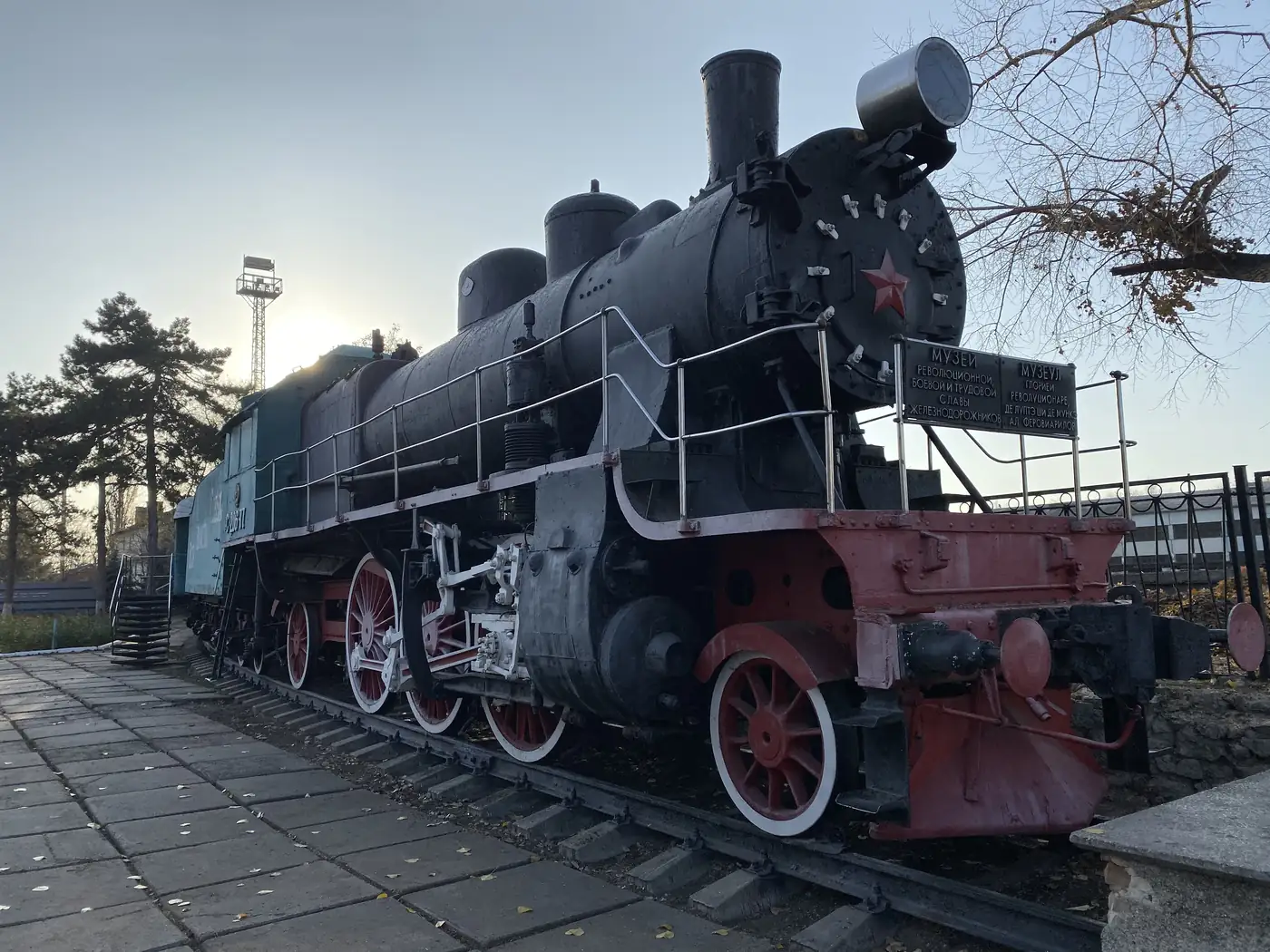
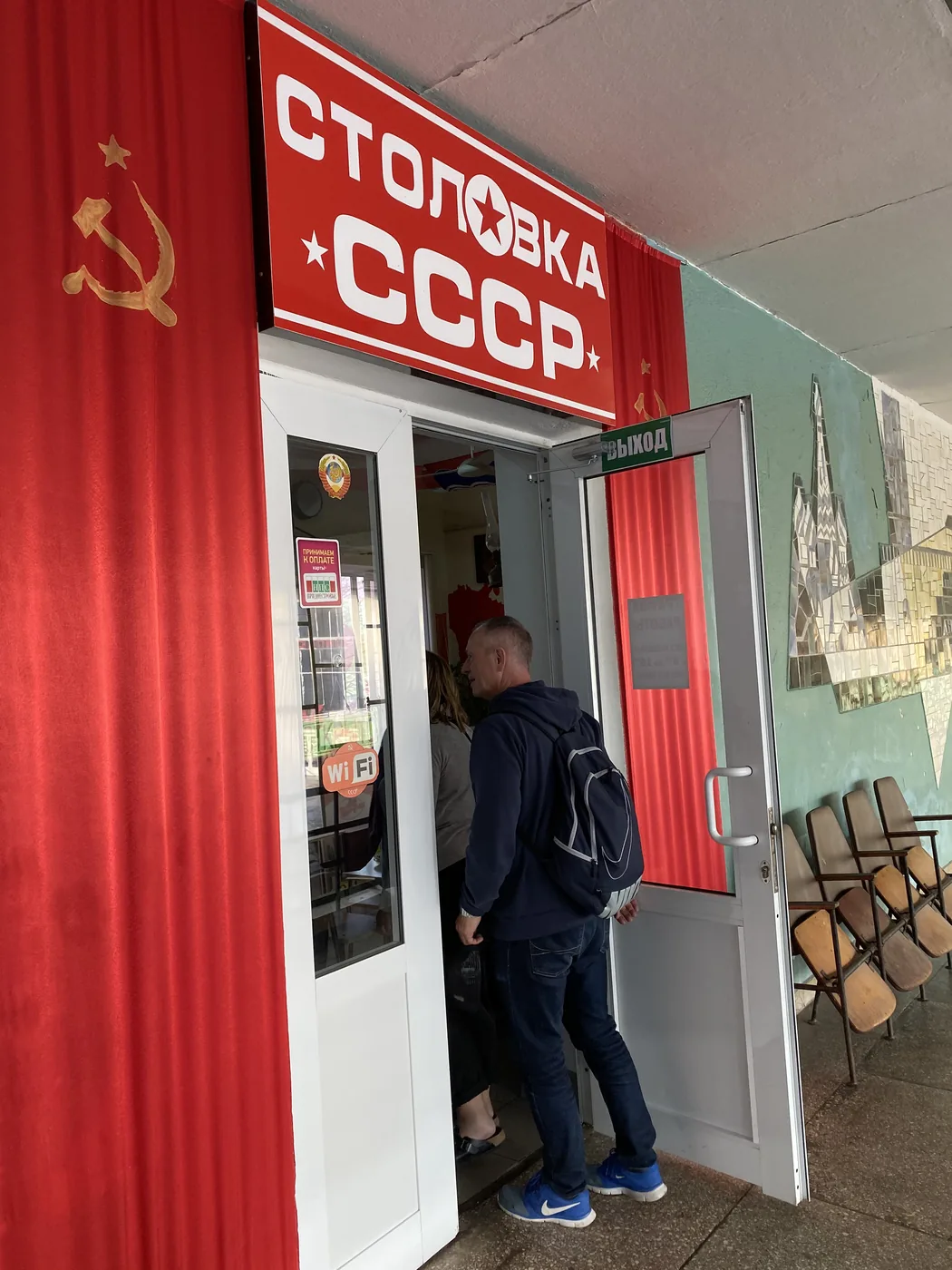
At the railway station, a black steam locomotive stands on display with a red star on its nose. Inside the station is a canteen called Stolovka USSR, which is roughly “the USSR canteen”. It has red banners on the walls and a hammer and sickle by the door.

Steam locomotive with a red star at Bender railway station
Stolovka USSR canteen sign at Bender station

We had borscht there in the late afternoon. By sunset we were on the bus out, two days after we had come in from Odessa, with a camera roll full of Lenins, red stars, faded rides and a currency nobody else in the world will take.

Can you still visit Transnistria?

It is much harder than in 2019. My route came in from Odessa in Ukraine. Ukraine has since closed its border with Transnistria, and the US State Department’s Moldova advisory of July 2026 tells Americans to reconsider travel to Transnistria because of the risk of armed conflict.

Entry from the Moldovan side still exists, through checkpoints run by the Transnistrian authorities. Checkpoint rules are unpredictable, and photos of military sites can get you detained. So check your own government’s advice first.

Where does it fit in the trip?

Transnistria was 1 of the 14 countries on my Eastern Europe trip, and the only one that no other country recognises. The day before it, I was underground in a Soviet missile base, which I wrote up in Chernobyl and a Nuclear Missile Base: Two Days in Cold War Ukraine. The rest of the trip is in Exploring Eastern Europe and communism: 14 countries in 1 month.

The trading came along the same way it always does, in about 15 minutes a day. I wrote up how that works in how I trade while travelling. Every trip is on the travel log, and more photos are on Instagram, @iamrecneps.
Would you visit a country that officially does not exist? Let me know in the comments.

Spencer Li

by Spencer Li
https://synapsetrading.com/wp-content/uploads/2026/10/transnistria-2019-red-and-green-tiraspol-city-sign.webp 900 1200 Spencer Li https://synapsetrading.com/wp-content/uploads/2026/10/synapse-logo-horizontal-light.png Spencer Li2019-11-12 10:00:002026-10-22 14:02:32Transnistria: 3 Days in the Country That Does Not Exist
Spencer Li

Chernobyl and a Nuclear Missile Base: Two Days in Cold War Ukraine

Travel & Lifestyle
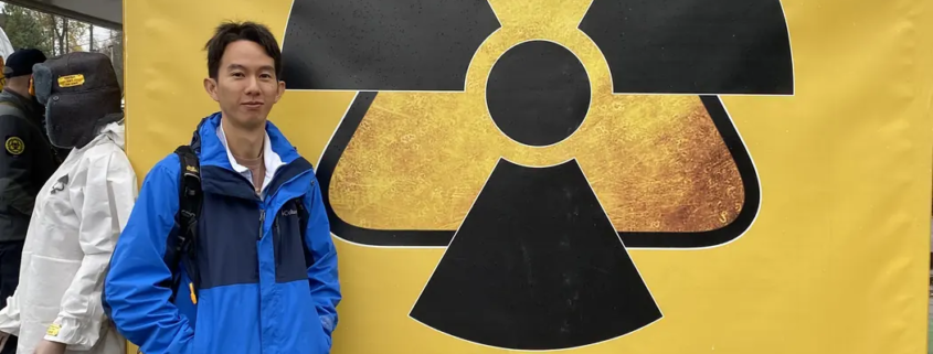
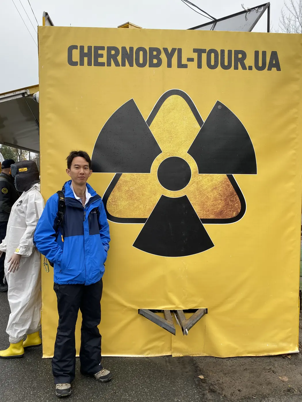
Spencer Li in front of a yellow radiation symbol banner at the Dytyatky checkpoint into the Chernobyl zone

At the end of 2019, on a month-long trip through 14 former communist countries, I spent 2 days in a row in Ukraine at the two ends of the Cold War. On 8 November I was inside the Chernobyl exclusion zone. On 9 November I was underground, in the launch room of a Soviet nuclear missile base.

Both places were built by the same system. Both show what happens when people sit at the controls of something that can go badly wrong, and how a system tries to protect itself from them.

Getting in nearly failed twice. A month before, our tour company wrote to warn us that the zone might be shut without notice for a military exercise on 9 November, which was our planned day, so the Chernobyl day moved forward to the 8th. Then, 16 days before the trip, my Ukraine e-visa was rejected because a supporting letter did not meet the rules. A corrected letter came back the same day. The visa went through.

What happened at Chernobyl?

In the early hours of 26 April 1986, reactor No. 4 at the Chernobyl Nuclear Power Plant exploded during a safety test. It is still rated the worst nuclear accident in history. It is one of only two ever given the maximum level 7 on the international scale. The other is Fukushima in 2011.

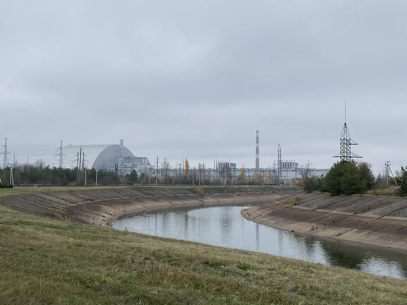
The Chernobyl power plant and the steel arch over Reactor 4, seen across the cooling canal

The town built for the plant’s workers, Pripyat, was evacuated the next day, and it has stood empty ever since. An exclusion zone of about 30 km was drawn around the plant.

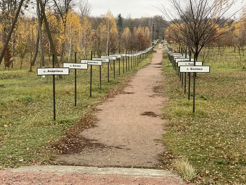
An avenue of signs for the evacuated villages, Chernobyl town

So you might be thinking, is it even safe to walk around in there? The numbers on the dosimeter in my hand tell part of that story, so here they are.

What is it like inside the zone?

The day started at the checkpoint just before 10am. My first photo inside the gate is of a dosimeter. It was a small EcoTest card on a lanyard.

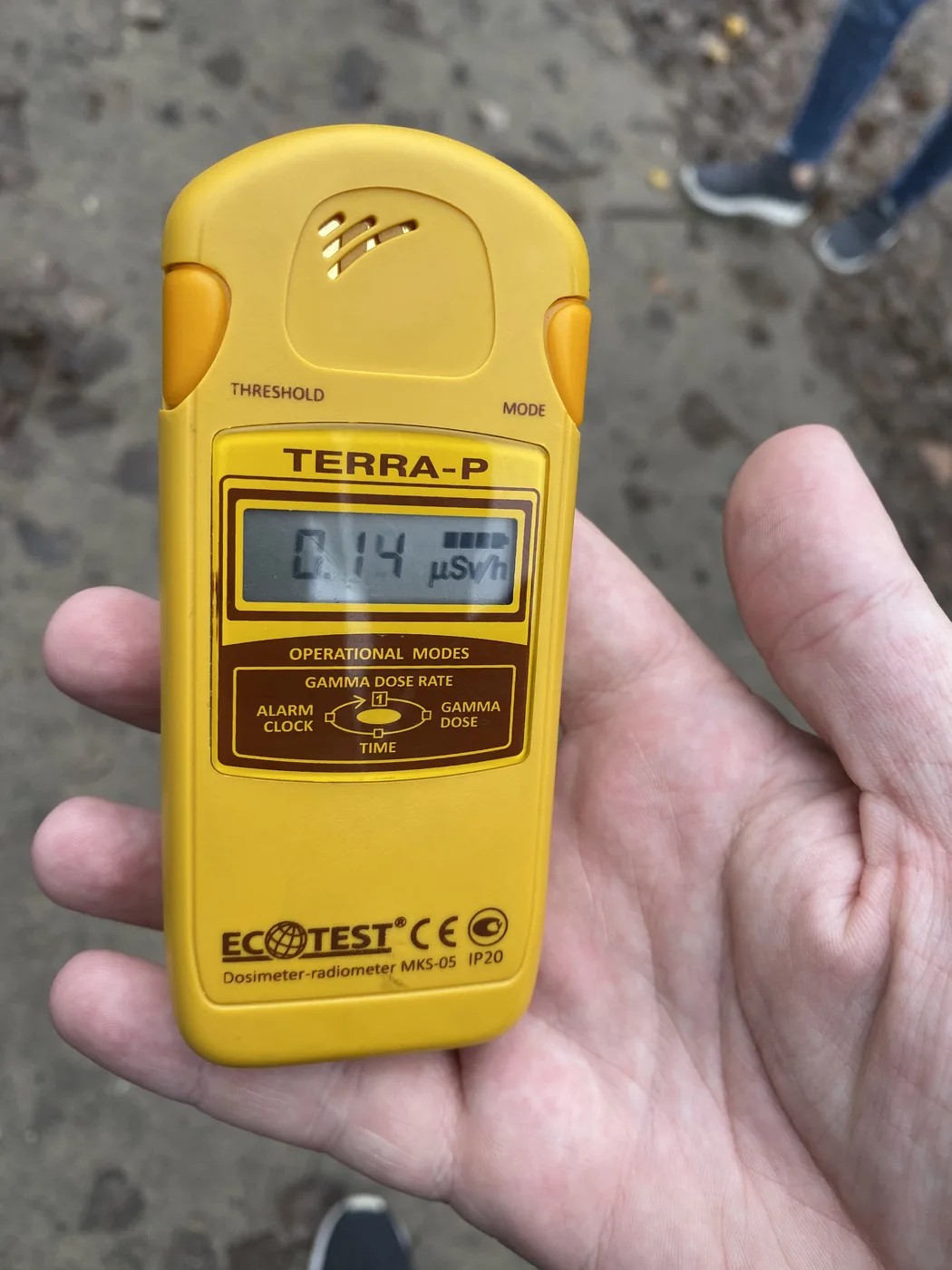
By 10:24 we were in the town of Chernobyl itself, about 15 km from the plant. A yellow Terra-P dosimeter read 0.14 microsieverts an hour there. The town has an avenue of signs, one for each village that was evacuated. There is a metal angel blowing a trumpet, and a yard of the robots and machines that were sent in to clean up.

A Terra-P dosimeter reading 0.14 microsieverts an hour in Chernobyl town

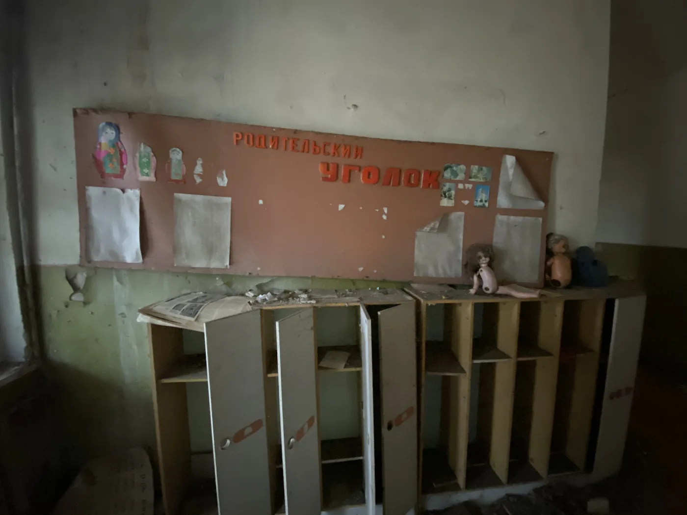
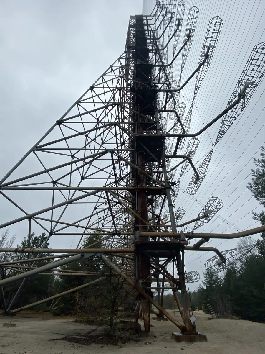
Next came the Duga radar. It was a Soviet early-warning antenna, and today it is a wall of rusted steel masts towering over the pine forest, with a faded pedestrian sign and a row of empty buildings at its feet. After that, an abandoned kindergarten, with dolls and cots still inside.

The rusted masts of the Duga radar in the Chernobyl zone
Lockers and old dolls in an abandoned kindergarten in the Chernobyl zone

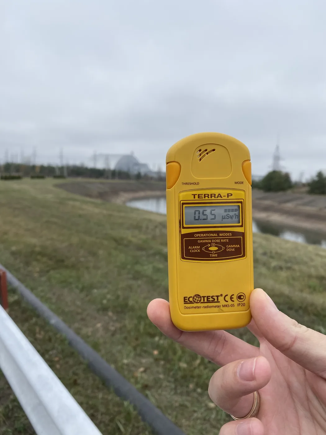
At 12:50 we stood across the cooling canal from the reactor. The Terra-P read 0.55, about 4 times the reading in town. Lunch was in a canteen inside the zone: soup, buckwheat, a sausage bun and a salad. Near the plant, a row of full-body radiation monitors stood at a doorway.

A dosimeter reading 0.55 microsieverts an hour across the cooling canal from Reactor 4

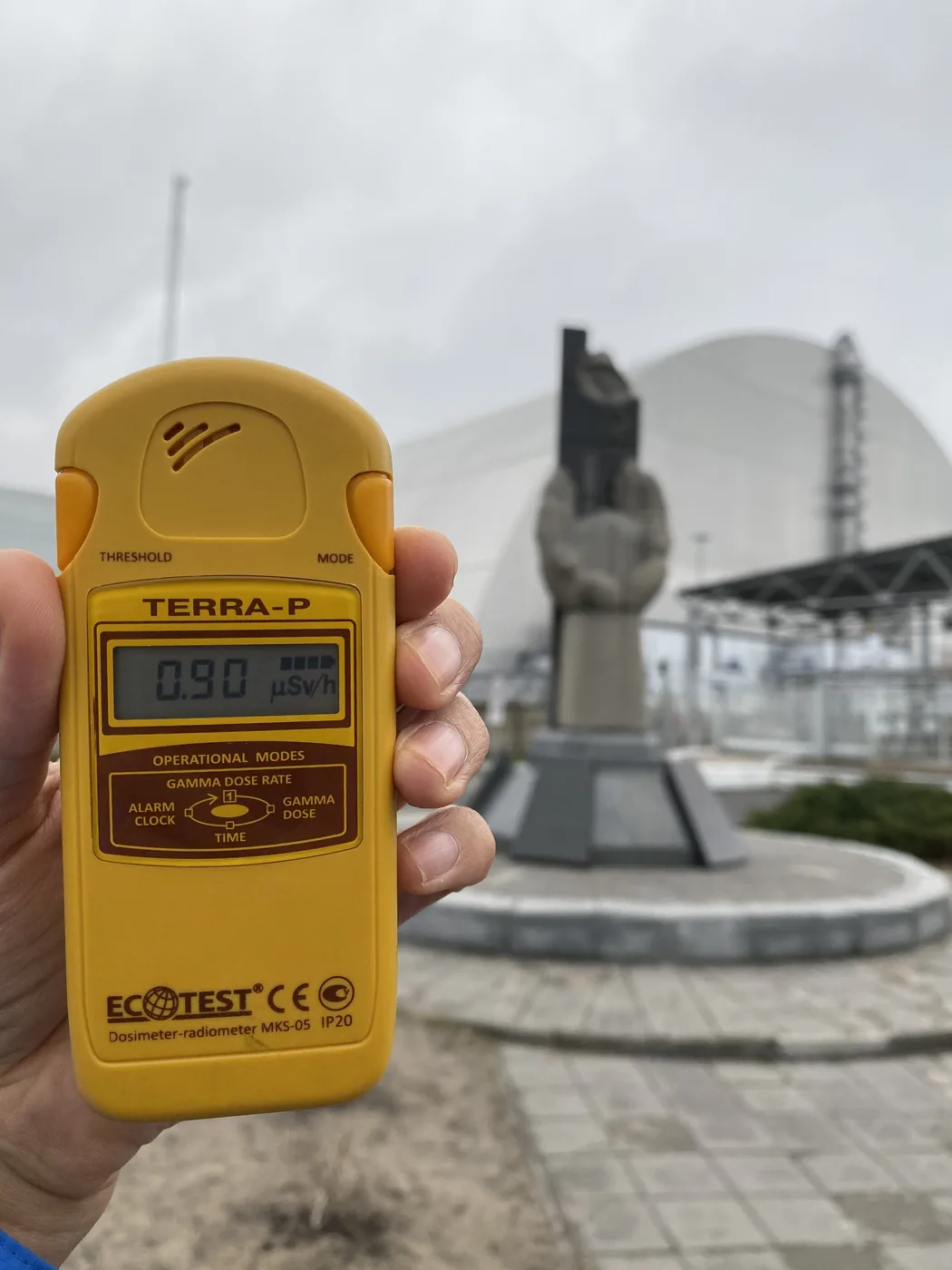
At 14:07 we reached the memorial in front of the giant steel arch that now covers Reactor 4. The reading there was 0.90. That is more than 6 times the town.

A dosimeter reading 0.90 at the memorial in front of the arch over Reactor 4

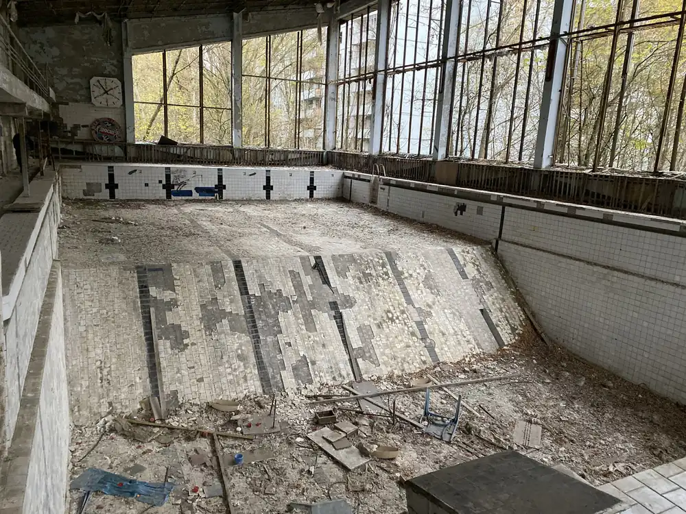
The afternoon was Pripyat. The café sign is still up, and the soda machines have rusted where they stand. The amusement park still has its bumper cars, a swing carousel and the Ferris wheel. There is an empty swimming pool with a clock on the wall, a school room with gas-mask filters across the floor, and a gas mask hanging in a tree.

The empty swimming pool in Pripyat

By 17:13 we were out. A kiosk at the exit sells T-shirts that say “Radioactive”.

Can you still visit Chernobyl?

No.

The zone has been closed to tourists since Russia’s invasion of Ukraine in February 2022, and visitor passes are suspended under martial law (a Kyiv tour guide’s page, and an AFP report of April 2026). Before that, official tours had run since 2011, and by 2019 tens of thousands of people a year were going. I went in late 2019, a little over 2 years before it closed.

What is a nuclear missile base doing in a museum?

The next day, on the road south from Kyiv towards Odessa, we stopped at a Cold War missile base near Pervomaisk. Its silo and launch control centre are now the Strategic Missile Forces Museum, which opened in 2001.

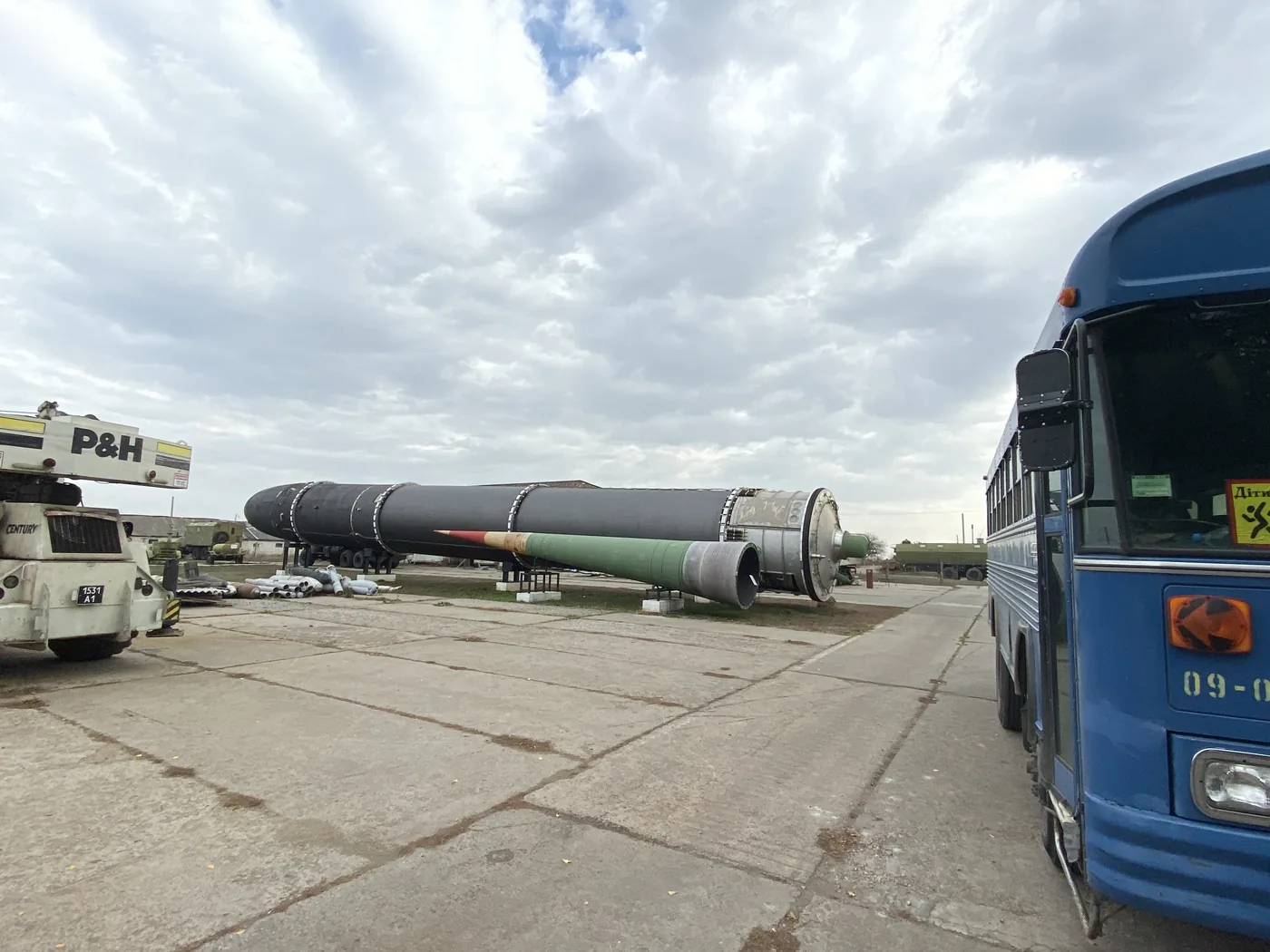
Above ground, the missiles lie on their sides in a park, next to launchers, a helicopter and a tank. One lay right beside our tour bus.

A Soviet missile on its side beside a tour bus at the Strategic Missile Forces Museum

The real thing is underground.

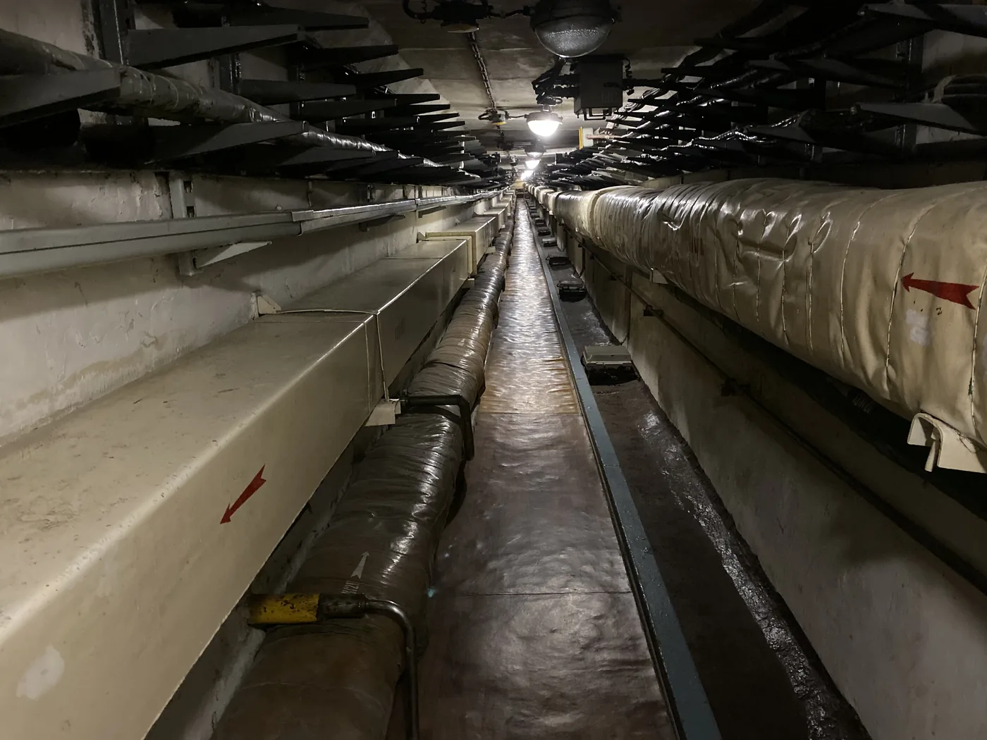
You go down a staircase, then along a long corridor lined with pipes. A red rotary phone hangs on the wall. Just above the launch room there is a crew rest room with bunks and a small TV, and a toilet the size of a cupboard. Then a hatch and a ladder take you down.

The pipe-lined corridor leading underground at the missile base

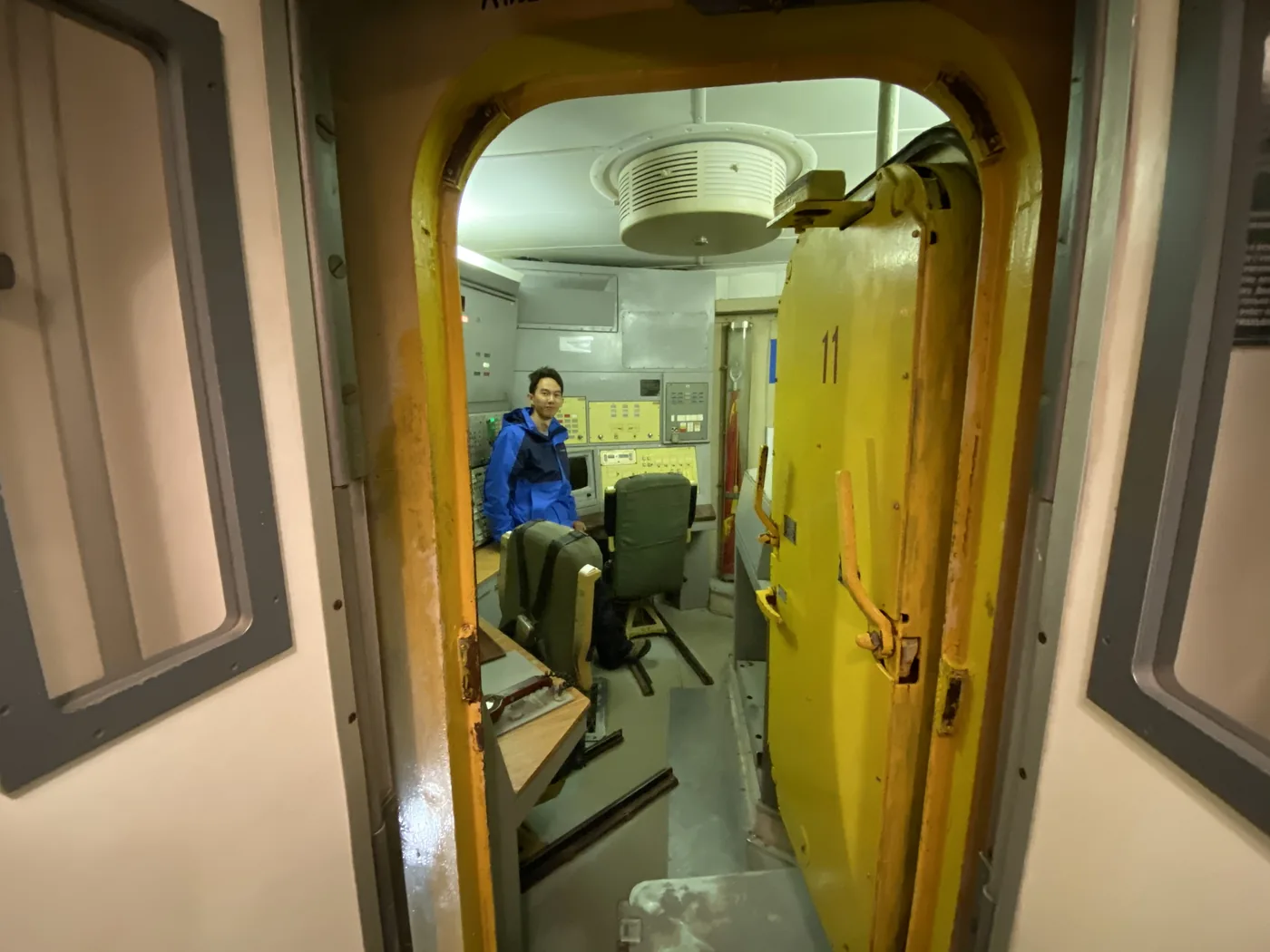
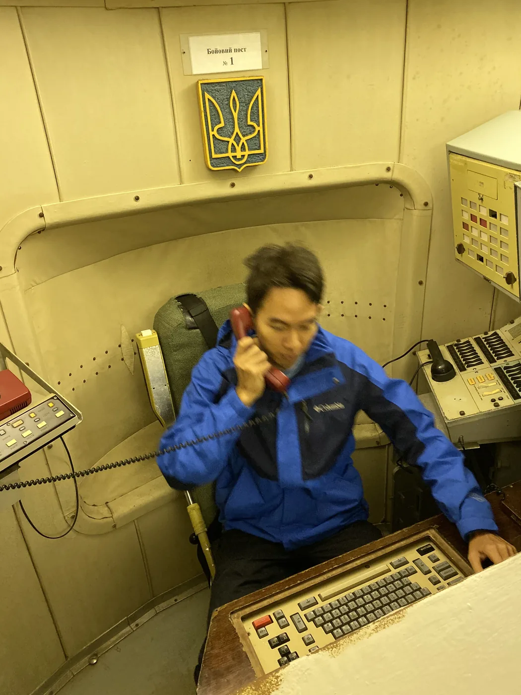
The door into the launch room is a thick yellow blast door with the number 11 on it. That matches the museum’s name for the room, Compartment 11. Inside, Ukraine’s trident hangs over the duty seat, beside panels of switches and lamps. I sat in that seat. Red phone to my ear.

The yellow blast door of Compartment 11, the launch room
Spencer Li in the duty seat of the launch room with the red phone

Back above ground, there were pelmeni, little dumplings, with sour cream.

Why does a launch room need two keys?

Two officers sat on duty in that room, in 6-hour shifts. On the tour, you go down in pairs, and the launch only runs when both of you turn your own key at the same time. One person alone cannot do it, however sure they are, and however scared. The rule does not live in anyone’s head. It is built into the room.

My own trading rules work the same way, on a far smaller scale. A rule written in my trading plan once sat there and did nothing on a bad morning. So now my rules are objects wherever I can make them objects, like a standing scale-out order that sits on the position. I wrote about that in Surviving Myself: What I Learnt in 15+ Years of Trading. A launch room is a much bigger version of the same idea. The people who designed it did not trust a single nervous human with the decision.

Can you still visit the missile base?

That is not clear. The museum ran daily guided tours before 2022, about 1.5 to 2 hours above ground and 20 minutes below. I found no source from 2026 on whether it is open now, so check with the museum or a Kyiv operator first.

These were 2 of the stops on my Eastern Europe trip. The rest, from Transnistria to Sarajevo, are in Exploring Eastern Europe and communism: 14 countries in 1 month. Every trip is on the travel log, and more photos are on Instagram, @iamrecneps.
Would you go to Chernobyl if it reopened? Let me know in the comments.

Spencer Li

by Spencer Li
https://synapsetrading.com/wp-content/uploads/2026/10/chernobyl-missile-base-spencer-li-in-front-of-a.webp 1400 1050 Spencer Li https://synapsetrading.com/wp-content/uploads/2026/10/synapse-logo-horizontal-light.png Spencer Li2019-11-09 10:00:002026-10-22 16:51:17Chernobyl and a Nuclear Missile Base: Two Days in Cold War Ukraine
Spencer Li

Belarus: Minsk, the Stalin Line, Khatyn and the Castles of Mir and Nesvizh

Travel & Lifestyle
Mir Castle's red brick towers at the end of a cobbled path, Belarus

In November 2019, I started 5 weeks across Eastern Europe in Belarus. I reached Minsk on the evening of 4 November and flew out to Kyiv late on the 7th.

That gave me 3 full days. One was free, so I spent it on two castles in the countryside. The other two were with a guide: Minsk itself, then an open-air museum of Soviet bunkers and the memorial at Khatyn. This is those 3 days, from my photos.

Why Belarus?

Belarus was part of the Soviet Union until 1991. In Minsk, Lenin still stands in front of the government building.

It is also a country the Second World War went straight through. So you might be thinking, what is there to see? More than you would expect, and most of it is about that war.

What are Mir and Nesvizh?

Two castles about 90 km south-west of Minsk, both on UNESCO’s list. I used my free day on them.

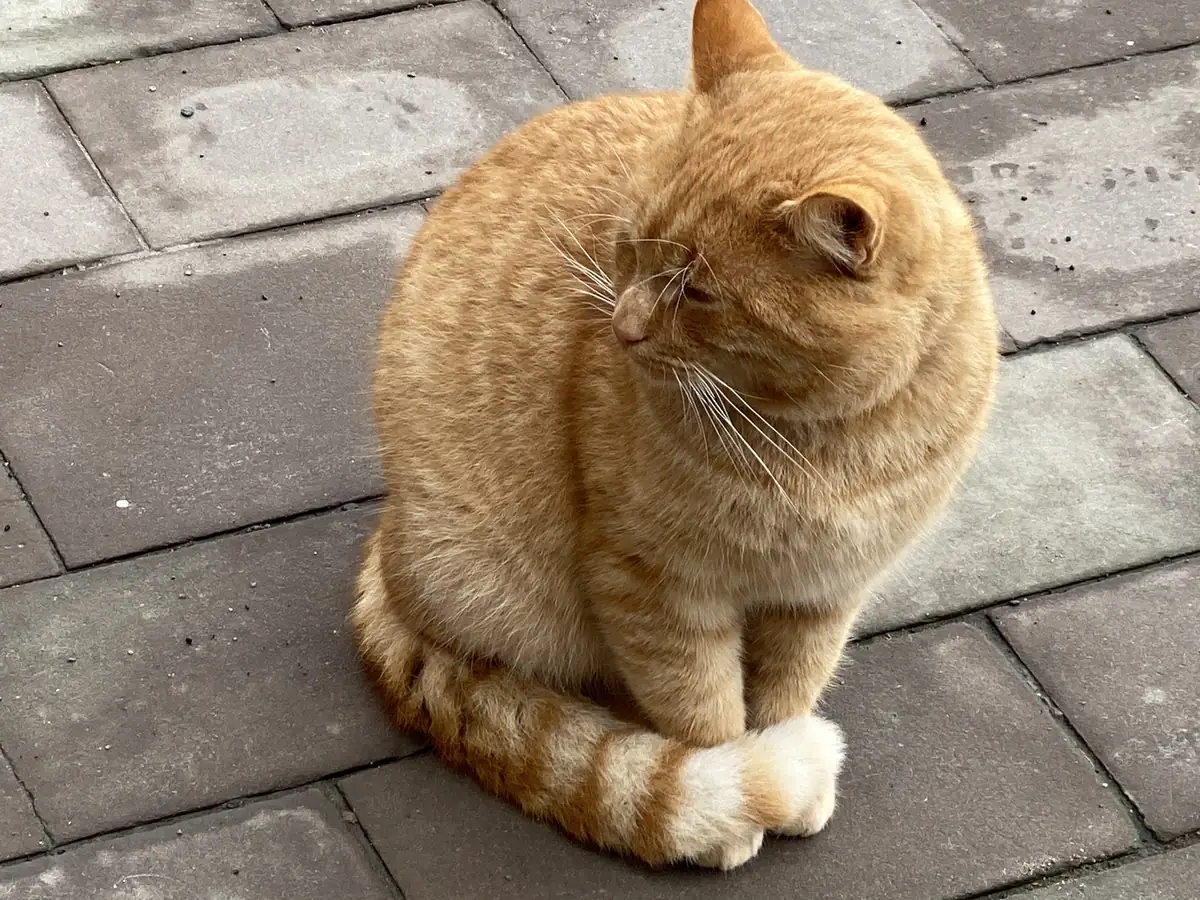
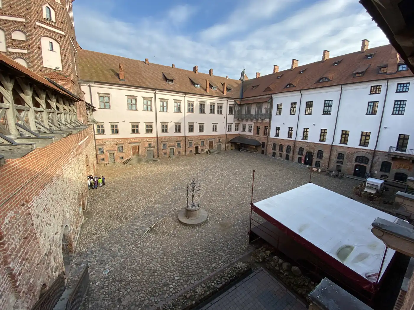
I was at Mir Castle by 10:20 on 5 November. It was built in the 16th century, with red brick towers trimmed in white stone round a square courtyard. Inside are rooms with coffered wooden ceilings, a pile of old cannonballs, and, when I was there, a ginger cat in one of the rooms.

A ginger cat sitting on the paving stones at Mir Castle
The courtyard of Mir Castle inside its brick and white walls

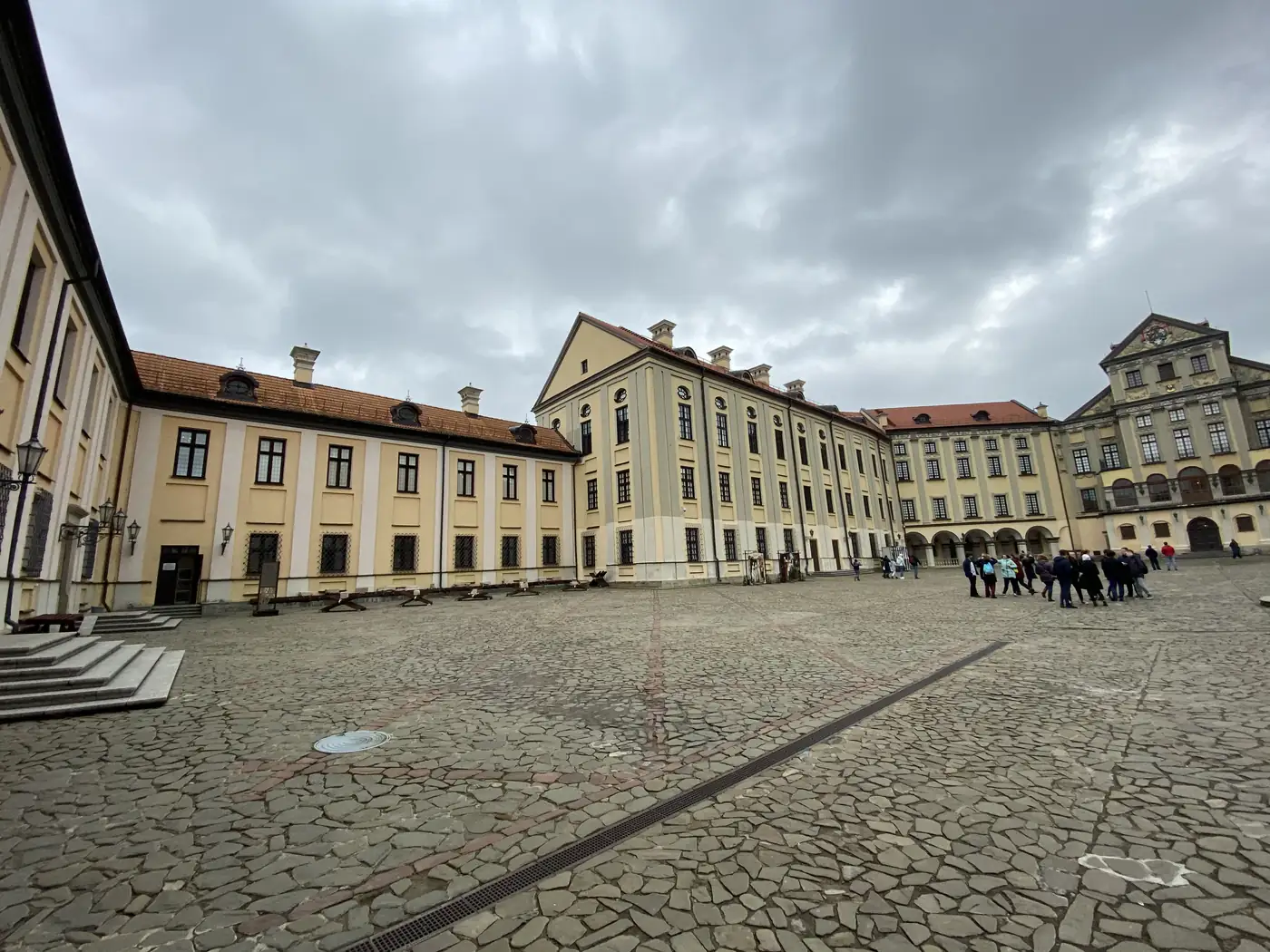
Nesvizh is half an hour further on. It was the seat of the Radziwiłł family, one of the richest in the old Polish-Lithuanian state, from 1533 until 1939. You cross a moat on a bridge to get in. One room has a tapestry with a globe woven into it.

Nesvizh Castle behind its moat and arched bridge

Both castles sat inside Poland between the two world wars, from 1921 to 1939. Mir went on the UNESCO list in 2000 and Nesvizh in 2005.

The cobbled courtyard of Nesvizh Castle, seat of the Radziwill family

Back in Minsk that afternoon, I found a museum of miniatures, with scale models of Mir, the opera theatre and the Palace of Independence.

What is Minsk like?

A city of wide avenues. About 80% of the city was destroyed in the war, and its population fell from about 300,000 to 50,000. It was rebuilt to Stalin’s taste, with broad avenues and grand blocks of stone.

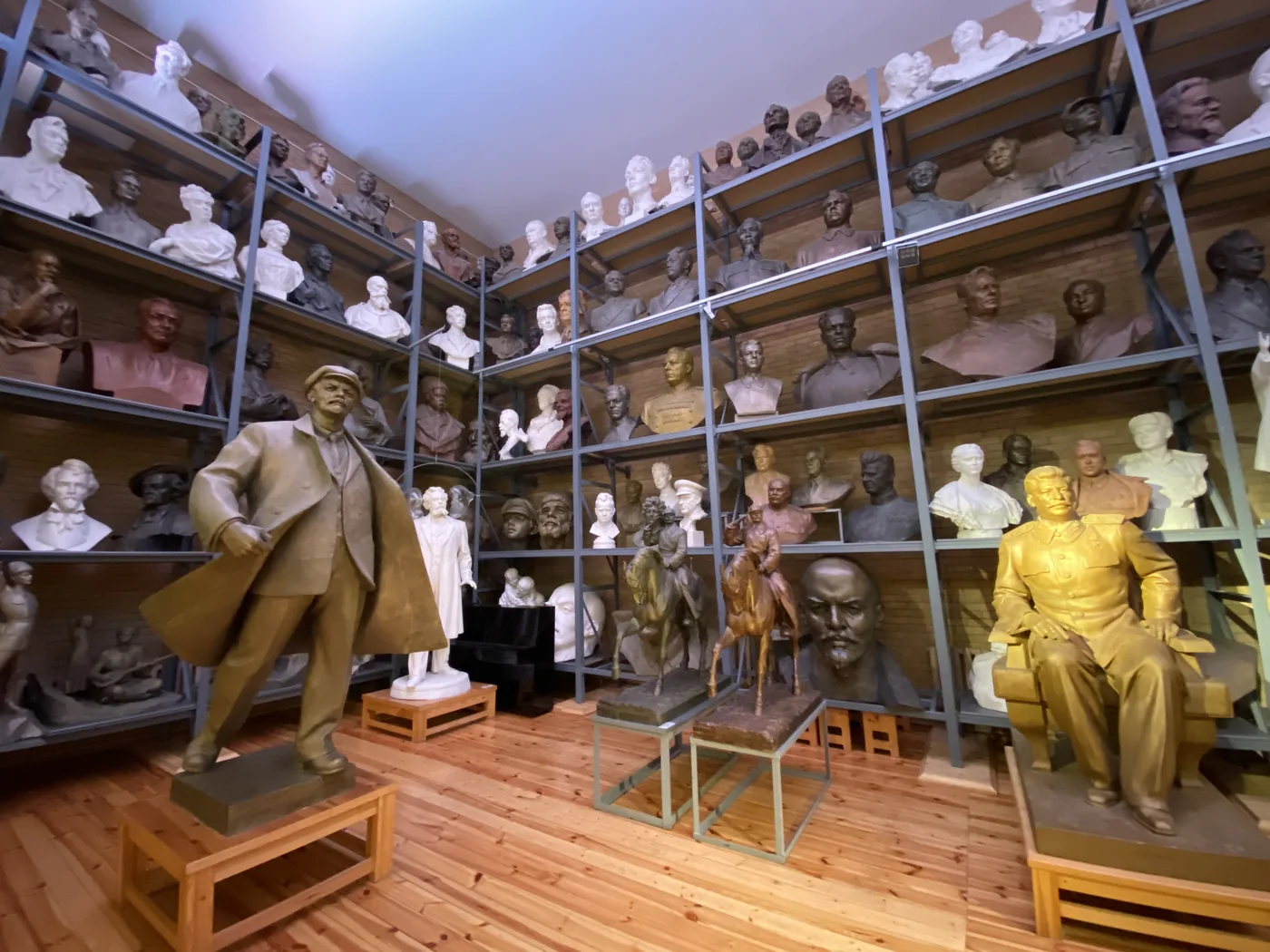
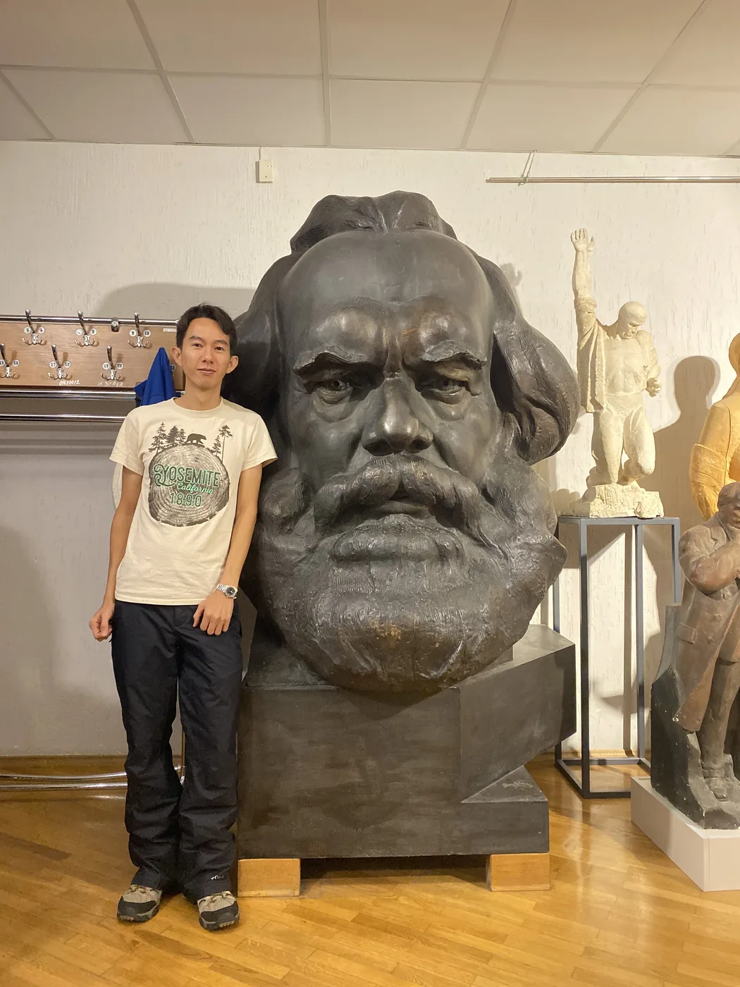
The tour started on the morning of 6 November at a sculptor’s studio. It belonged to Zair Azgur, who made monuments for the Soviet state, and it is now a museum. A giant head of Karl Marx stands at the entrance. Inside, on shelves that run from the floor right up to the ceiling, sit row after row of busts of Lenin, Stalin and Marx.

Shelves of busts of Lenin, Stalin and Marx in Zair Azgur's studio museum, Minsk
Spencer Li beside the giant bronze head of Karl Marx in the Azgur studio museum

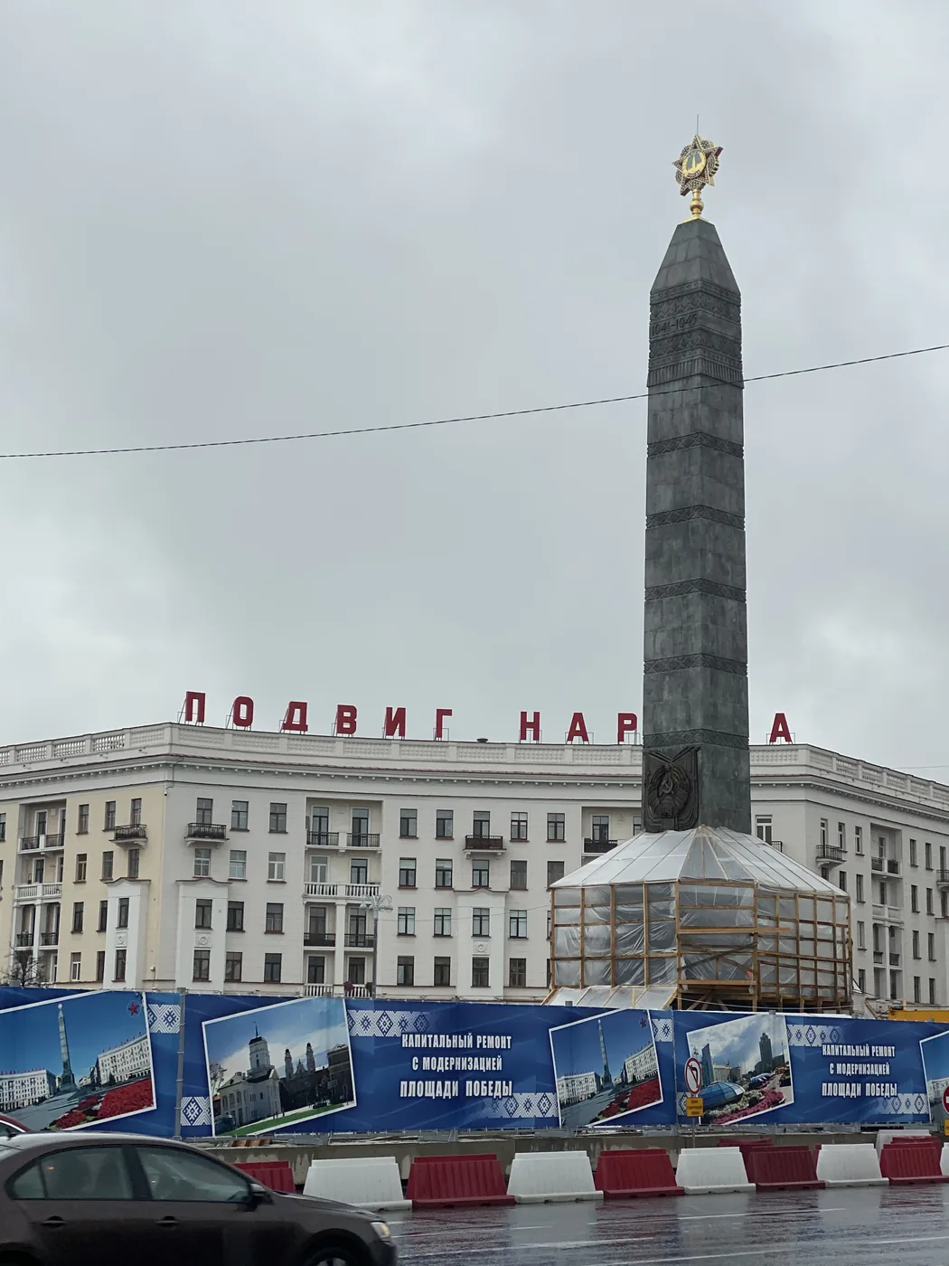
From there, the city’s war memorials. On Victory Square, a tall obelisk stands over an eternal flame. Nearby is the Palace of the Republic, a huge block fronted by columns.

The Victory obelisk on Victory Square, Minsk

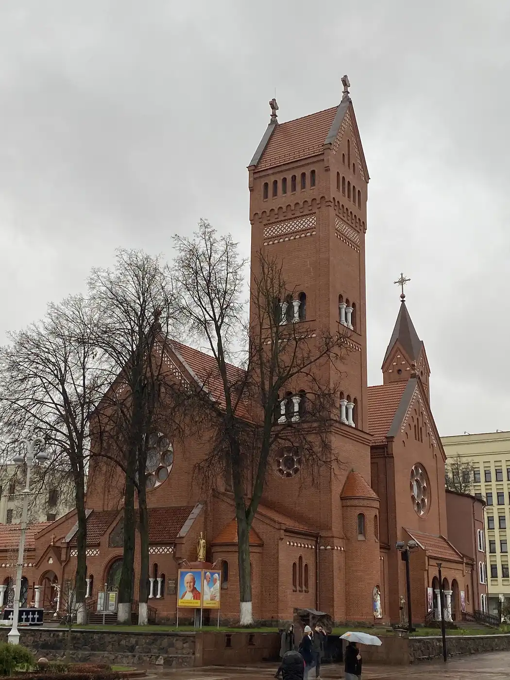
What is the Red Church?

The Church of Saints Simon and Helena, on the corner of Independence Square. Red brick. Neo-Romanesque, finished in 1910.

The Red Church of Saints Simon and Helena on Independence Square, Minsk

It has a sad story. A local landowner, Edward Woyniłłowicz, paid for it in memory of his two children, Simon and Helena, who had both died young. In Soviet times it was turned into a cinema. It is a church again now.

A short walk across the square, Lenin still stands in front of Government House.

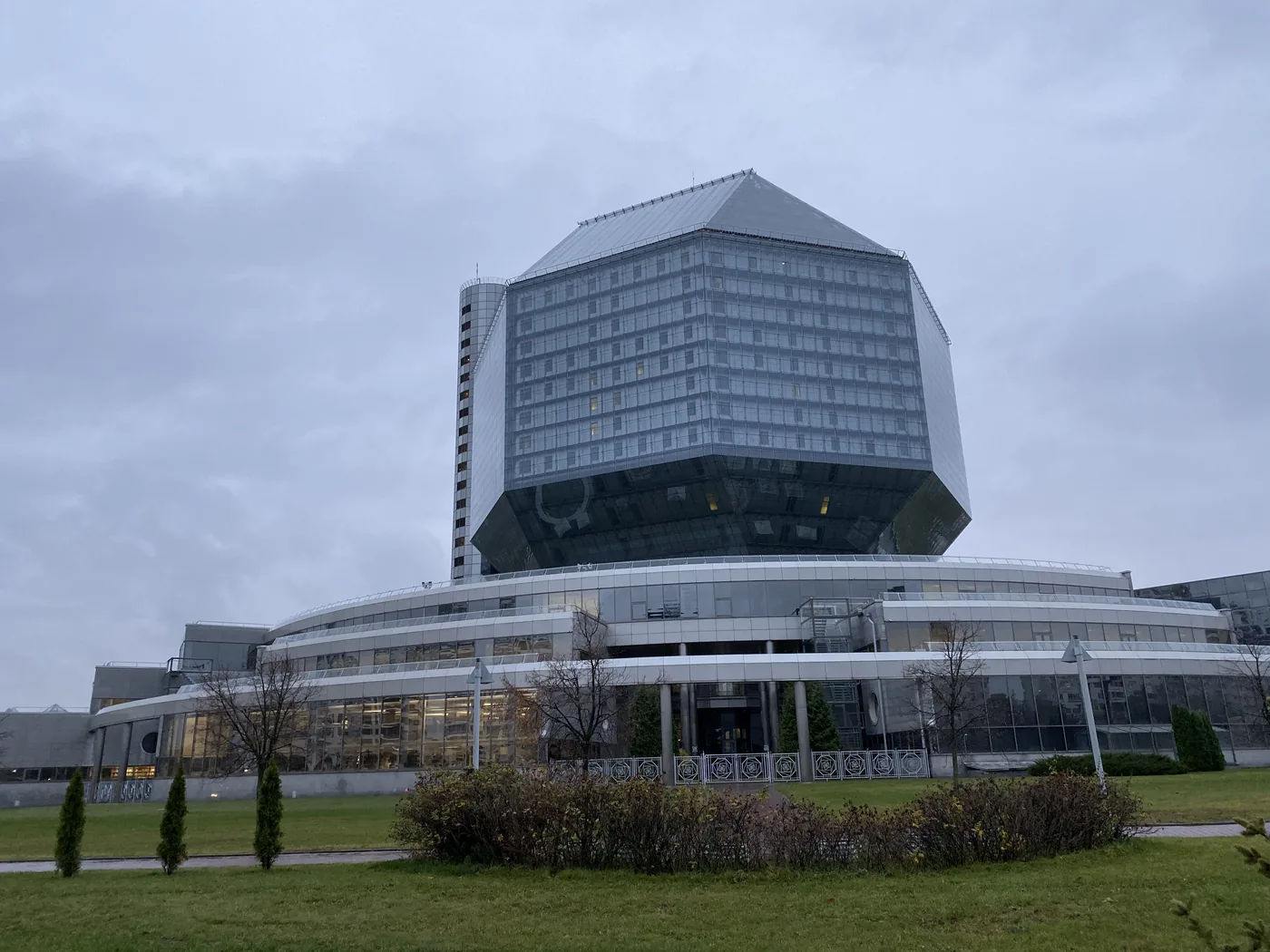
What is the National Library?

The strangest building in the city. It opened on 16 June 2006, and it is shaped like a giant cut diamond, a rhombicuboctahedron, about 73 metres tall.

The diamond-shaped National Library of Belarus in Minsk

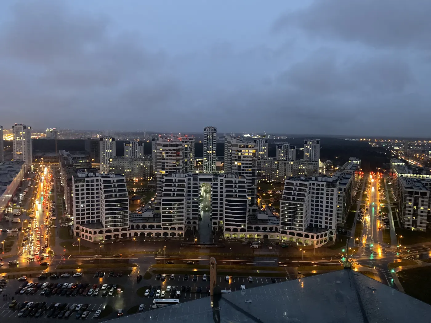
There is a viewing deck on the roof. We went up at about 17:20, just as the light was going, and by 17:40 the whole city was laid out below in the dusk, with the lights coming on along the avenues.

Minsk at dusk from the roof of the National Library

Then a ride on the metro, and borscht for dinner.

A bowl of Belarusian borscht with sour cream

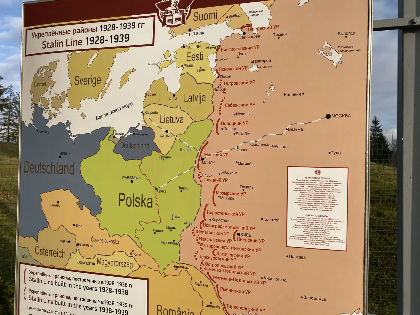
What is the Stalin Line?

A line of bunkers built along the old Soviet western border in the 1930s. The sign at the start of the walk dates it from 1928 to 1939. The stretch outside Minsk was opened as an open-air museum on 30 June 2005, for the 60th anniversary of the victory.

A map of the Stalin Line fortified districts built from 1928 to 1939

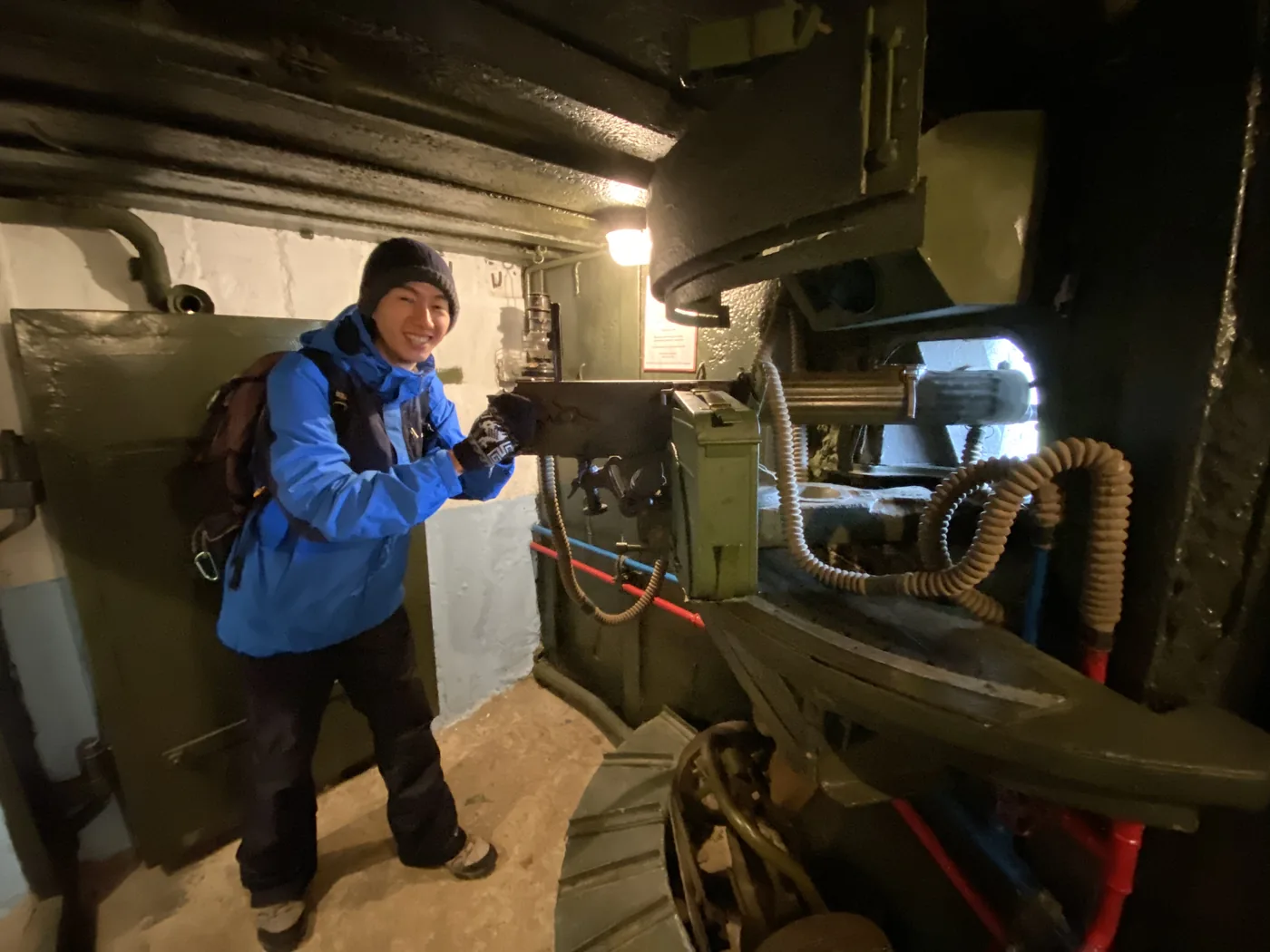
We spent the morning of 7 November there. You walk in under an arch and along a trail of concrete pillboxes, trenches and gun pits. I climbed into one of the bunkers and sat at the machine gun inside it.

Spencer Li at the machine gun inside a Stalin Line bunker

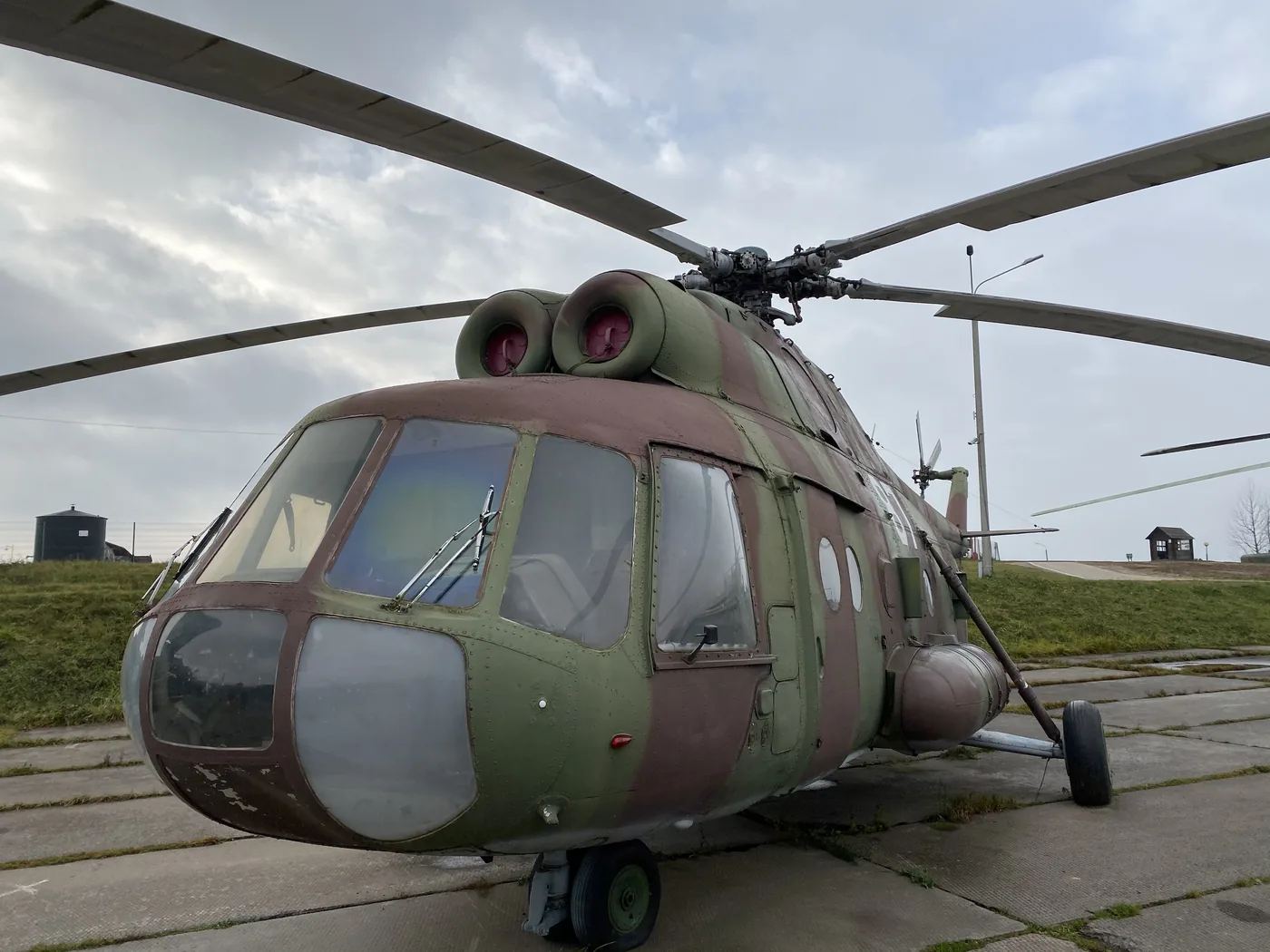
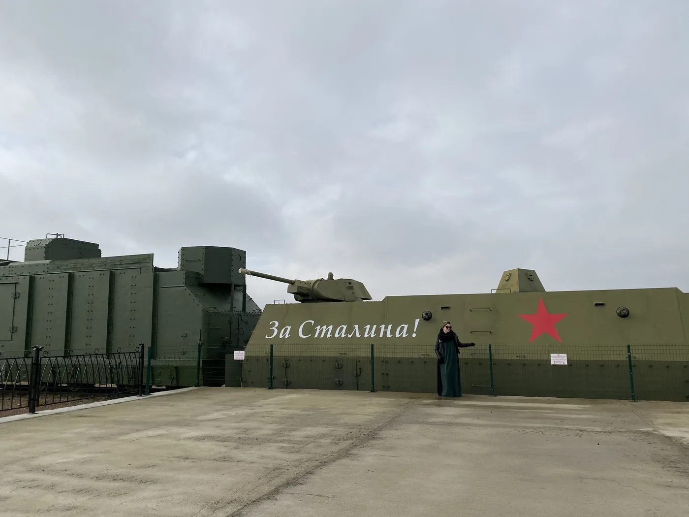
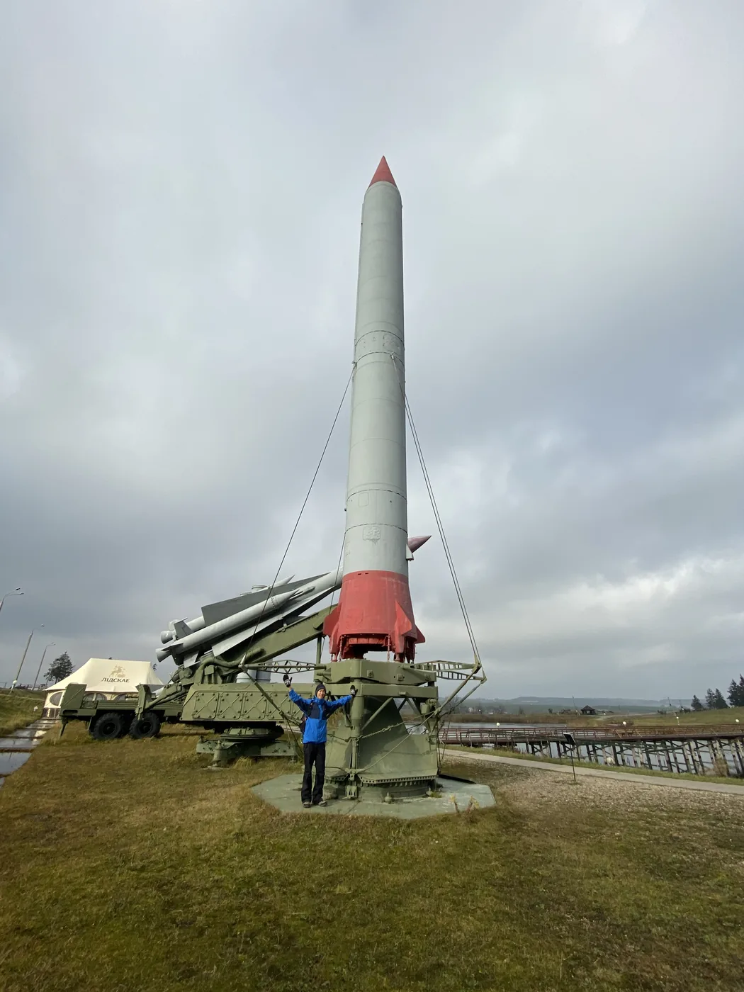
The rest is a field full of the Soviet military. A T-34 tank stands on a plinth. There are Mi-2 and Mi-8 helicopters, a Su-25 ground-attack jet, a hangar of tanks, and an armoured train with “За Сталина!”, “For Stalin!”, painted on its side. At the far end are the launch tubes of an S-300 air defence system and a white missile with a red tip.

A Mi-8 helicopter on display at the Stalin Line museum
An armoured train painted with For Stalin at the Stalin Line museum

Before we left, I stood behind one of the field guns, then put on ear defenders at the shooting range.

A white missile with a red tip on its launcher at the Stalin Line museum

What happened at Khatyn?

Khatyn was a village about 50 km north-east of Minsk. On 22 March 1943, it was burned by the occupying forces, with its people locked inside a barn. 149 people were killed, 75 of them children under 16. Only 8 survived.

The village was never rebuilt. In 1969, it became a memorial. At the entrance stands the Unbowed Man, a bronze of Yuzif Kaminsky, one of the few survivors, carrying his dead son Adam in his arms. When we were there, there were red carnations at its feet.

The Unbowed Man statue at the Khatyn memorial, with red carnations at its base

Behind him, the outline of each house is marked out on the ground, and where each one stood there is now a tall grey chimney with a small bell on top, one for every family’s home. There were 26 houses.

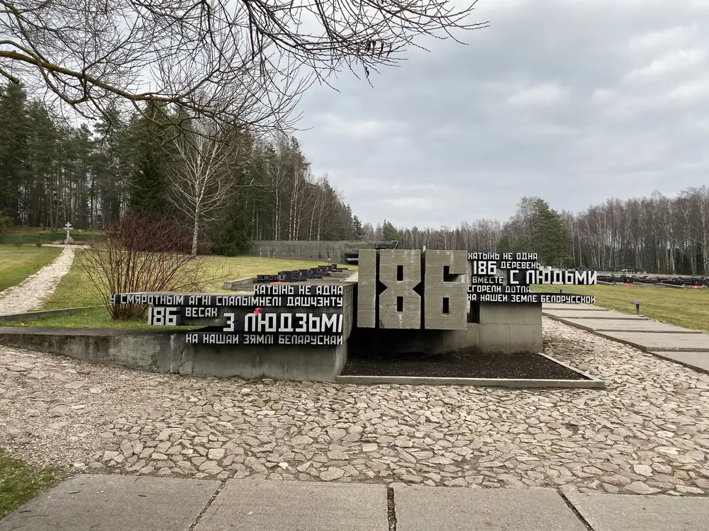
Beside the village is the Cemetery of Villages. It holds soil from 186 other villages in Belarus that were burned with their people in the war and never rebuilt, one urn for each.

The Cemetery of Villages wall marked 186 at the Khatyn memorial

How did I leave?

By air, at 22:40 that night. My first plan was the overnight train to Kyiv. Then I worked out that the visa-free entry only works if you fly in and out of Minsk airport, so I flew. Before the flight there was time for one more Belarusian dish: draniki, potato pancakes with sour cream.

How did the trading fit in?

The same way it always does, in about 15 minutes a day. In November, Minsk is 8 hours ahead of New York, so the US market opened at 17:30 local time, right as each day’s touring ended. I wrote up how that works, the watchlist, the alerts and the time zones, in how I trade while travelling.

Where does it fit in the trip?

Belarus was the first of 14 countries. Next came Ukraine, and Chernobyl and the nuclear missile base. The rest of the 5 weeks, all the way to Slovakia, is in Exploring Eastern Europe: 14 countries in 1 month. Every trip is on the travel log, and more photos are on Instagram, @iamrecneps.
Would you go for the castles or the Soviet bunkers first? Let me know in the comments.
Spencer Li

by Spencer Li
https://synapsetrading.com/wp-content/uploads/2026/10/belarus-2019-mir-castles-red-brick-towers-at.webp 1050 1400 Spencer Li https://synapsetrading.com/wp-content/uploads/2026/10/synapse-logo-horizontal-light.png Spencer Li2019-11-06 10:00:002026-10-22 16:48:01Belarus: Minsk, the Stalin Line, Khatyn and the Castles of Mir and Nesvizh
Page 3 of 7‹12345›»

Free checklist

The 15-Minute Swing Trader’s Checklist

The daily and weekly routine I use to find, manage and review trades in about 15 minutes a day, trading since 2007.
Get the free checklist

Topics

  • Trading foundations
  • Technical analysis
  • Strategies and systems
  • Risk and money
  • Trading psychology
  • Markets and products

Synapse Trading

Swing trading for busy professionals, in 15 minutes a day.

Start free

Learn

  • Start here
  • Free trading guides
  • Blog
  • Tools and resources

Programs

  • Trading Mastery Program
  • Daily trading signals
  • Student results
  • Public trade log

Company

  • About
  • Contact me
  • Partnerships
  • Disclaimer
  • Privacy policy
  • Terms & Conditions

Synapse Trading Pte Ltd
Registration No. 201316168H
WhatsApp +65-8897-1204
info@synapsetrading.com

Contact Us

Synapse Trading Pte Ltd
Registration No. 201316168H

Whatsapp: +65-8897-1204
Telegram: @iamrecneps
Email: info@synapsetrading.com

Links

Disclaimer
Privacy policy
Terms & Conditions
Contact us
Partnerships

© 2012-2026 Synapse Trading | All rights reserved. Educational content only, not personalised financial advice. Trading carries risk, including loss of capital. Past performance is not indicative of future results. Synapse Trading is not licensed or regulated by MAS.
  • Link to Facebook
  • Link to X
  • Link to Instagram
  • Link to Youtube
  • Link to LinkedIn
  • Link to Mail
Scroll to top Scroll to top Scroll to top